Country:
Region:
City:
Latitude and Longitude:
Time Zone:
Postal Code:
IP information under different IP Channel
ip-api
Country
Region
City
ASN
Time Zone
ISP
Blacklist
Proxy
Latitude
Longitude
Postal
Route
Luminati
Country
ASN
Time Zone
Europe/Rome
ISP
Progetto Evo S.r.l.
Latitude
Longitude
Postal
IPinfo
Country
Region
City
ASN
Time Zone
ISP
Blacklist
Proxy
Latitude
Longitude
Postal
Route
db-ip
Country
Region
City
ASN
Time Zone
ISP
Blacklist
Proxy
Latitude
Longitude
Postal
Route
ipdata
Country
Region
City
ASN
Time Zone
ISP
Blacklist
Proxy
Latitude
Longitude
Postal
Route
Popular places and events near this IP address
Altino, Abruzzo
Comune in Abruzzo, Italy
Distance: Approx. 3938 meters
Latitude and longitude: 42.1,14.33333333
Altino (Abruzzese: Davëdìnë) is a comune and town in the province of Chieti in the Abruzzo region of southern Italy. It is located on a rock spur commanding the valley of the Aventino river. The valley is richly cultivated with orchards, fruit, grapes and olives.
Casoli
Comune in Abruzzo, Italy
Distance: Approx. 1758 meters
Latitude and longitude: 42.11666667,14.28333333
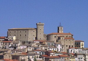
Casoli (Abruzzese: Càsule) a comune and town in the Province of Chieti in the Abruzzo region of Italy. It is situated on a foothill of the Majella mountain, at the base of which runs the Aventino River, tributary of the Sangro. As of 31 December 2004, it had a population of 5,901 and an area of 66 square kilometres (25 sq mi).
Palombaro
Comune in Abruzzo, Italy
Distance: Approx. 5655 meters
Latitude and longitude: 42.11666667,14.23333333
Palombaro is a comune and town in the Province of Chieti in the Abruzzo region of Italy

Roccascalegna
Comune in Abruzzo, Italy
Distance: Approx. 7055 meters
Latitude and longitude: 42.0625,14.305
Roccascalegna is a comune and town in the province of Chieti, part of the Abruzzo region of Italy.
Sant'Eusanio del Sangro
Comune in Abruzzo, Italy
Distance: Approx. 5287 meters
Latitude and longitude: 42.16666667,14.33333333
Sant'Eusanio del Sangro (Abruzzese: Sànde Sàgne) is a comune and town in the Province of Chieti in the Abruzzo region of Italy.

Piane d'Archi
Frazione in Abruzzo, Italy
Distance: Approx. 6239 meters
Latitude and longitude: 42.1049,14.3708
Piane d'Archi is a frazione of Archi, in the Province of Chieti in the Abruzzo, region of Italy.
Pianibbie
Frazione in Abruzzo, Italy
Distance: Approx. 2730 meters
Latitude and longitude: 42.1475,14.31611111
Pianibbie is a frazione in the Province of Chieti in the Abruzzo region of Italy.
Casoli internment camp
Distance: Approx. 1758 meters
Latitude and longitude: 42.1167,14.2833
The internment camp in Casoli, in the province of Chieti, was one of several internment camps set up by the fascist government following the entry of Italy into World War II, to sit foreigners and anti-fascists. It operated from July 1940 to September 1943, with a capacity of 80–90 people. Jewish refugees from Germany and Austria were interned first, then "ex-Yugoslavs".
Palazzo baronale
Distance: Approx. 7652 meters
Latitude and longitude: 42.0915,14.381
Palazzo baronale (Italian for Baronial Palace) is a fortified palace in Archi, Province of Chieti (Abruzzo).

Castello Masciantonio
Distance: Approx. 1038 meters
Latitude and longitude: 42.1188,14.2924
Castello Masciantonio (Italian for Masciantonio Castle) is a Renaissance castle in Casoli, Province of Chieti (Abruzzo).

Castello di Roccascalegna
Distance: Approx. 7054 meters
Latitude and longitude: 42.0625,14.3047
Castello di Roccascalegna (Italian for Castle of Roccascalegna) is a medieval castle in Roccascalegna, Province of Chieti, Abruzzo, southern Italy.
Castello Baglioni
Distance: Approx. 8111 meters
Latitude and longitude: 42.0883,14.2165
Castello Baglioni (Italian for Baglioni Castle) is a fortified palace in Civitella Messer Raimondo, Province of Chieti (Abruzzo).
Weather in this IP's area
scattered clouds
16 Celsius
16 Celsius
16 Celsius
17 Celsius
1025 hPa
81 %
1025 hPa
1008 hPa
10000 meters
0.89 m/s
1.79 m/s
80 degree
47 %
06:38:22
16:54:16


