Country:
Region:
City:
Latitude and Longitude:
Time Zone:
Postal Code:
IP information under different IP Channel
ip-api
Country
Region
City
ASN
Time Zone
ISP
Blacklist
Proxy
Latitude
Longitude
Postal
Route
Luminati
Country
ASN
Time Zone
Europe/Luxembourg
ISP
Fondation RESTENA
Latitude
Longitude
Postal
IPinfo
Country
Region
City
ASN
Time Zone
ISP
Blacklist
Proxy
Latitude
Longitude
Postal
Route
db-ip
Country
Region
City
ASN
Time Zone
ISP
Blacklist
Proxy
Latitude
Longitude
Postal
Route
ipdata
Country
Region
City
ASN
Time Zone
ISP
Blacklist
Proxy
Latitude
Longitude
Postal
Route
Popular places and events near this IP address

Belvaux
Town in the commune of Sanem in Luxembourg
Distance: Approx. 1731 meters
Latitude and longitude: 49.51666667,5.93333333
Belvaux (Luxembourgish: Bieles pronounced [ˈbiələs], German: Beles) is a town in the commune of Sanem, in south-western Luxembourg. As of 2024, the town has a population of 8,329.

Ehlerange
Town in Luxembourg
Distance: Approx. 1882 meters
Latitude and longitude: 49.51666667,5.96666667
Ehlerange (Luxembourgish: Éilereng, German: Ehleringen) is a small town in the commune of Sanem, in south-western Luxembourg. As of 2024, the town has a population of 983.

Belval-Université railway station
Railway station in Esch-sur-Alzette, Luxembourg
Distance: Approx. 1809 meters
Latitude and longitude: 49.495,5.96861111
Belval-Université railway station (Luxembourgish: Gare Belval-Universitéit, French: Gare de Belval-Université, German: Bahnhof Belval-Universität) is a railway station serving the neighbourhood of Belval, in west of Esch-sur-Alzette, in southern Luxembourg. It is operated by Chemins de Fer Luxembourgeois, the state-owned railway company. The station is situated on Line 60, which connects Luxembourg City to the Red Lands of the south of the country.

Belval-Rédange railway station
Railway station in Luxembourg
Distance: Approx. 1718 meters
Latitude and longitude: 49.50111111,5.92527778
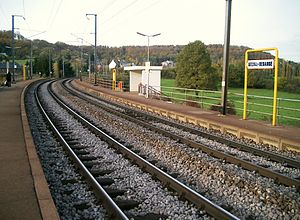
Belval-Rédange railway station (Luxembourgish: Gare Belval-Réideng, French: Gare de Belval-Rédange, German: Bahnhof Belval-Redingen) is a railway station serving the neighbourhood of Belval, in the west of Esch-sur-Alzette, in southern Luxembourg. The 'Rédange' in the name is a reference to the French town of Rédange, which lies just across the border. The station is operated by Chemins de Fer Luxembourgeois, the state-owned railway company.

Belvaux-Soleuvre railway station
Railway station in Sanem, Luxembourg
Distance: Approx. 1681 meters
Latitude and longitude: 49.5125,5.92861111
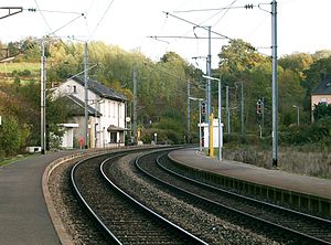
Belvaux-Soleuvre railway station (Luxembourgish: Gare Bieles-Zolwer, French: Gare de Belvaux-Soleuvre, German: Bahnhof Beles-Zolver) is a railway station serving the towns of Belvaux and Soleuvre, in the commune of Sanem, in south-western Luxembourg. The station is operated by Chemins de Fer Luxembourgeois, the state-owned railway company. The station is situated on Line 60, which connects Luxembourg City to the Red Lands of the south of the country.

Belval, Luxembourg
Distance: Approx. 797 meters
Latitude and longitude: 49.50027778,5.95722222
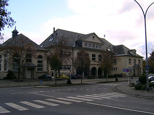
Belval is a quarter and neighbourhood in the west of Esch-sur-Alzette, in south-western Luxembourg. Belval is the site of the large steelworks that dominate the city. Due to the dominance of the steelworks, Belval suffered from the abandonment of steel production in Luxembourg, and is undergoing an extensive regeneration programme to help diversify beyond steel production.
Lycée Hubert Clément
Classical secondary school in Luxembourg
Distance: Approx. 2111 meters
Latitude and longitude: 49.50277778,5.9775
Lycée Hubert Clément (English: Hubert Clément High School), abbreviated to LHCE, is a high school in Esch-sur-Alzette, in south-western Luxembourg. It was founded as a single-sex girls school in 1955, paralleling Esch's all-boys school, Lycée de Garçons Esch-sur-Alzette, and was named Lycée de Jeunes Filles à Esch-sur-Alzette. Since the school became coeducational in 1970 and renamed the following year, the gender balance has been steadily eroded, particularly in mathematics (in which the majority of students are now boys).

Rédange
Commune in Grand Est, France
Distance: Approx. 2313 meters
Latitude and longitude: 49.4947,5.9203
Rédange (French pronunciation: [ʁedɑ̃ʒ]; German: Redingen; Lorraine Franconian: Réideng) is a commune in the Moselle department in Grand Est in north-eastern France.

Rockhal
Music venue in Luxembourg
Distance: Approx. 538 meters
Latitude and longitude: 49.4998241,5.9472513
The Rockhal, officially Centre de Musiques Amplifiées, is a concert hall in Esch-sur-Alzette, in southern Luxembourg. It opened on 23 September 2005, has a maximum capacity of 6,500 people and is sited on the former industrial site of Belval in the west of Esch.

Luxembourg Institute of Socio-Economic Research
Distance: Approx. 149 meters
Latitude and longitude: 49.503259,5.948442
The Luxembourg Institute of Socio-Economic Research (LISER) is a research center located in Esch-sur-Alzette, Luxembourg. LISER is a Luxembourgish public research institute under the jurisdiction of the Ministry of Higher Education and Research. Its research focus lies in the field of social and economic policy, including the spatial dimension.

National Resistance Museum, Luxembourg
World War II museum in Luxembourg
Distance: Approx. 2412 meters
Latitude and longitude: 49.4924,5.976
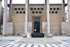
The National Museum of Resistance and Human Rights (Luxembourgish: Nationale Resistenzmusée; French: Musée National de la Résistance et des Droits Humains; German: Nationales Museum des Widerstands und der Menschenrechte) is located in the centre of Esch-sur-Alzette in the south-west of Luxembourg. The specially designed building (1956) traces the history of Luxembourg from 1940 to 1945 under the Nazi oppression, through the reactions of the people (passive resistance, resistance movements, forced enrolment, strike, refractory, Luxembourger in the maquis and in the Allied forces), until liberation, by photos, objects and works of art. There is also an exhibition of the Nazi concentration camps and the treatment of Luxembourg's Jews.

Belval-Lycée railway station
Railway station in Luxembourg
Distance: Approx. 1718 meters
Latitude and longitude: 49.50111111,5.92527778
Belval-Lycée railway station (French: Gare de Belval-Lycée) is a railway station serving the neighborhood of Belval, in the west of Esch-sur-Alzette, in southern Luxembourg. It opened on 29 September 2011. 'Lycée' refers to the school near the train station.
Weather in this IP's area
light rain
6 Celsius
3 Celsius
6 Celsius
7 Celsius
1012 hPa
96 %
1012 hPa
975 hPa
9490 meters
4.92 m/s
8.49 m/s
83 degree
100 %
07:52:38
16:50:33