Country:
Region:
City:
Latitude and Longitude:
Time Zone:
Postal Code:
IP information under different IP Channel
ip-api
Country
Region
City
ASN
Time Zone
ISP
Blacklist
Proxy
Latitude
Longitude
Postal
Route
Luminati
Country
Region
cm
City
herencia
ASN
Time Zone
Europe/Madrid
ISP
Gestioniza Infraestructuras S.L.
Latitude
Longitude
Postal
IPinfo
Country
Region
City
ASN
Time Zone
ISP
Blacklist
Proxy
Latitude
Longitude
Postal
Route
db-ip
Country
Region
City
ASN
Time Zone
ISP
Blacklist
Proxy
Latitude
Longitude
Postal
Route
ipdata
Country
Region
City
ASN
Time Zone
ISP
Blacklist
Proxy
Latitude
Longitude
Postal
Route
Popular places and events near this IP address

Herencia
Municipality of Spain
Distance: Approx. 7552 meters
Latitude and longitude: 39.36694444,-3.355
Herencia is a municipality located in the Province of Ciudad Real, in the autonomous community of Castilla-La Mancha, Spain. As of 2020, It had a population of 8,456. The postal code is 13640.

Villafranca de los Caballeros
Municipality in Castile-La Mancha, Spain
Distance: Approx. 1006 meters
Latitude and longitude: 39.42611111,-3.3575
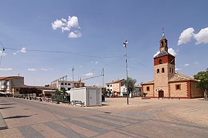
Villafranca de los Caballeros is a municipality located in the province of Toledo, Castile-La Mancha, Spain. According to the 2006 census (INE), the municipality had a population of 5327 inhabitants.
Weather in this IP's area
overcast clouds
12 Celsius
12 Celsius
12 Celsius
12 Celsius
1019 hPa
90 %
1019 hPa
944 hPa
10000 meters
7.2 m/s
12.4 m/s
105 degree
100 %
07:57:45
17:58:41