Country:
 Slovenia
Region:
City:
Latitude and Longitude:
Time Zone:
Postal Code:
IP information under different IP Channel
ip-api
Country
Region
City
ASN
Time Zone
ISP
Blacklist
Proxy
Latitude
Longitude
Postal
Route
IPinfo
Country
Region
City
ASN
Time Zone
ISP
Blacklist
Proxy
Latitude
Longitude
Postal
Route
MaxMind
Country
Region
City
ASN
Time Zone
ISP
Blacklist
Proxy
Latitude
Longitude
Postal
Route
Luminati
Country
SIASN
Time Zone
Europe/Ljubljana
ISP
SEEWEB s.r.l.
Latitude
Longitude
Postal
db-ip
Country
Region
City
ASN
Time Zone
ISP
Blacklist
Proxy
Latitude
Longitude
Postal
Route
ipdata
Country
Region
City
ASN
Time Zone
ISP
Blacklist
Proxy
Latitude
Longitude
Postal
Route
Popular places and events near this IP address

Šiška District
District in Upper Carniola, Slovenia
Distance: Approx. 739 meters
Latitude and longitude: 46.07,14.48638889
The Šiška District (pronounced [ˈʃiːʃka]; Slovene: Četrtna skupnost Šiška), or simply Šiška (), is the most populous district (mestna četrt) of the City Municipality of Ljubljana, the capital of Slovenia. It is named after the former villages of Spodnja Šiška and Zgornja Šiška.
Dravlje District
District in Upper Carniola, Slovenia
Distance: Approx. 1506 meters
Latitude and longitude: 46.08027778,14.47972222
The Dravlje District (pronounced [ˈdɾaːu̯ljɛ]; Slovene: Četrtna skupnost Dravlje), or simply Dravlje, is a district of the City Municipality of Ljubljana, the capital of Slovenia. It is named after the former village of Dravlje.

Tivoli Hall
Sports complex in Ljubljana, Slovenia
Distance: Approx. 1531 meters
Latitude and longitude: 46.05972222,14.495
Tivoli Hall (Slovene: Hala Tivoli) is a complex of two multi-purpose indoor sports arenas in the Tivoli City Park in Ljubljana, the capital of Slovenia. The complex was opened in 1965. The larger, ice hockey arena has a seating capacity of 7,000 people and is the home of HK Olimpija ice hockey club.

Dravlje
Place in Upper Carniola, Slovenia
Distance: Approx. 1506 meters
Latitude and longitude: 46.08027778,14.47972222
Dravlje (pronounced [ˈdɾaːu̯ljɛ]; German: Draule) is a former village in the City Municipality of Ljubljana, the capital of Slovenia.
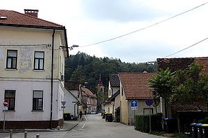
Spodnja Šiška
Place in Upper Carniola, Slovenia
Distance: Approx. 1450 meters
Latitude and longitude: 46.06416667,14.49638889
Spodnja Šiška (pronounced [ˈspoːdnja ˈʃiːʃka]; German: Unterschischka) is a formerly independent settlement in the northwest part of the capital Ljubljana in central Slovenia. It is part of the traditional region of Upper Carniola and is now included with the rest of the municipality in the Central Slovenia Statistical Region.

Koseze Pond
Artificial pond in Ljubljana, Slovenia
Distance: Approx. 711 meters
Latitude and longitude: 46.06731944,14.46882222
Koseze Pond (Slovene: Koseški bajer), Martinek Pond (Martinek bajer), Lake Koseze (Koseško jezero) or simply the Pond (Bajer) is an artificial pond at the edge of Ljubljana, the capital of Slovenia, between Šiška Hill to the west and the neighborhood of Mostec to the east. It is part of the Tivoli–Rožnik Hill–Šiška Hill Landscape Park and is named after the nearby Koseze neighborhood in Ljubljana's Šiška District. Near Koseze Pond, the Path of Remembrance and Comradeship touches Tivoli–Rožnik Hill–Šiška Hill Landscape Park.

Rožnik (hill)
Distance: Approx. 1246 meters
Latitude and longitude: 46.05563333,14.47691111
Rožnik (pronounced [ˈɾoːʒnik]) is a hill in the Rožnik District and Šiška District northwest of the Ljubljana city center. Together with Tivoli City Park, it forms Tivoli–Rožnik Hill–Šiška Hill Landscape Park. Extending from Tivoli Park, it is a popular hiking, running, and excursion destination for residents of Ljubljana.
Visitation of Mary Church (Ljubljana)
Distance: Approx. 1293 meters
Latitude and longitude: 46.05519722,14.47733056
Visitation of Mary Church (Slovene: cerkev Marijinega obiskanja) is a Roman Catholic pilgrimage church under the authority of the Roman Catholic Archdiocese of Ljubljana, located on Rožnik Hill in Ljubljana, Slovenia.

St. Bartholomew's Church (Ljubljana)
Distance: Approx. 1323 meters
Latitude and longitude: 46.06325833,14.49434444
St. Bartholomew's Church (Slovene: cerkev sv. Jerneja) — referred to by locals as the Old Church (Stara cerkev, which gave its name to a nearby Ljubljana city bus stop) — is a Catholic filial church and one of the oldest church buildings in Ljubljana, Slovenia.

Zgornja Šiška
Place in Upper Carniola, Slovenia
Distance: Approx. 591 meters
Latitude and longitude: 46.07194444,14.47611111
Zgornja Šiška (pronounced [ˈzɡoːɾnja ˈʃiːʃka]; German: Oberschischka) is a formerly independent settlement in the northwest part of the capital Ljubljana in central Slovenia. It is part of the traditional region of Upper Carniola and is now included with the rest of the municipality in the Central Slovenia Statistical Region.
Koseze (Ljubljana)
Place in Upper Carniola, Slovenia
Distance: Approx. 328 meters
Latitude and longitude: 46.06888889,14.475
Koseze (pronounced [kɔˈseːzɛ]; German: Koßes) is a formerly independent settlement in the northwest part of the capital Ljubljana in central Slovenia. It is part of the traditional region of Upper Carniola and is now included with the rest of the municipality in the Central Slovenia Statistical Region.

Computer History Museum Slovenia
Museum in Ljubljana, Slovenia
Distance: Approx. 969 meters
Latitude and longitude: 46.068611,14.490278
The Computer History Museum Slovenia (Slovene: Računalniški muzej) is a museum in Slovenia dedicated to preserving the history of computing and digital heritage. Highlighting computer artifacts tied to global computer history, the museum also presents a substantial collection of items linked to early Yugoslav and Slovene computer systems.
Weather in this IP's area
overcast clouds
12 Celsius
12 Celsius
11 Celsius
13 Celsius
1024 hPa
96 %
1024 hPa
985 hPa
6000 meters
0.51 m/s
100 %
07:24:36
18:09:05