Country:
Region:
City:
Latitude and Longitude:
Time Zone:
Postal Code:
IP information under different IP Channel
ip-api
Country
Region
City
ASN
Time Zone
ISP
Blacklist
Proxy
Latitude
Longitude
Postal
Route
Luminati
Country
ASN
Time Zone
Europe/Madrid
ISP
R Cable y Telecable Telecomunicaciones, S.A.U.
Latitude
Longitude
Postal
IPinfo
Country
Region
City
ASN
Time Zone
ISP
Blacklist
Proxy
Latitude
Longitude
Postal
Route
db-ip
Country
Region
City
ASN
Time Zone
ISP
Blacklist
Proxy
Latitude
Longitude
Postal
Route
ipdata
Country
Region
City
ASN
Time Zone
ISP
Blacklist
Proxy
Latitude
Longitude
Postal
Route
Popular places and events near this IP address

Cambados
Municipality in Galicia, Spain
Distance: Approx. 7751 meters
Latitude and longitude: 42.5,-8.8
Cambados is a municipality in Galicia, Spain in the province of Pontevedra. It is known for its historical monuments, its seafood and the famous white wine, Albariño.
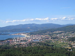
Vilanova de Arousa
Municipality
Distance: Approx. 393 meters
Latitude and longitude: 42.56285,-8.82782
Vilanova de Arousa (Galician: [ˌbilɐˈnɔβɐ ð(e) aˈɾowsɐ]; unofficial Spanish: Villanueva de Arosa) is a municipality in the province of Pontevedra, in the autonomous community of Galicia, Spain. It belongs to the comarca of O Salnés.
O Grove
Municipality
Distance: Approx. 8533 meters
Latitude and longitude: 42.494,-8.865
O Grove (alternative spelling: Ogrobe) is a municipality belonging to the province of Pontevedra, in Galicia, Spain. A peninsula that faces the Atlantic Ocean and the shores of O Salnés valley, enclosed by the southern Galician estuaries, the Rías Baixas.

A Illa de Arousa
Municipality in Galicia, Spain
Distance: Approx. 3090 meters
Latitude and longitude: 42.55444444,-8.86388889
A Illa de Arousa (Galician: [a ˈiʎɐ ð(e) aˈɾowsɐ]; unofficial Spanish: Isla de Arosa) is the only island municipality in Galicia, Spain in the province of Pontevedra. It is located in the heart of the Ria de Arousa. According to 2021 INE the island's population was 4,951 inhabitants.

Vilagarcía de Arousa
Municipality in Galicia, Spain
Distance: Approx. 6488 meters
Latitude and longitude: 42.597713,-8.763187
Vilagarcía de Arousa (Spanish: [bilaɣaɾˈθi.a ðe aˈɾowsa] , Galician: [ˌbilɐɣaɾˈθi.ɐ ð(e) aˈɾowsɐ]; unofficial Spanish: Villagarcía de Arosa) is a municipality in the province of Pontevedra, in Galicia, Spain. As of 2014 it has a population of 37,712, being ninth largest town in Galicia.
Arosa SC
Association football club in Spain
Distance: Approx. 5059 meters
Latitude and longitude: 42.588589,-8.776056
Arosa Sociedad Cultural is a Spanish football team based in Vilagarcía de Arousa, in the autonomous community of Galicia. Founded in 1945, it plays in Tercera Federación – Group 1, holding home games at Estadio A Lomba, with a capacity of 5,000 seats.

A Barbanza
Comarca in Galicia, Spain
Distance: Approx. 8252 meters
Latitude and longitude: 42.61388889,-8.90666667
A Barbanza is a comarca in the province of A Coruña, Galicia, Spain. Its capital is the municipality of Ribeira. The comarca contains four municipalities and 66,095 inhabitants (2019) in an area of 244.2 km².

O Salnés
Comarca in Galicia, Spain
Distance: Approx. 6860 meters
Latitude and longitude: 42.50888889,-8.79861111
O Salnés is a comarca in the Galician Province of Pontevedra. It covers an area of 275.2 km2, and had an overall population of 114,600 at the 2011 Census; the latest official estimate (as at the start of 2018) was 113,052.

Cortegada Island
Island in Galicia, Spain
Distance: Approx. 6904 meters
Latitude and longitude: 42.61861,-8.78486
Cortegada is an almost tidal island (it is possible to go walking when the lowest tides happen, but a small amount of water flow does not disappear) in a coastal inlet near Pontevedra in Galicia, Spain. It is part of the Atlantic Islands of Galicia National Park.
Céltiga FC
Spanish football club
Distance: Approx. 4275 meters
Latitude and longitude: 42.559107,-8.88096
Céltiga Fútbol Club is a Spanish football team based in A Illa de Arousa in the autonomous community of Galicia. Founded in 1967, it plays in Tercera División – Group 1. Its stadium is Estadio Salvador Otero with a capacity of 2,000 seats.
Castro de Achadizo
Archaeological site in Galicia, Spain
Distance: Approx. 7175 meters
Latitude and longitude: 42.61638889,-8.88444444
Castro de Achadizo is a ruined site in Province of A Coruña, Galicia, Spain.

IGAFA
Professional training center school in Galicia
Distance: Approx. 4612 meters
Latitude and longitude: 42.5609,-8.8855
The Galician Institute of Aquaculture Training ( IGaFA or IGAFA ) is an educational body dependent on the Dirección Xeral de Innovación e Desenvolvemento (Directorate General of Innovation and Development) of the Consellería de Pesca e Asuntos Marítimos (Ministry of Fisheries and Maritime Affairs) of the Galician autonomous government (Xunta de Galicia). It is co-financed by the European Social Fund. Courses are taught for obtaining the certificates of shell fisherman, aquaculturist and specialists in marine cultures.
Weather in this IP's area
overcast clouds
18 Celsius
18 Celsius
17 Celsius
20 Celsius
1016 hPa
59 %
1016 hPa
1015 hPa
10000 meters
2.41 m/s
4.41 m/s
96 degree
100 %
08:27:07
18:13:04

