Country:
Region:
City:
Latitude and Longitude:
Time Zone:
Postal Code:
IP information under different IP Channel
ip-api
Country
Region
City
ASN
Time Zone
ISP
Blacklist
Proxy
Latitude
Longitude
Postal
Route
Luminati
Country
Region
an
City
algarrobo
ASN
Time Zone
Europe/Madrid
ISP
Arnold Calle Telecom, S.l.
Latitude
Longitude
Postal
IPinfo
Country
Region
City
ASN
Time Zone
ISP
Blacklist
Proxy
Latitude
Longitude
Postal
Route
db-ip
Country
Region
City
ASN
Time Zone
ISP
Blacklist
Proxy
Latitude
Longitude
Postal
Route
ipdata
Country
Region
City
ASN
Time Zone
ISP
Blacklist
Proxy
Latitude
Longitude
Postal
Route
Popular places and events near this IP address

Vélez-Málaga
Place in Málaga, Spain
Distance: Approx. 7919 meters
Latitude and longitude: 36.78333333,-4.1
Vélez-Málaga (Spanish pronunciation: [ˈbeleθ ˈmalaɣa]) is a municipality and the capital of the Axarquía comarca in the province of Málaga, in the Spanish autonomous community of Andalusia. It is the most important city in the comarca. Locally it is referred to as Vélez.

Torrox
Municipality in Andalusia, Spain
Distance: Approx. 7968 meters
Latitude and longitude: 36.75,-3.95
Torrox is a municipality in the province of Málaga in the autonomous community of Andalusia, southern Spain. It belongs to the comarca of Axarquía. It is located in the Costa del Sol (specifically the Costa del Sol Oriental), on the shores of the Mediterranean Sea and the foothills of the Sierra de Almijara.

Algarrobo, Spain
Municipality and town in Andalucía, Spain
Distance: Approx. 4123 meters
Latitude and longitude: 36.76666667,-4.03333333
It's a place in spain

Árchez
Municipality in Andalusia, Spain
Distance: Approx. 4775 meters
Latitude and longitude: 36.83888889,-3.99055556
Árchez is a small village in the province of Málaga, in southern Spain. The village is situated approximately 21 kilometres from Vélez Málaga. It has a population of approximately 408 residents, who are known as Archeros.

Canillas de Albaida
Place in Andalusia, Spain
Distance: Approx. 6169 meters
Latitude and longitude: 36.85,-3.98333333
Canillas de Albaida is a town and municipality in the province of Málaga, part of the autonomous community of Andalusia in southern Spain. It has a population of approximately 800 residents. The natives are called Canilleros.

Cómpeta
Municipality in Andalucía, Spain
Distance: Approx. 4575 meters
Latitude and longitude: 36.83333333,-3.98333333
Cómpeta is a town and municipality in the comarca of Axarquía, and province of Málaga, part of the autonomous community of Andalusia in southern Spain. The municipality is situated approximately 18 kilometres from the coast (Costa del Sol), and 52 kilometres from Málaga, the provincial capital. It is situated at 638 metres above sea level in the foothills of La Maroma (the highest peak of the Sierra de Tejeda).

Salares
Place in Andalusia, Spain
Distance: Approx. 5550 meters
Latitude and longitude: 36.85,-4.01666667
Salares is a town and municipality in the province of Málaga, part of the autonomous community of Andalusia in southern Spain. It belongs to the comarca of La Axarquía. The Sierras of Tejeda, Almijara and Alhama Natural Park is just east of the village.

Sayalonga
Place in Andalusia, Spain
Distance: Approx. 265 meters
Latitude and longitude: 36.8,-4.01666667
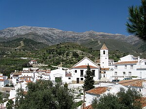
Sayalonga is a town and municipality in the province of Málaga, part of the autonomous community of Andalusia in southern Spain. It belongs to the comarca of La Axarquía. The municipality is situated approximately 38 kilometres from the capital of Málaga and 12 kilometres from Vélez Málaga.

Sedella
Place in Andalusia, Spain
Distance: Approx. 5804 meters
Latitude and longitude: 36.85,-4.033
Sedella is a town and municipality in the province of Málaga, part of the autonomous community of Andalusia in southern Spain. The municipality is situated approximately 54 kilometres from the provincial capital of Málaga, 23 from Vélez-Málaga and 8 from Canillas de Aceituno. The Sierras of Tejeda, Almijara and Alhama Natural Park is just north of the village.
Arenas, Málaga
Municipality in Andalusia, Spain
Distance: Approx. 3267 meters
Latitude and longitude: 36.81583333,-4.04472222
Arenas is a municipality in the province of Málaga located in the autonomous community of Andalusia in southern Spain. It is situated in the comarca of Axarquía. By way of road it is located 12 kilometers from Vélez-Málaga, 50 km from Málaga and 577 km from Madrid.

Bentomiz Castle
Distance: Approx. 2730 meters
Latitude and longitude: 36.804028,-4.043956
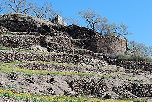
Bentomiz Castle is an ancient Moorish fortress built on a hill near the village of Arenas in the province of Málaga. It sits at a height of 711 metres (2,333 ft), and lies to the northeast of Vélez-Málaga. The castle site is thought to have been occupied by the Phoenicians, Greeks and Romans, although it is not clear which parts of the ruins date to which period.
Corumbela
Village in Andalusia, Spain
Distance: Approx. 2446 meters
Latitude and longitude: 36.821111,-4.005278
Corumbela is a village in the province of Málaga, Andalusia, Spain. The date of foundation is unknown, although it is believed that it was populated by Iberians. The name is Roman and means "dove".
Weather in this IP's area
few clouds
14 Celsius
13 Celsius
12 Celsius
15 Celsius
1016 hPa
79 %
1016 hPa
980 hPa
10000 meters
1.79 m/s
4.47 m/s
346 degree
14 %
07:54:37
18:07:02
