185.143.217.164 - IP Lookup: Free IP Address Lookup, Postal Code Lookup, IP Location Lookup, IP ASN, Public IP
Country:
Region:
City:
Location:
Time Zone:
Postal Code:
ISP:
ASN:
language:
User-Agent:
Proxy IP:
Blacklist:
IP information under different IP Channel
ip-api
Country
Region
City
ASN
Time Zone
ISP
Blacklist
Proxy
Latitude
Longitude
Postal
Route
db-ip
Country
Region
City
ASN
Time Zone
ISP
Blacklist
Proxy
Latitude
Longitude
Postal
Route
IPinfo
Country
Region
City
ASN
Time Zone
ISP
Blacklist
Proxy
Latitude
Longitude
Postal
Route
IP2Location
185.143.217.164Country
Region
troms og finnmark
City
lakselv
Time Zone
Europe/Oslo
ISP
Language
User-Agent
Latitude
Longitude
Postal
ipdata
Country
Region
City
ASN
Time Zone
ISP
Blacklist
Proxy
Latitude
Longitude
Postal
Route
Popular places and events near this IP address

Finnmark
County in Northern Norway
Distance: Approx. 5811 meters
Latitude and longitude: 70,25
Finnmark (Norwegian: [ˈfɪ̀nːmɑrk] ; Northern Sami: Finnmárku [ˈfinːˌmaːrːhkuː]; Kven: Finmarkku; Finnish: Finnmark; Russian: Финнмарк) is a county in northern Norway. By land, it borders Troms county to the west, Finland's Lapland region to the south, and Russia's Murmansk Oblast to the east, and by water, the Norwegian Sea (Atlantic Ocean) to the northwest, and the Barents Sea (Arctic Ocean) to the north and northeast. The county was formerly known as Finmarkens amt or Vardøhus amt.

Porsanger Municipality
Municipality in Finnmark, Norway
Distance: Approx. 615 meters
Latitude and longitude: 70.05222222,24.95583333
Porsanger (Northern Sami: Porsáŋgu; Kven: Porsanki) is a municipality in Finnmark county, Norway. The administrative centre of the municipality is the village of Lakselv. Other villages in the municipality include Børselv, Brenna, Indre Billefjord, Kistrand, Olderfjord, and Skoganvarre.
Lakselv
Village in Porsanger, Norway
Distance: Approx. 22 meters
Latitude and longitude: 70.05111111,24.97166667
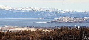
(Norwegian; lit. 'Salmon River'), Leavdnja (Northern Sami) or Lemmijoki (Kven) is the largest village and administrative centre of Porsanger Municipality in Finnmark county, Norway. The village lies at the southern end of the large Porsangerfjorden. The 2.36-square-kilometre (580-acre) village has a population (2023) of 2,224 which gives the village a population density of 942 inhabitants per square kilometre (2,440/sq mi).

Station Group Banak
Norwegian military airbase
Distance: Approx. 1712 meters
Latitude and longitude: 70.06666667,24.97388889
Station Group Banak (Norwegian: Stasjonsgruppe Banak), formerly Banak Air Station (Banak flystasjon), is a military airbase located at Banak, just north of Lakselv in Porsanger Municipality in Finnmark, Norway. Operated by the Royal Norwegian Air Force (RNoAF), it serves a detachment of the 330 Squadron, which operates two Westland Sea King helicopters used for search and rescue operations in Finnmark, Svalbard and surrounding Arctic sea areas (the northern Norwegian Sea, the Barents Sea and the Arctic Sea). Of the station's two helicopters, one is on standby at any given time.

Lakselva
River in Finnmark, Norway
Distance: Approx. 6801 meters
Latitude and longitude: 69.9904,24.9574
Lakselva (Northern Sami: Leavdnjajohka; Kven: Lemmijoki) is a river in Finnmark county in northern Norway. It begins in Karasjok Municipality runs north through Porsanger Municipality into the Porsangerfjorden, a fjord off of the Barents Sea. The 103-kilometre (64 mi) long river runs past the village of Lakselv.

Lakselv Airport
Airport in Banak, Norway
Distance: Approx. 1712 meters
Latitude and longitude: 70.06666667,24.97388889
Lakselv Airport (Norwegian: Lakselv lufthavn; IATA: LKL, ICAO: ENNA) is an international airport located at Banak, 1.5 kilometers (1 mile) north of the village of Lakselv in Porsanger Municipality in Finnmark county, Norway. Co-located with the military Station Group Banak, the airport is owned and operated by the state-owned Avinor. The airport is also branded as North Cape Airport, although the North Cape is 190 km (120 mi) away, and the nearest airport is Honningsvåg Airport, Valan.
Banak, Norway
Peninsula in Finnmark, Norway
Distance: Approx. 1762 meters
Latitude and longitude: 70.067,24.966
Banak is a small peninsula in Porsanger Municipality in Finnmark county, Norway. It juts into the Vestbotn bay of the vast Porsangerfjorden. Located immediately north of the village of Lakselv, the peninsula has Brennelvfjorden to its east and the river Lakselva to the east.

Lakselv Church
Church in Finnmark, Norway
Distance: Approx. 724 meters
Latitude and longitude: 70.050356,24.952947
Lakselv Church (Norwegian: Lakselv kirke) is a parish church of the Church of Norway in Porsanger Municipality in Finnmark county, Norway. It is located in the village of Lakselv. It is one of the churches for the Porsanger parish which is part of the Indre Finnmark prosti (deanery) in the Diocese of Nord-Hålogaland.
Brennelvfjorden
Fjord in Finnmark, Norway
Distance: Approx. 2350 meters
Latitude and longitude: 70.06774,25.01064
Brennelvfjorden (Northern Sami: Lavttevuotna, Finnish: Lohtivuono) is a fjord in the most innermost section of Vesterbotn and Porsangerfjorden in Porsanger Municipality in Finnmark county, Norway. The fjord reaches 4 kilometres (2.5 mi) south to Lakselv. Situated on the western side of Oldereidneset, the fjord is bordered by Langneset to the north and Banakneset to the south, near Banak Airport.
Østerbotn
Distance: Approx. 8398 meters
Latitude and longitude: 70.09599722,25.15010833
Østerbotn or Austerbotn (Northern Sami: Soggovuotna, Finnish: Sokkuvuono) is the innermost part of Porsangerfjorden in Porsanger Municipality in Finnmark county, Norway.
Vesterbotn
Arm of a fjord in northern Norway
Distance: Approx. 4635 meters
Latitude and longitude: 70.09289722,24.97724444
Vesterbotn (Northern Sami: Leavdnjavuotna, Kven: Lemmivuono, and Finnish: Lemmivuono) is an arm of the Porsangerfjorden located in Porsanger Municipality, Finnmark county, Norway.
Weather in this IP's area
light snow
-3 Celsius
-9 Celsius
-3 Celsius
-3 Celsius
998 hPa
74 %
998 hPa
956 hPa
10000 meters
6.17 m/s
190 degree
