Country:
 Cyprus
Region:
City:
Latitude and Longitude:
Time Zone:
Postal Code:
IP information under different IP Channel
ip-api
Country
Region
City
ASN
Time Zone
ISP
Blacklist
Proxy
Latitude
Longitude
Postal
Route
IPinfo
Country
Region
City
ASN
Time Zone
ISP
Blacklist
Proxy
Latitude
Longitude
Postal
Route
MaxMind
Country
Region
City
ASN
Time Zone
ISP
Blacklist
Proxy
Latitude
Longitude
Postal
Route
Luminati
Country
CYRegion
05
City
paphos
ASN
Time Zone
Asia/Nicosia
ISP
Primetel PLC
Latitude
Longitude
Postal
db-ip
Country
Region
City
ASN
Time Zone
ISP
Blacklist
Proxy
Latitude
Longitude
Postal
Route
ipdata
Country
Region
City
ASN
Time Zone
ISP
Blacklist
Proxy
Latitude
Longitude
Postal
Route
Popular places and events near this IP address
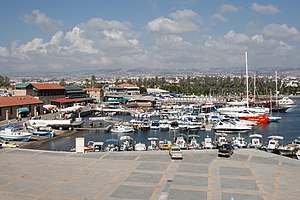
Paphos
City and municipality in Paphos District, Cyprus
Distance: Approx. 431 meters
Latitude and longitude: 34.76666667,32.41666667
Paphos ( PAF-oss; Greek: Πάφος [ˈpafos]; Turkish: Baf;) is a coastal city in southwest Cyprus and the capital of Paphos District. In classical antiquity, two locations were called Paphos: Old Paphos, today known as Kouklia, and New Paphos. It is the fourth-largest city in the country, after Nicosia, Limassol and Larnaca, with an urban population of 63,600 in 2018.

Tombs of the Kings (Paphos)
Ancient burial site in Cyprus
Distance: Approx. 1562 meters
Latitude and longitude: 34.775,32.40694444
The Tombs of the Kings (Greek: Τάφοι των Βασιλέων [ˈtafi ton vasiˈleon], Turkish: Kral Mezarları) is a large necropolis lying about two kilometres north of Paphos harbour in Cyprus. In 1980, it was designated a UNESCO World Heritage Site along with Paphos and Kouklia. The underground tombs, many of which date back to the 4th century BC, are carved out of solid rock, and are thought to have been the burial sites of Paphitic aristocrats and high officials up to the third century AD (the name comes from the magnificence of the tombs; no kings were in fact buried here).

Stelios Kyriakides Stadium
Sports venue in Paphos, Cyprus
Distance: Approx. 1735 meters
Latitude and longitude: 34.76918611,32.44014444
The Stelios Kyriakides Stadium (previous Pafiako Stadium) (Greek: Στάδιο Στέλιος Κυριακίδης) is a multi-use stadium in Paphos, the stadium holds 9,394 people. It has a full size running track around the outside of its football and rugby playing field and is used for many athletics events throughout the year. It is regarded as one of the best pitches in Cyprus and situated ideally for the public.
Paphos General Hospital
Hospital in Paphos District, Cyprus
Distance: Approx. 3291 meters
Latitude and longitude: 34.7889,32.446
Paphos General Hospital is the Paphos district's main medical centre. With four stories and 25,000 square metres (270,000 sq ft) this pyramid shaped hospital is designed to offer to patients first aid to MRI Scans. It was opened in 1992 and the hospital currently operates with all the necessary departments.
Aphroditi Sports Hall
Distance: Approx. 1563 meters
Latitude and longitude: 34.76861111,32.43833333
Aphroditi Sports Hall is the largest arena in the city of Paphos. It is named after "Aphrodite", also known as Venus, one of the 12 ancient Greek gods which is said was born at Petra Tou Romiou 20 km East. This arena can host up to 2,000 spectators.

Church of Panagia Theoskepasti
Paphos church in cyprus
Distance: Approx. 1259 meters
Latitude and longitude: 34.757,32.4159
Panagia Theoskepasti (Greek: Εκκλησία Παναγίας Θεοσκέπαστης) is a Byzantine Church of Cyprus church at the center of Kato Paphos, Cyprus. It is part of an area inscribed in the list of the UNESCO World Heritage Sites in 1980.
Geroskipou Municipality Stadium
Distance: Approx. 3170 meters
Latitude and longitude: 34.7438,32.4407
Geroskipou Stadium (Greek: Δημοτικό Στάδιο Γεροσκήπου) is a small stadium in Geroskipou, which serves as the reserve home ground of Pafos FC.

Paphos Archaeological Museum
Distance: Approx. 939 meters
Latitude and longitude: 34.7716,32.4302
Paphos Archaeological Museum is a museum in Paphos, western Cyprus. It contains items ranging in age from the Neolithic to 1700 AD, with five rooms showcasing exhibits dating from the Neolithic era to the Middle Ages. Most of the artefacts were unearthed in Palepafos (Kouklia), Nea Pafos (Paphos) and Marion-Arsinoe (Polis), and also from Pegeia, Kisonerga, Lempa, Pano Arodes, Salamiou, Akourdalia, Pomos, Kidasi, Geroskipou and other places.

Paphos Archaeological Park
Archaeological park in Cyprus
Distance: Approx. 2040 meters
Latitude and longitude: 34.75566667,32.40416667
Paphos Archaeological Park (also Kato Pafos Archaeological Park) contains the major part of the important ancient Greek and Roman city and is located in Paphos, southwest Cyprus. The park, still under excavation, is within the Nea Pafos ("New Paphos") section of the coastal city. Its sites and monuments date from prehistoric times through the Middle Ages.

Basilica of Panagia Limeniotissa
Building in Paphos, Cyprus
Distance: Approx. 1783 meters
Latitude and longitude: 34.75581,32.40784
The Basilica of Panagia Limeniotissa(Greek: Βασιλική της Παναγίας Λιμενιώτισσας) is a ruined basilica in Paphos, Cyprus. It was built at the beginning of the 5th century and it is dedicated to "Our Lady of the Harbour". The basilica of Panagia Limeniotissa is situated in a short distance north of Paphos harbour, close to the restaurants of the harbour and it is part of the Paphos Archaeological Park.
Chloraka Municipal Stadium
Stadium in Cyprus
Distance: Approx. 2894 meters
Latitude and longitude: 34.7924,32.4126
Koinotiko Chlorakas is the central stadium located in Chlorakas, Paphos in Cyprus. The first stadium had a capacity of 500 seats but after the renovation of 1983 the stadium increased its capacity to 3500. It is the home base of local team Akritas Chlorakas, a team consisting of Cypriot players mostly with the longest history in the city of Paphos.

Paphos Lighthouse
Lighthouse
Distance: Approx. 1567 meters
Latitude and longitude: 34.7606,32.4063
Paphos Lighthouse is a well known lighthouse on the island of Cyprus, near to the city of Paphos. It is sited on a peninsula known as Paphos point which extends into the Mediterranean Sea, at the south western end of the island. Built in 1888, when Cyprus was under British administration, the island was a key military base protecting the route of ships travelling through the Suez Canal to the colonies.
Weather in this IP's area
scattered clouds
23 Celsius
23 Celsius
20 Celsius
23 Celsius
1010 hPa
68 %
1010 hPa
1007 hPa
10000 meters
3.09 m/s
20 degree
40 %
06:37:01
18:50:26