Country:
Region:
City:
Latitude and Longitude:
Time Zone:
Postal Code:
IP information under different IP Channel
ip-api
Country
Region
City
ASN
Time Zone
ISP
Blacklist
Proxy
Latitude
Longitude
Postal
Route
Luminati
Country
ASN
Time Zone
Europe/Brussels
ISP
SA EASI
Latitude
Longitude
Postal
IPinfo
Country
Region
City
ASN
Time Zone
ISP
Blacklist
Proxy
Latitude
Longitude
Postal
Route
db-ip
Country
Region
City
ASN
Time Zone
ISP
Blacklist
Proxy
Latitude
Longitude
Postal
Route
ipdata
Country
Region
City
ASN
Time Zone
ISP
Blacklist
Proxy
Latitude
Longitude
Postal
Route
Popular places and events near this IP address

Ittre
Municipality in French Community, Belgium
Distance: Approx. 5169 meters
Latitude and longitude: 50.65,4.26666667
Ittre (French pronunciation: [itʁ] ; Walloon: Ite; Dutch: Itter, Dutch pronunciation: [ˈɪtər]) is a municipality of Wallonia located in the Belgian province of Walloon Brabant. Since the fusion of the Belgian municipalities in 1977, the municipality is composed of three districts: Haut-Ittre, Ittre and Virginal-Samme. Ittre was the geographical center of Belgium until World War I. The geographical center was moved to Walhain due to the allocation of the East Cantons (Eupen-Malmédy) to Belgium (Treaty of Versailles).
Nivelles
Municipality in Wallonia, Belgium
Distance: Approx. 4553 meters
Latitude and longitude: 50.58333333,4.31666667
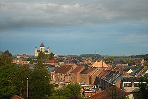
Nivelles (French: [nivɛl] ; Dutch: Nijvel [ˈnɛivəl] ; Walloon: Nivele) is a city and municipality of Wallonia located in the Belgian province of Walloon Brabant. The Nivelles municipality includes the former municipalities of Baulers, Bornival, Thines, and Monstreux. The Nivelles arrondissement includes all the municipalities in Walloon Brabant.

Nivelles-Baulers
Belgian race track
Distance: Approx. 288 meters
Latitude and longitude: 50.62111111,4.32694444
Nivelles-Baulers was a 2.314 mi (3.724 km) race track in Nivelles (in French)/Nijvel (in Dutch) near Brussels, Belgium.

Collegiate Church of St. Gertrude, Nivelles
Church in Walloon Brabant, Belgium
Distance: Approx. 2928 meters
Latitude and longitude: 50.5975,4.32333333
The Collegiate Church of St. Gertrude (French: Collégiale Sainte-Gertrude) is a Roman Catholic collegiate church in Nivelles, Walloon Brabant, Belgium, which was built in the 11th century. It is dedicated to Saint Gertude, the patron saint of cats.

Bois-Seigneur-Isaac Abbey
Distance: Approx. 2287 meters
Latitude and longitude: 50.644,4.322
Bois-Seigneur-Isaac Abbey is a former Augustinian abbey in Wallonia, then a Premonstratensian priory, dependent on Averbode Abbey and now occupied by the Lebanese Maronite Order. It is located in Ophain-Bois-Seigneur-Isaac, Belgium (a village now part of the town of Braine-l'Alleud).

Château de Bois-Seigneur-Isaac
Distance: Approx. 2167 meters
Latitude and longitude: 50.643,4.323
Bois-Seigneur-Isaac Castle (French: Château de Bois-Seigneur-Isaac) is a stately home in Ophain-Bois-Seigneur-Isaac, Wallonia, part of the commune of Braine-l'Alleud, Walloon Brabant, Belgium. The present building dates from 1737, but the site is substantially older.

Weerde railway station
Railway station in Flemish Brabant, Belgium
Distance: Approx. 5457 meters
Latitude and longitude: 50.584,4.2817
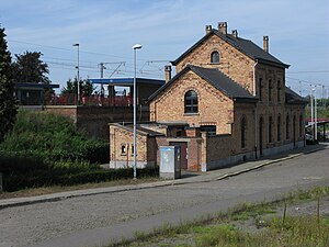
Weerde is a railway station in the town of Weerde, Flemish Brabant, Belgium. The station opened on 1 January 1864 on the Lines 25 and 27. The train services are operated by National Railway Company of Belgium (NMBS).

Eppegem railway station
Railway station in Flemish Brabant, Belgium
Distance: Approx. 6815 meters
Latitude and longitude: 50.5731,4.2727
Eppegem is a railway station in the town of Eppegem, Flemish Brabant, Belgium. The station opened on 1 March 1865 on the Lines 25 and 27. The train services are operated by National Railway Company of Belgium (NMBS).

Ophain-Bois-Seigneur-Isaac
Village in Brabant, Wallonia
Distance: Approx. 5051 meters
Latitude and longitude: 50.66666667,4.35
Ophain-Bois-Seigneur-Isaac (Walloon: Opin) is a village of Wallonia and a district of the municipality of Braine-l'Alleud, located in the province of Walloon Brabant, Belgium. It was a municipality in its own right before the fusion of the Belgian municipalities in 1977. Some popular spots to see are La grange, Ferme du Moulin à Eau, Carrefour express, Place d'Ophain, Chez Detant, and Chateau Bois Seigneur.

Nivelles Abbey
Distance: Approx. 2928 meters
Latitude and longitude: 50.5975,4.32333333
Nivelles Abbey (French: Abbaye de Nivelles) is a former Imperial Abbey of the Holy Roman Empire founded in 640. It is located in Nivelles, Walloon Brabant, Belgium.

Nivelles railway station
Railway station in Walloon Brabant, Belgium
Distance: Approx. 2582 meters
Latitude and longitude: 50.60111111,4.33527778
Nivelles railway station (French: Gare de Nivelles; Dutch: Station Nijvel) is a railway station in Nivelles, Walloon Brabant, Belgium. The station opened on 1 June 1874 and is located on railway line 124. The train services are operated by the National Railway Company of Belgium (SNCB/NMBS).

Lillois-Witterzée
Village in Brabant, Wallonia
Distance: Approx. 3505 meters
Latitude and longitude: 50.64416667,4.36472222
Lillois-Witterzée (Walloon: Liloe) is a village of Wallonia and a district of the municipality of Braine-l'Alleud, located in the province of Walloon Brabant, Belgium. It was a municipality in its own right before the fusion of the Belgian municipalities in 1977.
Weather in this IP's area
moderate rain
6 Celsius
4 Celsius
5 Celsius
7 Celsius
1009 hPa
95 %
1009 hPa
991 hPa
10000 meters
2.7 m/s
5.45 m/s
156 degree
100 %
08:03:08
16:53:01
