185.136.205.98 - IP Lookup: Free IP Address Lookup, Postal Code Lookup, IP Location Lookup, IP ASN, Public IP
Country:
Region:
City:
Location:
Time Zone:
Postal Code:
ISP:
ASN:
language:
User-Agent:
Proxy IP:
Blacklist:
IP information under different IP Channel
ip-api
Country
Region
City
ASN
Time Zone
ISP
Blacklist
Proxy
Latitude
Longitude
Postal
Route
db-ip
Country
Region
City
ASN
Time Zone
ISP
Blacklist
Proxy
Latitude
Longitude
Postal
Route
IPinfo
Country
Region
City
ASN
Time Zone
ISP
Blacklist
Proxy
Latitude
Longitude
Postal
Route
IP2Location
185.136.205.98Country
Region
gaziantep
City
sehitkamil
Time Zone
Europe/Istanbul
ISP
Language
User-Agent
Latitude
Longitude
Postal
ipdata
Country
Region
City
ASN
Time Zone
ISP
Blacklist
Proxy
Latitude
Longitude
Postal
Route
Popular places and events near this IP address

Gaziantep
Metropolitan municipality in Turkey
Distance: Approx. 3144 meters
Latitude and longitude: 37.06277778,37.37916667
Gaziantep, historically Aintab and still informally called Antep, is a major city in south-central Turkey. It is the capital of the Gaziantep Province, in the westernmost part of Turkey's Southeastern Anatolia Region and partially in the Mediterranean Region. It is located approximately 185 km (115 mi) east of Adana and 97 km (60 mi) north of Aleppo, Syria and situated on the Sajur River.
Kamil Ocak Stadium
Distance: Approx. 2653 meters
Latitude and longitude: 37.06757222,37.37759167
Kamil Ocak Stadium (Turkish: Kamil Ocak Stadyumu) was a multi-purpose stadium in Gaziantep, Turkey. It was used mostly for football matches and was the home ground of Gaziantepspor until 2017. The stadium hold 16,981 people.

Gaziantep Synagogue
Former synagogue in Gaziantep, Turkey
Distance: Approx. 3175 meters
Latitude and longitude: 37.064166,37.381645
The Gaziantep Synagogue, also known as the Great Synagogue of Gaziantep, is a former Jewish congregation and synagogue located in Gaziantep, in south-central Turkey. No longer used as a synagogue, the building is abandoned.
Sanko Park
Shopping mall in Gaziantep, Turkey
Distance: Approx. 2415 meters
Latitude and longitude: 37.063062,37.359931
Sanko Park is an enclosed shopping mall located in Gaziantep, Turkey. The largest enclosed mall in the region, construction of the US$160 million project began in 2007, and the centre opened in the spring of 2009. Because of its location in southeastern Turkey, it draws a significant number of shoppers from nearby Syria.

Siege of Aintab
Distance: Approx. 3095 meters
Latitude and longitude: 37.06666694,37.38333306
The siege of Aintab (French: Les Quatres Sièges d'Aïntab; Ottoman Turkish: عین تاب قوشاتماسى; Turkish: Antep Kuşatması) was a military engagement between the Turkish National Forces and the French Army of the Levant occupying the city of Aintab (present-day Gaziantep) during the Turkish War of Independence (specifically its southern front, known as the Franco-Turkish War). Fighting began in April 1920, when French forces opened fire on the city. It ended with the Kemalist defeat and the city's surrender to the French military forces on 9 February 1921.

Şirvani Mosque
Mosque in Gaziantep, Turkey
Distance: Approx. 3047 meters
Latitude and longitude: 37.06583333,37.38166667
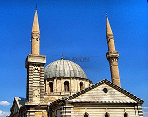
Şirvani Camii, Şirvani Mehmet Efendi Camii or İki Şerefeli Camii is a mosque in Gaziantep, Turkey. It is located in the Seferpaşa neighborhood, southwest of Gaziantep Castle. The mosque, which is one of the oldest in the city, was undertaken by Şirvani Mehmet Effendi.
2012 Gaziantep bombing
Distance: Approx. 2072 meters
Latitude and longitude: 37.078132,37.378578
The 2012 Gaziantep bombing was a terrorist bomb attack which occurred in the city of Gaziantep, Turkey on 20 August 2012, the second day of the three-day celebrations of "Şeker Bayramı" (Eid-ul-Fitr) that refers to the end of the Islamic holy month of Ramadan.
Kamil Ocak Sport Hall
Multi-purpose sport venue in Gaziantep, Turkey
Distance: Approx. 2580 meters
Latitude and longitude: 37.0675,37.3763
Kamil Ocak Sport Hall (Turkish: Kamil Ocak Spor Salonu) is an indoor multi-purpose sport venue that is located in Gaziantep, Turkey. Opened in 1969, the hall has a seating capacity of 2,500 spectators. It is home to Royal Halı Gaziantep, which plays currently in the Turkish Basketball League.
Gaziantep Castle
Castle in Turkey
Distance: Approx. 3112 meters
Latitude and longitude: 37.0664,37.3833
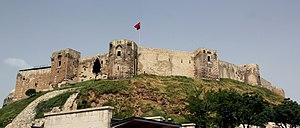
Gaziantep Castle (Turkish: Gaziantep Kalesi) is a castle on top of a mound in the centre of Gaziantep, Turkey. First used as an observation point during the Hittite Empire, it was expanded into a castle during Roman rule. The castle was severely damaged by earthquakes in February 2023.

Liberation Mosque
Mosque in Şahinbey, Turkey
Distance: Approx. 3184 meters
Latitude and longitude: 37.06027778,37.37555556
Liberation Mosque (Turkish: Kurtuluş Camii), formerly the St. Mary's Cathedral or Holy Mother of God Church (Armenian: Սուրբ Աստուածածին Եկեղեցի, romanized: Surp Asdvazdadzin Egeghetsʿi), is located in the Tepebaşı district of Şahinbey, Gaziantep in Turkey. Initially built as an Armenian Apostolic church, it was converted into a stable after the Armenian genocide; and later, into a jail.

May 2016 Gaziantep bombing
Car bombing in Turkey attributed to ISIL
Distance: Approx. 2443 meters
Latitude and longitude: 37.0675169,37.3739705
On 1 May 2016, a car bombing took place in the Turkish city of Gaziantep. The bombing took place at 09:17 (UTC+3) in front of the police headquarters along the thoroughfare Prof. Dr.

Aintab Sanjak
District of the Ottoman Empire
Distance: Approx. 3095 meters
Latitude and longitude: 37.06666667,37.38333333
The Aintab Sanjak (Arabic: سنجق عنتاب) was a prefecture (sanjak) of the Ottoman Empire, located in modern-day Turkey. The city of Aintab (modern-day Gaziantep) was the sanjak's capital. It had a population of 187,899 in 1914.
Weather in this IP's area
clear sky
10 Celsius
8 Celsius
9 Celsius
10 Celsius
1024 hPa
28 %
1024 hPa
918 hPa
10000 meters
3.09 m/s
180 degree

