185.135.68.11 - IP Lookup: Free IP Address Lookup, Postal Code Lookup, IP Location Lookup, IP ASN, Public IP
Country:
Region:
City:
Location:
Time Zone:
Postal Code:
ISP:
ASN:
language:
User-Agent:
Proxy IP:
Blacklist:
IP information under different IP Channel
ip-api
Country
Region
City
ASN
Time Zone
ISP
Blacklist
Proxy
Latitude
Longitude
Postal
Route
db-ip
Country
Region
City
ASN
Time Zone
ISP
Blacklist
Proxy
Latitude
Longitude
Postal
Route
IPinfo
Country
Region
City
ASN
Time Zone
ISP
Blacklist
Proxy
Latitude
Longitude
Postal
Route
IP2Location
185.135.68.11Country
Region
al anbar
City
al fallujah
Time Zone
Asia/Baghdad
ISP
Language
User-Agent
Latitude
Longitude
Postal
ipdata
Country
Region
City
ASN
Time Zone
ISP
Blacklist
Proxy
Latitude
Longitude
Postal
Route
Popular places and events near this IP address
Anbar (town)
Former town in Al Anbar, Iraq
Distance: Approx. 6300 meters
Latitude and longitude: 33.375,43.71666667
Anbar (Arabic: الأنبار, romanized: al-Anbār, Syriac: ܐܢܒܐܪ, romanized: Anbar) was an ancient and medieval town in central Iraq. It played a role in the Roman–Persian Wars of the 3rd–4th centuries, and briefly became the capital of the Abbasid Caliphate before the founding of Baghdad in 762. It remained a moderately prosperous town through the 10th century, but quickly declined thereafter.

Fallujah
City in Al Anbar, Iraq
Distance: Approx. 553 meters
Latitude and longitude: 33.35,43.78333333
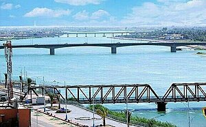
Fallujah (Arabic: ٱلْفَلُّوجَة al-Fallūjah [el.fɐl.ˈluː.dʒɐ]) is a city in Al Anbar Governorate, Iraq. Situated on the Euphrates River, it is located roughly 69 kilometres (43 mi) to the west of the capital city of Baghdad and 50 kilometres (31 mi) from the neighboring city of Ramadi. The city is located in the region defined as Sunni Triangle by the United States, as majority of its residents are Arabic-speaking Sunni Muslims.
Abdul-Aziz al-Samarrai Mosque
Mosque in Fallujah, Al Anbar, Iraq
Distance: Approx. 1176 meters
Latitude and longitude: 33.345,43.7865
The Abdul-Aziz al-Samarrai Mosque is an Islamic mosque located in Fallujah, Iraq. The mosque came to worldwide attention when Sunni militants inside the mosque directed small-arms and rocket fire at US Marines. US forces returned fire, when a Cobra helicopter fired a Hellfire missile at the base of the mosque's minaret and an F-16 intentionally dropped a bomb on the mosque.

First Battle of Fallujah
Operation of the Iraq War
Distance: Approx. 553 meters
Latitude and longitude: 33.35,43.78333333
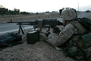
The First Battle of Fallujah, code-named Operation Vigilant Resolve, was an operation against militants in Fallujah as well as an attempt to apprehend or kill the perpetrators of the killing of four U.S. contractors in March 2004. The chief catalyst for the operation was the highly publicized killing and mutilation of four Blackwater USA private military contractors, and the killings of five American soldiers in Habbaniyah a few days earlier. The battle, and especially the images of Iraqi civilians killed or injured in the fighting, caused many Iraqis to become resentful of the US presence.

Second Battle of Fallujah
2004 battle of the Iraq War
Distance: Approx. 553 meters
Latitude and longitude: 33.35,43.78333333
The Second Battle of Fallujah, initially codenamed Operation Phantom Fury, Operation al-Fajr (Arabic: الفجر, lit. 'The Dawn') was an American-led offensive of the Iraq War that began on 7 November 2004 and lasted about six weeks. A joint military effort of the United States, the Iraqi Interim Government, and the United Kingdom, the battle was the war's first major engagement fought solely against the Iraqi insurgency, not the military forces of the Ba'athist Iraq government. Operation Phantom Fury took place seven months after the First Battle of Fallujah, an attempt to capture or kill insurgent elements involved in the 2004 Fallujah ambush that killed four employees of the private military contractor Blackwater.

Battle of Misiche
Battle between the Sasanians and the Romans (244)
Distance: Approx. 1994 meters
Latitude and longitude: 33.36388889,43.79722222
The Battle of Misiche (Greek: Μισιχή), Mesiche, or Massice (Middle Persian: 𐭬𐭱𐭩𐭪 mšyk; Parthian: 𐭌𐭔𐭉𐭊 mšyk) (dated between January 13 and March 14, 244 AD.) was fought between the Sasanians and the Romans in Misiche, Mesopotamia.

Battle of Ramadi (2004)
Battle in 2004 as part of the Iraq War
Distance: Approx. 553 meters
Latitude and longitude: 33.35,43.78333333
The Battle of Ramadi was fought in the spring of 2004, during the same time as the First Battle of Fallujah, for control of the capital of the Al Anbar Governorate in western Iraq. A coalition military force consisting of the 2nd Battalion, 4th Marines were stationed to defend the city from an insurgent assault. In April 2004, Fallujah was under siege by Coalition Forces and insurgents were looking to relieve pressure on the city by attempting an offensive of their own.
Fallujah Barrage
Dam in Al Anbar Governorate, Iraq
Distance: Approx. 5072 meters
Latitude and longitude: 33.30861111,43.7725
The Fallujah Barrage is a barrage on the Euphrates near Fallujah in Al Anbar Governorate, Iraq. Construction of the barrage was completed in 1985. Unlike many other dams in the Euphrates, the Fallujah Barrage does not include a hydroelectric power station and its main function is to raise the water level of the river for irrigation.
Fall of Fallujah
Battle that took place from late 2013 to early 2014
Distance: Approx. 1865 meters
Latitude and longitude: 33.3667,43.7667
The fall of Fallujah was a battle in the city of Fallujah in western Iraq that took place from late 2013 to early 2014, in which Islamic State (IS) and other Sunni insurgents captured the city of Fallujah. It was one of the first Iraqi cities to fall out of the control of the Iraqi Government, and resulted in the Anbar campaign.

Third Battle of Fallujah
Battle between the Iraqi government and the Islamic State
Distance: Approx. 1865 meters
Latitude and longitude: 33.3667,43.7667
The Third Battle of Fallujah, code-named Operation Breaking Terrorism (Arabic: عملية كسر الإرهاب) by the Iraqi government, was a military operation against ISIL launched to capture the city of Fallujah and its suburbs, located about 69 kilometres (43 mi) west of Baghdad, the capital of Iraq. The operation began on 22 May 2016, three months after the Iraqi forces had started the total siege of Fallujah. On 26 June, Iraqi forces recaptured the city of Fallujah, before recapturing the remaining pocket of ISIL resistance in Fallujah's western outskirts two days later.
Al Azrakiyah
Village in Al Anbar, Iraq
Distance: Approx. 4314 meters
Latitude and longitude: 33.35,43.73333333
Al Azrakiyah (also: Mintaqat Al Azrakiyah) is a village in Iraq, which is located in the Al Anbar Governorate west of the city of Fallujah, on the river Euphrates. On the southern banks of river Euphrathes lies Halabisah. In 2016, during the Anbar offensive and the Third Battle of Fallujah, there was intense fighting in the area between the Iraqi army and ISIL militants.
Al-Fallujah Stadium
Stadium in Iraq
Distance: Approx. 2944 meters
Latitude and longitude: 33.35138889,43.81102778
Al-Fallujah Stadium (Arabic: ملعب الفلوجة, Malʿabu al-Fallūjah) is a multi-purpose stadium in Al-Fallujah, Iraq. It is currently used mostly for football matches and is the home stadium of Al-Jolan SC. Opened in February 2022, it has a capacity of 7,000 spectators.
Weather in this IP's area
clear sky
15 Celsius
14 Celsius
15 Celsius
15 Celsius
1022 hPa
39 %
1022 hPa
1016 hPa
10000 meters
2.25 m/s
2.26 m/s
198 degree
2 %