185.135.33.8 - IP Lookup: Free IP Address Lookup, Postal Code Lookup, IP Location Lookup, IP ASN, Public IP
Country:
 Germany
Region:
City:
Location:
Time Zone:
Postal Code:
ISP:
ASN:
language:
User-Agent:
Proxy IP:
Blacklist:
IP information under different IP Channel
ip-api
Country
Region
City
ASN
Time Zone
ISP
Blacklist
Proxy
Latitude
Longitude
Postal
Route
db-ip
Country
Region
City
ASN
Time Zone
ISP
Blacklist
Proxy
Latitude
Longitude
Postal
Route
IPinfo
Country
Region
City
ASN
Time Zone
ISP
Blacklist
Proxy
Latitude
Longitude
Postal
Route
IP2Location
185.135.33.8Country
deRegion
bayern
City
graben
Time Zone
Europe/Berlin
ISP
Language
User-Agent
Latitude
Longitude
Postal
ipdata
Country
Region
City
ASN
Time Zone
ISP
Blacklist
Proxy
Latitude
Longitude
Postal
Route
Popular places and events near this IP address

Principal passes of the Alps
Distance: Approx. 6508 meters
Latitude and longitude: 47.60333333,11.63555556
This article lists the principal mountain passes and tunnels in the Alps, and gives a history of transport across the Alps.

Lenggries
Municipality in Bavaria, Germany
Distance: Approx. 3444 meters
Latitude and longitude: 47.68027778,11.57388889
Lenggries is a municipality and a village in Bavaria, Germany. It is the center of the Isarwinkel, the region along the Isar between Bad Tölz and Wallgau. The town has about 9,500 inhabitants.

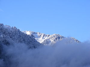
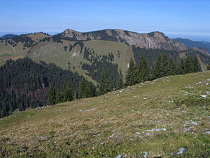
Bavarian Prealps
Distance: Approx. 5002 meters
Latitude and longitude: 47.65,11.65
The Bavarian Prealps (German: Bayerische Voralpen) are a mountain range within the Northern Limestone Alps along the Austria–Germany border. They include the Bavarian Prealp region between the river Loisach to the west and the river Inn to the east; the range is about 80 kilometres (50 mi) long and 20–30 kilometres (12–19 mi) wide. The term is not defined politically, but alpine-geographically because, although the range is mostly located in Bavaria, southeast Germany, small areas of the Bavarian Prealps lie in the state of Tyrol (e.g.
Brauneck
Distance: Approx. 5329 meters
Latitude and longitude: 47.66666667,11.51666667
Brauneck is a mountain in Bavaria, Germany. It is the 'house mountain' of Lenggries. The mountain is a popular local skiing destination.

Fockenstein
Distance: Approx. 6227 meters
Latitude and longitude: 47.68333333,11.65
Fockenstein is a 1,564-metre-high (5,131 ft) mountain in Bavaria, Germany. It is located in what is called the Bavarian Prealps, west of the lake Tegernsee.

Geierstein
Mountain in Bavaria, Germany
Distance: Approx. 4475 meters
Latitude and longitude: 47.68333333,11.61666667
Geierstein (also Geigerstein) is a 1,491 m high mountain in the western Mangfall Mountains, part of the Bavarian Prealps, in Bavaria, Germany.
Kampen (mountain)
Distance: Approx. 6033 meters
Latitude and longitude: 47.66305556,11.66138889
The Kampen is a mountain in Bavaria, Germany.

Schönberg (Bavarian Prealps)
Distance: Approx. 4709 meters
Latitude and longitude: 47.63888889,11.64388889
Schönberg is a mountain of the Tegernsee Mountains in Bavaria, Germany.
Seekarkreuz
Distance: Approx. 5002 meters
Latitude and longitude: 47.65,11.65
Seekarkreuz is a mountain of Bavaria, Germany.

Jachen
River in Germany
Distance: Approx. 125 meters
Latitude and longitude: 47.6491,11.5843
The Jachen is a river in Bavaria, Germany. It flows into the Isar south of Lenggries.

Hohenburg (Lenggries)
Distance: Approx. 2632 meters
Latitude and longitude: 47.67306944,11.59099167
The Hohenburg (previously also called Hochenburg) is a ruined medieval castle near Lenggries in Bavaria, Germany. Once a dominating centre of power in the region, it was destroyed by fire on 21 July 1717.

Schloss Hohenburg
Distance: Approx. 2491 meters
Latitude and longitude: 47.67222222,11.58722222
Schloss Hohenburg is a Baroque schloss (palace) in Lenggries, Bavaria, Germany.
Weather in this IP's area
overcast clouds
8 Celsius
8 Celsius
8 Celsius
8 Celsius
1022 hPa
59 %
1022 hPa
898 hPa
10000 meters
0.32 m/s
2.37 m/s
116 degree
100 %