185.134.229.250 - IP Lookup: Free IP Address Lookup, Postal Code Lookup, IP Location Lookup, IP ASN, Public IP
Country:
Region:
City:
Location:
Time Zone:
Postal Code:
ISP:
ASN:
language:
User-Agent:
Proxy IP:
Blacklist:
IP information under different IP Channel
ip-api
Country
Region
City
ASN
Time Zone
ISP
Blacklist
Proxy
Latitude
Longitude
Postal
Route
db-ip
Country
Region
City
ASN
Time Zone
ISP
Blacklist
Proxy
Latitude
Longitude
Postal
Route
IPinfo
Country
Region
City
ASN
Time Zone
ISP
Blacklist
Proxy
Latitude
Longitude
Postal
Route
IP2Location
185.134.229.250Country
Region
silistra
City
tutrakan
Time Zone
Europe/Sofia
ISP
Language
User-Agent
Latitude
Longitude
Postal
ipdata
Country
Region
City
ASN
Time Zone
ISP
Blacklist
Proxy
Latitude
Longitude
Postal
Route
Popular places and events near this IP address
Oltenița
Municipality in Călărași, Romania
Distance: Approx. 4383 meters
Latitude and longitude: 44.08666667,26.63666667
Oltenița (Romanian pronunciation: [olˈtenitsa] ) is a city in Călărași County, Muntenia, Romania, on the left bank of the river Argeș, where its waters flow into the Danube.

Argeș (river)
River in Romania
Distance: Approx. 1021 meters
Latitude and longitude: 44.05916667,26.61694444
The Argeș (Romanian pronunciation: [ˈardʒeʃ] ) is a river in Southern Romania, a left tributary of the Danube. It is 350 km (220 mi) long, and its basin area is 12,550 km2 (4,850 sq mi). Its source is in the Făgăraș Mountains, in the Southern Carpathians and it flows into the Danube at Oltenița.

Battle of Turtucaia
Battle in World War I
Distance: Approx. 0 meters
Latitude and longitude: 44.05,26.6167
The Battle of Turtucaia (Romanian: Bătălia de la Turtucaia; Bulgarian: Битка при Тутракан, Bitka pri Tutrakan), also known as Tutrakan Epopee (Bulgarian: Тутраканска епопея, Tutrakanska epopeya) in Bulgaria, was the opening battle of the first Central Powers offensive during the Romanian Campaign of World War I. The battle lasted for five days and ended with the capture of the fortress of Turtucaia (now Tutrakan) and the surrender of its Romanian defenders.
Tutrakan
Place in Silistra, Bulgaria
Distance: Approx. 3 meters
Latitude and longitude: 44.05,26.61666667
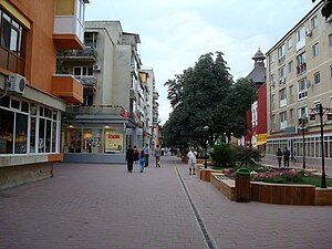
Tutrakan (Bulgarian: Тутракан [ˈtutrɐkan], Romanian: Тurtucaia, Turkish: Turtukaya) is a town in northeastern Bulgaria, an administrative centre of the homonymous municipality, part of Silistra Province. It is situated on the right bank of the Danube opposite the Romanian town of Oltenița (to which it was linked through a ferry but the ferry does not work anymore), in the very west of Southern Dobruja, 58 km east of Rousse and 62 km west of Silistra.

Chirnogi
Commune in Călărași, Romania
Distance: Approx. 7886 meters
Latitude and longitude: 44.11666667,26.58333333
Chirnogi is a commune in Călărași County, Muntenia, Romania. It is composed of a single village, Chirnogi.
Zboiul
River in Călărași, Romania
Distance: Approx. 1115 meters
Latitude and longitude: 44.0581,26.6085
The Zboiul is a small left tributary of the river Danube in Romania. It discharges into the Danube just upstream of the confluence of Danube and Argeș, west of Oltenița. Its length is 28 km (17 mi) and its basin size is 86 km2 (33 sq mi).

Battle of Oltenița
1853 battle of the Crimean War
Distance: Approx. 4383 meters
Latitude and longitude: 44.08666667,26.63666667
The Battle of Oltenița (or Oltenitza) was fought on 4 November 1853 and was the first engagement of the Crimean War. In this battle an Ottoman army under the command of Omar Pasha was defending its fortified positions from the Russian forces led by General Peter Dannenberg, until the Russians were ordered to withdraw. The Russian attack was called off just when they reached the Ottoman fortifications, and they retreated in good order, but suffered heavy losses.
Port of Oltenița
Port in Romania
Distance: Approx. 2469 meters
Latitude and longitude: 44.0634,26.6413
The Port of Oltenița is one of the largest Romanian river ports, located in the city of Oltenița on the Danube River.

Tutrakan Municipality
Municipality in Silistra, Bulgaria
Distance: Approx. 8433 meters
Latitude and longitude: 43.98333333,26.56666667
Tutrakan Municipality (Bulgarian: Община Тутракан) is a municipality (obshtina) in Silistra Province, Northeastern Bulgaria, located along the right bank of Danube river in the Danubian Plain. It is named after its administrative centre - the town of Tutrakan. The municipality embraces a territory of 448.35 km² with a population of 16,920 inhabitants, as of December 2009.

Oltenița Water Tower
Water tower in Oltenița, Romania
Distance: Approx. 5103 meters
Latitude and longitude: 44.093,26.6388
The Oltenița Water Tower is a water tower located at 2B Argeșului Street in Oltenița, Romania. The 34.5-meter high octagonal tower was the town’s first structure made of reinforced concrete. Bidding for the building contract took place in 1913, and it was completed in 1916.
Weather in this IP's area
clear sky
16 Celsius
15 Celsius
16 Celsius
16 Celsius
1014 hPa
38 %
1014 hPa
1007 hPa
10000 meters
0.86 m/s
0.71 m/s
327 degree
