Country:
Region:
City:
Latitude and Longitude:
Time Zone:
Postal Code:
IP information under different IP Channel
ip-api
Country
Region
City
ASN
Time Zone
ISP
Blacklist
Proxy
Latitude
Longitude
Postal
Route
Luminati
Country
Region
occ
City
montpellier
ASN
Time Zone
Europe/Paris
ISP
ADISTA SAS
Latitude
Longitude
Postal
IPinfo
Country
Region
City
ASN
Time Zone
ISP
Blacklist
Proxy
Latitude
Longitude
Postal
Route
db-ip
Country
Region
City
ASN
Time Zone
ISP
Blacklist
Proxy
Latitude
Longitude
Postal
Route
ipdata
Country
Region
City
ASN
Time Zone
ISP
Blacklist
Proxy
Latitude
Longitude
Postal
Route
Popular places and events near this IP address
Fréjus
Commune in Provence-Alpes-Côte d'Azur, France
Distance: Approx. 122 meters
Latitude and longitude: 43.433,6.737
Fréjus (French: [fʁeʒys] ; Occitan: Frejús [fɾeˈdʒys]) is a commune in the Var department in the Provence-Alpes-Côte d'Azur region in Southeastern France. It neighbours Saint-Raphaël, effectively forming one urban agglomeration. The north of the commune forms part of the Massif de l'Esterel.

Saint-Raphaël, Var
Commune in Provence-Alpes-Côte d'Azur, France
Distance: Approx. 2805 meters
Latitude and longitude: 43.4252,6.7684
Saint-Raphaël (French: [sɛ̃ ʁafaɛl]; Occitan: Sant Rafèu Occitan pronunciation: [ˈsan raˈfɛw]) is a commune in the Var department, Provence-Alpes-Côte d'Azur region, Southeastern France. Immediately to the west of Saint-Raphaël lies a larger and older town, Fréjus; together they form an urban agglomeration known as Var Estérel Méditerranée, which also encompasses the smaller communes of Les Adrets-de-l'Estérel, Puget-sur-Argens and Roquebrune-sur-Argens. In the second half of the 19th century, the township came under the influence of Mayor Felix Martin and writer Jean-Baptiste Alphonse Karr; owing to their efforts and its beneficial climate the commune developed into a seaside resort popular with artists, sportsmen and politicians.
Argens
River in France
Distance: Approx. 2597 meters
Latitude and longitude: 43.41,6.73722222
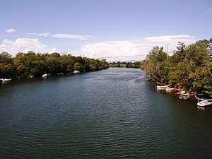
The Argens (French pronunciation: [aʁʒɑ̃(s)]; Occitan: Argens) is a 116 km long river of the French Riviera. Its 2,734 km2 (1,056 sq mi) drainage basin is fully included in the Var department. The river goes through Vidauban, Le Muy, Roquebrune-sur-Argens, Fréjus, then it flows into the Mediterranean Sea, near Fréjus.

Fréjus Cathedral
Distance: Approx. 98 meters
Latitude and longitude: 43.433174,6.736751
Fréjus Cathedral (French: Cathédrale Saint-Léonce de Fréjus) is a Roman Catholic church located in the town of Fréjus in the Var department of Provence, southeast France, and dedicated to Saint Leontius of Fréjus. The cathedral was the seat of the Bishop of Fréjus from the 5th century. The diocese was abolished in 1801 but restored in 1822 under bull Paternae charitatis.
Fréjus station
Railway station in Fréjus, France
Distance: Approx. 270 meters
Latitude and longitude: 43.43194444,6.73277778
Gare de Fréjus is a railway station serving Fréjus, Var department, southeastern France. It is situated on the Marseille–Ventimiglia railway. The station is served by regional trains (TER Provence-Alpes-Côte d'Azur) to Nice, Marseille and Toulon.
Reyran
River in France
Distance: Approx. 2542 meters
Latitude and longitude: 43.4105,6.7338
The Reyran is a torrent of the Var department in Provence-Alpes-Côte d'Azur, France and a tributary of the Argens. It is an ephemeral stream, 26.8 km long, which originates in Bagnols-en-Forêt in the Var, 12 km from Fréjus. The Reyran flows only three months a year and can be dry the rest of the year.
Canton of Fréjus
Distance: Approx. 580 meters
Latitude and longitude: 43.43,6.73
The canton of Fréjus is an administrative division of the Var department, southeastern France. Its borders were modified at the French canton reorganisation which came into effect in March 2015. Its seat is in Fréjus.
Canton of Saint-Raphaël
Distance: Approx. 2809 meters
Latitude and longitude: 43.43,6.77
The canton of Saint-Raphaël is an administrative division of the Var department, southeastern France. Its borders were modified at the French canton reorganisation which came into effect in March 2015. Its seat is in Saint-Raphaël.

Arènes de Fréjus
Distance: Approx. 535 meters
Latitude and longitude: 43.434,6.729
Arènes de Fréjus or Amphithéâtre de Fréjus is a 12,000-capacity Roman amphitheatre located in Fréjus, France. The structure was built in the 1st century. In recent times the arena has been used for major rock concerts, hosting artists such as Rod Stewart, Queen, Iron Maiden, David Bowie and Tina Turner.

Missiri mosque
Distance: Approx. 2796 meters
Latitude and longitude: 43.45766389,6.72714167
The Missiri Mosque is a former French military community center inspired by sub-Saharan Islamic architecture. It was constructed in 1928–1930 for the Senegalese Tirailleurs based in military camps in Fréjus, southern France. Although its appearance evokes that of a mosque, its purpose and uses remained secular.
Mémorial des guerres en Indochine
National necropolis in Fréjus, Var, France
Distance: Approx. 1864 meters
Latitude and longitude: 43.44527778,6.75166667
The Mémorial des guerres en Indochine (Indochina War Memorial) is located in the municipality of Fréjus, Gallieni sector, in the Var department. It was inaugurated on 16 February 1993 by François Mitterrand, President of France. The bodies resting in the national necropolis of Fréjus are those of soldiers Morts pour la France (Died for France) who died either between 1940 and 1945, or, for the most part, between 1946 and 1954 in the First Indochina War.
Estérel Côte d'Azur Agglomération
Communauté d'agglomération in Provence-Alpes-Côte d'Azur, France
Distance: Approx. 2515 meters
Latitude and longitude: 43.43333333,6.76666667
Estérel Côte d'Azur Agglomération (before May 2021: Var Estérel Méditerranée) is a communauté d'agglomération, an intercommunal structure, centred on the cities of Fréjus and Saint-Raphaël. It is located in the Var department, in the Provence-Alpes-Côte d'Azur region, southeastern France. It was created in January 2013.
Weather in this IP's area
few clouds
18 Celsius
17 Celsius
16 Celsius
19 Celsius
1011 hPa
53 %
1011 hPa
1009 hPa
10000 meters
2.16 m/s
5.74 m/s
274 degree
16 %
07:29:35
17:06:52


