Country:
Region:
City:
Latitude and Longitude:
Time Zone:
Postal Code:
IP information under different IP Channel
ip-api
Country
Region
City
ASN
Time Zone
ISP
Blacklist
Proxy
Latitude
Longitude
Postal
Route
Luminati
Country
Region
ag
City
rupperswil
ASN
Time Zone
Europe/Zurich
ISP
VTX Services SA
Latitude
Longitude
Postal
IPinfo
Country
Region
City
ASN
Time Zone
ISP
Blacklist
Proxy
Latitude
Longitude
Postal
Route
db-ip
Country
Region
City
ASN
Time Zone
ISP
Blacklist
Proxy
Latitude
Longitude
Postal
Route
ipdata
Country
Region
City
ASN
Time Zone
ISP
Blacklist
Proxy
Latitude
Longitude
Postal
Route
Popular places and events near this IP address

Allschwil
Municipality in Basel-Landschaft, Switzerland
Distance: Approx. 2719 meters
Latitude and longitude: 47.55,7.53333333
Allschwil (German pronunciation: [ˈalʃvi:l]) is a village and a municipality in the district of Arlesheim in the canton of Basel-Country in Switzerland. Allschwil is a seamless suburb of Basel and is located between Basel to the east and Alsace in France to the west. The official language of Allschwil is (the Swiss variety of Standard) German, but the main spoken language is the local variant of the Alemannic Swiss German dialect.
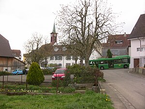
Schönenbuch
Municipality in Basel-Landschaft, Switzerland
Distance: Approx. 1485 meters
Latitude and longitude: 47.53333333,7.48333333
Schönenbuch (Swiss German: Schönebuech) is a municipality in the district of Arlesheim in the canton of Basel-Landschaft in Switzerland.

Attenschwiller
Commune in Grand Est, France
Distance: Approx. 3994 meters
Latitude and longitude: 47.5675,7.465
Attenschwiller (French pronunciation: [atənʃvilɛʁ] ; German: Attenschweiler) is a commune in the Haut-Rhin department in Alsace in north-eastern France.

Buschwiller
Commune in Grand Est, France
Distance: Approx. 2169 meters
Latitude and longitude: 47.5592,7.5081
Buschwiller (German: Buschweiler) is a commune in the Haut-Rhin department in Alsace in north-eastern France.

Folgensbourg
Commune in Grand Est, France
Distance: Approx. 4240 meters
Latitude and longitude: 47.5511,7.4458
Folgensbourg (French pronunciation: [fɔlɡənsbuʁ] ; German: Volkensberg; Alsatian: Folgeschburg) is a commune in the Haut-Rhin department, in Alsace in north-eastern France.

Hagenthal-le-Bas
Commune in Grand Est, France
Distance: Approx. 2337 meters
Latitude and longitude: 47.5256,7.4781
Hagenthal-le-Bas (French pronunciation: [agəntal lə ba] ; German: Niederhagenthal) is a commune in the Haut-Rhin department in Alsace in north-eastern France. The Château de la famille d'Eplingen there has been owned by the town since 2003 and been a listed historical monument since 2010.
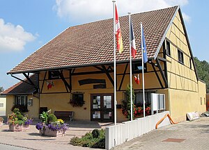
Hagenthal-le-Haut
Commune in Grand Est, France
Distance: Approx. 3260 meters
Latitude and longitude: 47.5203,7.4686
Hagenthal-le-Haut (French pronunciation: [agəntal lə o] ; German: Oberhagenthal) is a commune in the Haut-Rhin department in Alsace in north-eastern France.
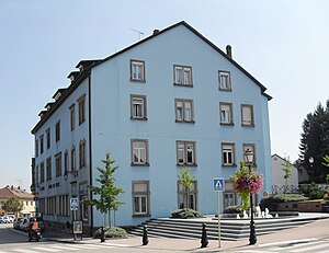
Hégenheim
Commune in Grand Est, France
Distance: Approx. 3082 meters
Latitude and longitude: 47.5614,7.5269
Hégenheim (French pronunciation: [eɡənaim] ; German: Hegenheim; Alsatian: Hagena) is a commune in the Haut-Rhin department in Alsace in north-eastern France. It is adjacent to the Swiss town of Allschwil, and is part of the Basel urban area.
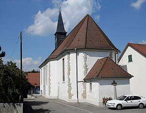
Neuwiller
Commune in Grand Est, France
Distance: Approx. 2116 meters
Latitude and longitude: 47.5253,7.5169
Neuwiller (French pronunciation: [nœvilɛʁ], Alsatian and Basel German: Näiwil, German: Neuweiler) is a commune in the Haut-Rhin department in Alsace in north-eastern France. It is surrounded to the north, east and south by the Swiss canton of Basel-Landschaft, and is roughly 7 km from Basel itself.

Wentzwiller
Commune in Grand Est, France
Distance: Approx. 1875 meters
Latitude and longitude: 47.5511,7.4806
Wentzwiller (French pronunciation: [vɛntswilɛʁ] ; German: Wenzweiler; Alsatian: Wànzwiller) is a commune in the Haut-Rhin department in Alsace in north-eastern France.

Château de la famille d'Eplingen
Château in Alsace, France
Distance: Approx. 2538 meters
Latitude and longitude: 47.524,7.4767
Château de la famille d'Eplingen is a château in the commune of Hagenthal-le-Bas, in the department of Haut-Rhin, Alsace, France. Built in either the 16th or 17th century, the château became a national property in 1799 and remained so until it moved into private hands in the 1840s. The remodeling performed by its new owners were mostly to the external structure of the building.
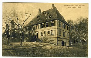
Château de Hegenheim
Distance: Approx. 3255 meters
Latitude and longitude: 47.5624,7.5287
The Château de Hegenheim is a castle in the commune of Hégenheim, in the department of Haut-Rhin, Alsace, France. It has been a listed historical monument since 1990.
Weather in this IP's area
overcast clouds
9 Celsius
6 Celsius
8 Celsius
10 Celsius
1029 hPa
78 %
1029 hPa
988 hPa
10000 meters
5.14 m/s
120 degree
100 %
07:15:42
17:11:19