185.132.114.89 - IP Lookup: Free IP Address Lookup, Postal Code Lookup, IP Location Lookup, IP ASN, Public IP
Country:
Region:
City:
Location:
Time Zone:
Postal Code:
ISP:
ASN:
language:
User-Agent:
Proxy IP:
Blacklist:
IP information under different IP Channel
ip-api
Country
Region
City
ASN
Time Zone
ISP
Blacklist
Proxy
Latitude
Longitude
Postal
Route
db-ip
Country
Region
City
ASN
Time Zone
ISP
Blacklist
Proxy
Latitude
Longitude
Postal
Route
IPinfo
Country
Region
City
ASN
Time Zone
ISP
Blacklist
Proxy
Latitude
Longitude
Postal
Route
IP2Location
185.132.114.89Country
Region
moravskoslezsky kraj
City
trinec
Time Zone
Europe/Prague
ISP
Language
User-Agent
Latitude
Longitude
Postal
ipdata
Country
Region
City
ASN
Time Zone
ISP
Blacklist
Proxy
Latitude
Longitude
Postal
Route
Popular places and events near this IP address

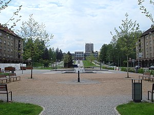
Třinec
City in the Czech Republic
Distance: Approx. 144 meters
Latitude and longitude: 49.67777778,18.67277778
Třinec (Czech: [ˈtr̝̊ɪnɛts] ; Polish: Trzyniec [ˈtʂɨɲɛt͡s] ; German: Trzynietz) is a city in Frýdek-Místek District in the Moravian-Silesian Region of the Czech Republic. It has about 34,000 inhabitants and is the least populated statutory city in the country. The city is an important cultural centre of the Polish minority in Trans-Olza, which makes up 12.1% of the population (as of 2021).

Werk Arena
Czech indoor hockey arena
Distance: Approx. 995 meters
Latitude and longitude: 49.66990833,18.66377222
Werk Arena is an indoor sporting arena located in Třinec, Czech Republic. The capacity of the arena is 5,400 people.

Lyžbice
Neighborhood of Třinec
Distance: Approx. 1405 meters
Latitude and longitude: 49.66666667,18.68055556
(Polish: , German: Lischbitz) is a part of the town of Třinec in Frýdek-Místek District, Moravian-Silesian Region, Czech Republic, on the Olza River. It was a separate municipality but later became administratively a part of the town of Třinec. It lies in the historical region of Cieszyn Silesia and has a population of 17,239 (1 January 2008).

Třinec Iron and Steel Works
Czech producer of long rolled steel products
Distance: Approx. 1917 meters
Latitude and longitude: 49.69027778,18.65277778
Třinec Iron and Steel Works (TŽ) (Czech: Třinecké železárny, Polish: Huta trzyniecka) is a producer of long rolled steel products in Třinec, Moravian-Silesian Region, Czech Republic. TŽ produces over a third of all steel produced in the Czech Republic (roughly 2.5 million tons annually). Since its establishment, Třinecké železárny's plants have produced more than 150 million tons of crude steel.

Kojkovice
Distance: Approx. 2632 meters
Latitude and longitude: 49.7,18.6825
(Polish: ) is a village in Frýdek-Místek District, Moravian-Silesian Region, Czech Republic, on the border with Poland. It was a separate municipality but became administratively a part of Třinec (Trzyniec) in 1960. It lies in the historical region of Cieszyn Silesia and has a population of 287 (1 January 2008).
Oldřichovice (Třinec)
Distance: Approx. 3253 meters
Latitude and longitude: 49.65138889,18.65083333
(Polish: , German: Oldrzichowitz) is a village in Frýdek-Místek District, Moravian-Silesian Region, Czech Republic. It was a separate municipality but became administratively a part of Třinec in 1980. It has a population of 3,182 (1 January 2008).

Tyra (stream)
River in Moravian-Silesian, Czech Republic
Distance: Approx. 1203 meters
Latitude and longitude: 49.68305556,18.65638889
The Tyra (also called Tyrka) is a stream in the Czech Republic, a left tributary of the Olza River. It flows through Třinec in the Moravian-Silesian Region. It is 13.0 km (8.1 mi) long.

Horní Líštná
Distance: Approx. 2939 meters
Latitude and longitude: 49.69305556,18.70388889
(Polish: , German: Ober Lischna) is a village in Frýdek-Místek District, Moravian-Silesian Region, Czech Republic. It was a separate municipality but became administratively a part of Třinec in 1960. It lies on the border with Poland, in the historical region of Cieszyn Silesia and has a population of 311 (1 January 2008).

Dolní Líštná
Distance: Approx. 1225 meters
Latitude and longitude: 49.68416667,18.68444444
(Polish: , German: Nieder Lischna) is a village in Frýdek-Místek District, Moravian-Silesian Region, Czech Republic. It was a separate municipality but became administratively a part of Třinec in 1946. It has a population of 4,600 (1 January 2008).
Stadion Rudolfa Labaje
Distance: Approx. 1024 meters
Latitude and longitude: 49.6686,18.66784
Stadion Rudolfa Labaje is a football stadium in Třinec in the Czech Republic. It is the home ground of football side FK Třinec. The stadium is named after Rudolf Łabaj, a local Polish footballer who played for the club.
Staré Město (Třinec)
Distance: Approx. 253 meters
Latitude and longitude: 49.67916417,18.66825278
Staré Město (Polish: Stare Miasto, "Old Town") is administratively a part of the town of Třinec in Frýdek-Místek District, Moravian-Silesian Region, Czech Republic. It is the historical centre of the town. It lies in the historical region of Cieszyn Silesia and has a population of 5,713 (1 January 2008).

Sports Hall STARS Třinec
Sports hall in Třinec, Czech Republic
Distance: Approx. 804 meters
Latitude and longitude: 49.67055556,18.66833333
Sports Hall STARS Třinec is a sports hall in Třinec, Czech Republic. The hall has a capacity of 900 spectators. The floorball club FBC Třinec uses it for its home matches, and other clubs in the vicinity from the 2023–24 season.
Weather in this IP's area
overcast clouds
7 Celsius
5 Celsius
7 Celsius
7 Celsius
1004 hPa
90 %
1004 hPa
949 hPa
10000 meters
2.67 m/s
5.87 m/s
157 degree
90 %

