Country:
Region:
City:
Latitude and Longitude:
Time Zone:
Postal Code:
IP information under different IP Channel
ip-api
Country
Region
City
ASN
Time Zone
ISP
Blacklist
Proxy
Latitude
Longitude
Postal
Route
Luminati
Country
Region
nw
City
konigswinter
ASN
Time Zone
Europe/Berlin
ISP
Vodafone GmbH
Latitude
Longitude
Postal
IPinfo
Country
Region
City
ASN
Time Zone
ISP
Blacklist
Proxy
Latitude
Longitude
Postal
Route
db-ip
Country
Region
City
ASN
Time Zone
ISP
Blacklist
Proxy
Latitude
Longitude
Postal
Route
ipdata
Country
Region
City
ASN
Time Zone
ISP
Blacklist
Proxy
Latitude
Longitude
Postal
Route
Popular places and events near this IP address

Drachenfels Railway
Rack railway in Königswinter, North Rhine-Westphalia, Germany
Distance: Approx. 5139 meters
Latitude and longitude: 50.674257,7.198513
The Drachenfels Railway (German: Drachenfelsbahn) is a rack railway line in the North Rhine-Westphalia region of Germany. The line runs from Königswinter, on the east bank of the Rhine, to the summit of the Drachenfels mountain at an altitude of 289 m (948 ft). Besides the two terminal stations, an intermediate station serves the Schloss Drachenburg.

Siebengebirge
Distance: Approx. 2553 meters
Latitude and longitude: 50.67944444,7.24833333
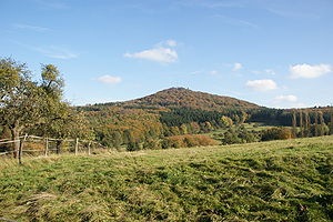
The Siebengebirge(), occasionally Sieben Mountains or Seven Mountains, are a hill range of the German Central Uplands on the east bank of the Middle Rhine, southeast of Bonn.

Drachenfels (Siebengebirge)
Hill in Germany
Distance: Approx. 5254 meters
Latitude and longitude: 50.66527778,7.20972222
The Drachenfels ("Dragon's Rock", German pronunciation: [ˈdʁaxənˌfɛls]) is a hill (321 metres (1,053 ft)) in the Siebengebirge uplands between Königswinter and Bad Honnef in Germany. The hill was formed by rising magma that could not break through to the surface, and then cooled and became solid underneath. It is the subject of much tourism and romanticism in the North Rhine-Westphalia area.

Hotel Petersberg
Distance: Approx. 3904 meters
Latitude and longitude: 50.68611111,7.2075
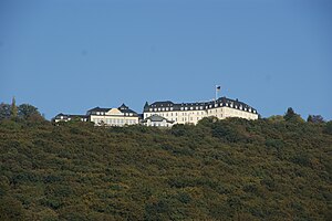
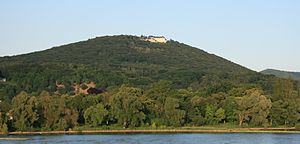
Hotel Petersberg is a hotel and official guest house of Germany, termed the "Bundesgästehaus" (the official title being Gästehaus der Verfassungsorgane der Bundesrepublik Deutschland). It is located on the Petersberg, a prominent mountain of the Siebengebirge near Bonn, Germany. With a height of 331 metres (1,086 ft), it overlooks the cities of Königswinter, on the right bank of the Rhine river, and Bonn on the opposite side.

Heisterbach Abbey
Distance: Approx. 3130 meters
Latitude and longitude: 50.69527778,7.21388889
Heisterbach Abbey (Kloster Heisterbach; also Petersthal, formerly Petersberg) was a Cistercian monastery in the Siebengebirge near Oberdollendorf in North Rhine-Westphalia, Germany.

CJD Christophorusschule Königswinter
Private, alternative secondary school in Rhein-Sieg-Kreis, Germany
Distance: Approx. 5335 meters
Latitude and longitude: 50.68333333,7.18722222
The CJD Christophorusschule Königswinter is a state recognized private, alternative school located in Rhein-Sieg-Kreis (North Rhine-Westphalia, on the border to Rhineland-Palatinate), and is run by the Christliches Jugenddorfwerk Deutschlands (Christian Youth Village Foundation of Germany – CJD). The school consists of a secondary school and a high school, which correspond to the state equivalents. The Christophorusschule has about 1,450 male and female students (including 400 in the secondary school), and about 105 teachers for instruction.
Oberdollendorf
Stadtteil of Königswinter in North Rhine-Westphalia, Germany
Distance: Approx. 5299 meters
Latitude and longitude: 50.70222222,7.18194444
Oberdollendorf is a municipal district of Königswinter, a city in the Rhein-Sieg district, in North Rhine-Westphalia, Germany. The vineyards which dominate the town are part of the Mittelrhein wine region.

Schloss Drachenburg
Villa in Königswinter
Distance: Approx. 5131 meters
Latitude and longitude: 50.6686729,7.2063442
Schloss Drachenburg or Drachenburg Castle is a private villa styled as a palace and constructed in the late 19th century. It was completed in only two years (1882–84) on the Drachenfels hill in Königswinter, a German town on the east bank of the Rhine, south of the city of Bonn. Baron Stephan von Sarter (1833–1902), a broker and banker, planned to live there, but never did.
Quirrenbach (Pleisbach)
River in Germany
Distance: Approx. 3272 meters
Latitude and longitude: 50.6868,7.2971
Quirrenbach is a small river of North Rhine-Westphalia, Germany. It is a right tributary of the Pleisbach in Hüscheid.
Petersberg (Siebengebirge)
Distance: Approx. 3904 meters
Latitude and longitude: 50.68611111,7.2075
The Petersberg (331 metres (1,086 ft)), formerly known as the Stromberg, is a mountain in the Siebengebirge mountain range near Bonn, Germany. It overlooks the cities of Königswinter, on the right bank of the Rhine river, and Bonn on the opposite side. Today the peak is the site of the Hotel Petersberg, which serves as a guest house of the Federal Republic of Germany.

Großer Ölberg
Distance: Approx. 2255 meters
Latitude and longitude: 50.68222,7.24833
The Großer Ölberg (also: Oelberg), at 460 metres above sea level, is the highest hill in the Siebengebirge range in Germany. It is located in the borough of Königswinter near the village of Ittenbach and south of a subpeak known as the Kleiner Ölberg (331.7 m above sea level (NN)). Thanks to the transmission mast on the summit, it is visible from a long way off, for example from the A 3 motorway, and is easily distinguishable from its neighbours.

Königswinter station
Railway station in Königswinter, Germany
Distance: Approx. 5197 meters
Latitude and longitude: 50.67861111,7.19305556
Königswinter station is a station on the East Rhine Railway (German: Rechte Rheinstrecke) in the city of Königswinter in the Rhein-Sieg-Kreis district of North Rhine-Westphalia, Germany. It is a protected as a monument. The station was opened on 11 July 1870 as part of the extension of the East Rhine Railway from Neuwied to Oberkassel.
Weather in this IP's area
clear sky
5 Celsius
2 Celsius
4 Celsius
5 Celsius
1024 hPa
86 %
1024 hPa
1002 hPa
10000 meters
2.57 m/s
130 degree
07:29:42
16:59:26

