Country:
Region:
City:
Latitude and Longitude:
Time Zone:
Postal Code:
IP information under different IP Channel
ip-api
Country
Region
City
ASN
Time Zone
ISP
Blacklist
Proxy
Latitude
Longitude
Postal
Route
Luminati
Country
ASN
Time Zone
Europe/Rome
ISP
NEXT SRL
Latitude
Longitude
Postal
IPinfo
Country
Region
City
ASN
Time Zone
ISP
Blacklist
Proxy
Latitude
Longitude
Postal
Route
db-ip
Country
Region
City
ASN
Time Zone
ISP
Blacklist
Proxy
Latitude
Longitude
Postal
Route
ipdata
Country
Region
City
ASN
Time Zone
ISP
Blacklist
Proxy
Latitude
Longitude
Postal
Route
Popular places and events near this IP address
Santi Angeli Custodi a Città Giardino
Church in Rome, Italy
Distance: Approx. 988 meters
Latitude and longitude: 41.93586667,12.53581389
Santi Angeli Custodi (Holy Guardian Angels), church on Via Alpi Apuane, Rome.

Rebibbia
Urban zone of Rome, Italy
Distance: Approx. 2081 meters
Latitude and longitude: 41.93097,12.571664
Rebibbia is an urban zone of Rome, Italy. It is located on the ancient Via Tiburtina on the northeast edge of the city. Administratively Rebibbia is part of both Ponte Mammolo quarter of Rome and Municipio IV of Rome.

Mons Sacer
Hill northeast of ancient Rome
Distance: Approx. 1343 meters
Latitude and longitude: 41.9408,12.5325
The Mons Sacer, Sacer Mons, or Sacred Mount is a hill in Rome, famed as the location of the first secession of the plebs, in 494 BC.
Ponte Nomentano
Ancient bridge of Rome
Distance: Approx. 1302 meters
Latitude and longitude: 41.933611,12.5325
The Ponte Nomentano (called Pons Lamentanus during the Middle Ages) is a Roman bridge in Rome, Italy, which carried the Via Nomentana over the Aniene (Latin: Anio). Having lain outside the city limits for most of its history, the picturesque bridge is noted for its medieval bridge tower, which served to protect this important northern approach to Rome.

Conca d'Oro (Rome Metro)
Rome metro station
Distance: Approx. 1680 meters
Latitude and longitude: 41.93944444,12.52777778
Conca d'Oro is an underground station on Line B of the Rome Metro. It is located in the Monte Sacro quarter, under the large Piazza Conca d'Oro. The works, which cost €513 million, started in October 2005.

Jonio (Rome Metro)
Rome metro station
Distance: Approx. 1958 meters
Latitude and longitude: 41.94638889,12.52805556
Jonio is an underground station on Line B of the Rome Metro. It is located in the Monte Sacro quarter, under the intersection between Viale Jonio and Via Scarpanto. The station was opened on 21 April 2015.
San Giovanni Crisostomo al Monte Sacro Alto
Church in Rome, Italy
Distance: Approx. 590 meters
Latitude and longitude: 41.940516,12.542894
San Giovanni Crisostomo al Monte Sacro Alto is a church in Rome named in honour of John Chrysostom, in the district Monte Sacro Alto, Via Emilio De Marchi, off the Via Nomentana.
San Liborio, Rome
Church in Rome, Italy
Distance: Approx. 1770 meters
Latitude and longitude: 41.9424,12.5676
The church of San Liborio is a church in Rome, in the district Ponte Mammolo, in Via Diego Fabbri. Designed by architect Ennio Canino, it was built in the late 1990s and inaugurated 7 November 1998. The parish was erected on 28 May 1965 with the decree Neminem fugit, issued by the Cardinal Vicar Luigi Traglia, and entrusted to the secular priests of the Institute of Sodales Priests.

Roma Nomentana railway station
Railway station in Rome, Italy
Distance: Approx. 2046 meters
Latitude and longitude: 41.9325,12.52361111
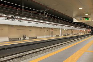
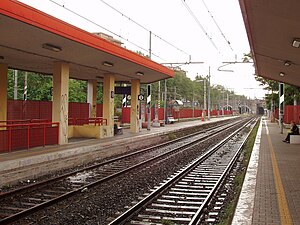
The Roma Nomentana railway station is a railway station in Rome located between the African quarter and the neighborhood Monte Sacro, connected to each other by a pedestrian underpass. The station and exchange car park can be accessed from via Valle d'Aosta, a road located between Via Nomentana and via delle Valli.
Santissimo Redentore a Valmelaina
Church in Rome, Italy
Distance: Approx. 2038 meters
Latitude and longitude: 41.948032,12.52847
Santissimo Redentore a Valmelaina is a 20th-century parochial church and titular church in northeastern Rome, dedicated to Jesus as the Most Holy Redeemer.

San Ponziano, Rome
Church in Rome, Italy
Distance: Approx. 1228 meters
Latitude and longitude: 41.9474,12.5447
San Ponziano [sam ponˈtsjaːno] is a 20th-century parochial church and titular church in the northern suburbs of Rome, dedicated to Pope Pontian (d. AD 235).
Santa Gemma Galgani a Monte Sacro
Church in Rome, Italy
Distance: Approx. 1253 meters
Latitude and longitude: 41.94454,12.536978
Santa Gemma Galgani a Monte Sacro is a 20th-century parochial church and titular church in northeastern Rome, dedicated to Saint Gemma Galgani (1878–1903).
Weather in this IP's area
clear sky
12 Celsius
10 Celsius
10 Celsius
13 Celsius
1020 hPa
62 %
1020 hPa
1015 hPa
10000 meters
2.06 m/s
280 degree
06:59:58
16:49:11


