Country:
 Germany
Region:
City:
Latitude and Longitude:
Time Zone:
Postal Code:
IP information under different IP Channel
ip-api
Country
Region
City
ASN
Time Zone
ISP
Blacklist
Proxy
Latitude
Longitude
Postal
Route
IPinfo
Country
Region
City
ASN
Time Zone
ISP
Blacklist
Proxy
Latitude
Longitude
Postal
Route
MaxMind
Country
Region
City
ASN
Time Zone
ISP
Blacklist
Proxy
Latitude
Longitude
Postal
Route
Luminati
Country
DERegion
rp
City
framersheim
ASN
Time Zone
Europe/Berlin
ISP
VSE NET GmbH
Latitude
Longitude
Postal
db-ip
Country
Region
City
ASN
Time Zone
ISP
Blacklist
Proxy
Latitude
Longitude
Postal
Route
ipdata
Country
Region
City
ASN
Time Zone
ISP
Blacklist
Proxy
Latitude
Longitude
Postal
Route
Popular places and events near this IP address

Alzey
Town in Rhineland-Palatinate, Germany
Distance: Approx. 4172 meters
Latitude and longitude: 49.74583333,8.11527778
Alzey (German pronunciation: [ˈaltsaɪ] ) is a Verband-free town – one belonging to no Verbandsgemeinde – in the Alzey-Worms district in Rhineland-Palatinate, Germany. It is the fifth-largest town in Rhenish Hesse, after Mainz, Worms, Ingelheim am Rhein and Bingen. Alzey is one of the Nibelungenstädte – towns associated with the Nibelungenlied – because it is represented in this work by the character Volker von Alzey.

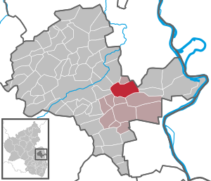
Alzey-Land
Distance: Approx. 3917 meters
Latitude and longitude: 49.75166667,8.11611111
Alzey-Land is a Verbandsgemeinde ("collective municipality") in the district Alzey-Worms, Rhineland-Palatinate, Germany. It is located around the town Alzey, which is the seat of Alzey-Land, but not part of the Verbandsgemeinde.
Gau-Odernheim
Municipality in Rhineland-Palatinate, Germany
Distance: Approx. 3308 meters
Latitude and longitude: 49.78472222,8.19416667
Gau-Odernheim (until 1896 simply Odernheim) is an Ortsgemeinde – a municipality belonging to a Verbandsgemeinde, a kind of collective municipality – in the Alzey-Worms district in Rhineland-Palatinate, Germany.

Albig
Municipality in Rhineland-Palatinate, Germany
Distance: Approx. 3847 meters
Latitude and longitude: 49.76666667,8.11666667
Albig is an Ortsgemeinde – a municipality belonging to a Verbandsgemeinde, a kind of collective municipality – in Rhenish Hesse in the Alzey-Worms district in Rhineland-Palatinate, Germany.

Biebelnheim
Municipality in Rhineland-Palatinate, Germany
Distance: Approx. 4105 meters
Latitude and longitude: 49.79666667,8.17055556
Biebelnheim is an Ortsgemeinde – a municipality belonging to a Verbandsgemeinde, a kind of collective municipality – in the Alzey-Worms district in Rhineland-Palatinate, Germany.
Dittelsheim-Heßloch
Municipality in Rhineland-Palatinate, Germany
Distance: Approx. 5191 meters
Latitude and longitude: 49.74388889,8.23694444
Dittelsheim-Heßloch (or Dittelsheim-Hessloch) is an Ortsgemeinde – a municipality belonging to a Verbandsgemeinde, a kind of collective municipality – in the Alzey-Worms district in Rhineland-Palatinate, Germany.
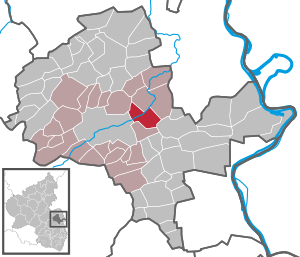
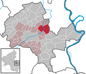
Framersheim
Municipality in Rhineland-Palatinate, Germany
Distance: Approx. 413 meters
Latitude and longitude: 49.75805556,8.17416667
Framersheim is an Ortsgemeinde – a municipality belonging to a Verbandsgemeinde, a kind of collective municipality – in the Alzey-Worms district in Rhineland-Palatinate, Germany.

Gau-Heppenheim
Municipality in Rhineland-Palatinate, Germany
Distance: Approx. 1980 meters
Latitude and longitude: 49.74222222,8.17333333
Gau-Heppenheim is an Ortsgemeinde – a municipality belonging to a Verbandsgemeinde, a kind of collective municipality – in the Alzey-Worms district in Rhineland-Palatinate, Germany.

Hochborn
Municipality in Rhineland-Palatinate, Germany
Distance: Approx. 4604 meters
Latitude and longitude: 49.72388889,8.20083333
Hochborn (until 1971: Blödesheim) is an Ortsgemeinde – a municipality belonging to a Verbandsgemeinde, a kind of collective municipality – in the Alzey-Worms district in Rhineland-Palatinate, Germany. This Ortsgemeinde earned a Germany-wide media presence in early 2001 when a television spot from the 1970s made by the then Südwestfunk was broadcast by Stefan Raab on his show TV total; it was about the place called Blödesheim. Stefan Raab then visited Hochborn during Carnival (locally known as Fastnachtszeit) and for a few weeks thereafter campaigned for a return to the name Blödesheim.

Alzey station
Railway station in Alzey, Germany
Distance: Approx. 4393 meters
Latitude and longitude: 49.750091,8.109894
Alzey station is, along with the stations Alzey Süd and Alzey West, one of three stations in the urban area of the Rhenish Hesse (German: Rheinhessen) town of Alzey in the German state of Rhineland-Palatinate. It is classified by Deutsche Bahn as a category 3 station.

Rhenish-Hessian Hills
Distance: Approx. 3696 meters
Latitude and longitude: 49.75,8.12
The Rhenish-Hessian Hills (German: Rheinhessisches Hügelland), also called the "Land of the Thousand Hills" (Land der 1000 Hügel), refers to that part of Rhenish Hesse within the German state of Rhineland-Palatinate. It lies within the counties of Alzey-Worms and Mainz-Bingen, and covers the same area as the natural region known as the Rhenish Hesse Tableland and Hill Country (Rheinhessisches Tafel- und Hügelland). It covers an area of around 1,400 km2.
Castra Alteium
Late-Roman border fort
Distance: Approx. 4167 meters
Latitude and longitude: 49.7429,8.1174
The Castra Alteium (German: Kastell Alzey) is a former late-Roman border fort on the Danube-Iller-Rhine Limes (DIRL).: X.IV.3 It is located in the territory of the city of Alzey in Rhenish Hesse, Germany. The fort was presumably built in the course of the last reconstruction measures on the Rhine frontier between 367 and 370 AD under the western Emperor Valentinian I. Previously, there was a Roman civilian settlement (Vicus), Altiaia, which was devastated by Alamanni in 352–353. The fort was also destroyed twice, and probably abandoned at the end of the fifth century.
Weather in this IP's area
clear sky
16 Celsius
15 Celsius
14 Celsius
17 Celsius
1020 hPa
83 %
1020 hPa
1002 hPa
10000 meters
2.68 m/s
5.89 m/s
41 degree
4 %
07:11:09
19:30:17