Country:
 Great Britain
Region:
City:
Latitude and Longitude:
Time Zone:
Postal Code:
IP information under different IP Channel
ip-api
Country
Region
City
ASN
Time Zone
ISP
Blacklist
Proxy
Latitude
Longitude
Postal
Route
IPinfo
Country
Region
City
ASN
Time Zone
ISP
Blacklist
Proxy
Latitude
Longitude
Postal
Route
MaxMind
Country
Region
City
ASN
Time Zone
ISP
Blacklist
Proxy
Latitude
Longitude
Postal
Route
Luminati
Country
 FR
FRRegion
idf
City
paris
ASN
Time Zone
Europe/Paris
ISP
Lycatel Distribution Uk Limited
Latitude
Longitude
Postal
db-ip
Country
Region
City
ASN
Time Zone
ISP
Blacklist
Proxy
Latitude
Longitude
Postal
Route
ipdata
Country
Region
City
ASN
Time Zone
ISP
Blacklist
Proxy
Latitude
Longitude
Postal
Route
Popular places and events near this IP address

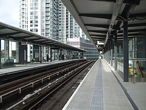
Crossharbour DLR station
Docklands Light Railway station
Distance: Approx. 333 meters
Latitude and longitude: 51.4956,-0.0144
Crossharbour is a light metro station on the Docklands Light Railway (DLR) Bank-Lewisham Line in Cubitt Town, East London. The station is situated on the Isle of Dogs and is between Mudchute and South Quay stations and is in Travelcard Zone 2. The Docklands Light Railway station opened as "Crossharbour" on 31 August 1987 on the site of the former Millwall Docks railway station, and was renamed in 1994 to "Crossharbour and London Arena".
South Quay DLR station
Docklands Light Railway station
Distance: Approx. 248 meters
Latitude and longitude: 51.4998,-0.0161
South Quay is a Docklands Light Railway (DLR) station on the Isle of Dogs, East London, England. The station is between Crossharbour and Heron Quays stations and is in Travelcard Zone 2. South Quay is in Millwall and is located on the southern shore of the South Dock of the West India Docks; the current station platforms sit astride the channel connecting Millwall Dock to the West India Docks.
London Arena
Former indoor arena in London, England
Distance: Approx. 227 meters
Latitude and longitude: 51.49673,-0.01484
The London Arena (also known as London Docklands Arena) was an indoor arena and exhibition centre in Millwall, close to the Cubitt Town area of Poplar, on the Isle of Dogs, in east London, England which was inaugurated in 1989 and demolished for housing in 2006. It could seat up to 12,500 people in the stands and up to 15,000 in concert mode. Events ranged from sport events like basketball, ice hockey, professional wrestling, and boxing to music concerts and trade exhibitions.

Samuda Estate
Housing estate in Cubitt Town, London
Distance: Approx. 331 meters
Latitude and longitude: 51.49722222,-0.00888889
The Samuda Estate is on the east side of Manchester Road, in Cubitt Town on the Isle of Dogs. With 505 dwellings it is home to about 1,500 people and covers 11.4 acres (4.6 ha).

Millwall Docks railway station
Former railway station in England
Distance: Approx. 301 meters
Latitude and longitude: 51.4959,-0.0144
Millwall Docks was a railway station located in the Millwall area of the Isle of Dogs in east London. It was between South Dock and North Greenwich stations on the Millwall Extension Railway (MER) branch of the London and Blackwall Railway (LBR). It opened in December 1871 and was situated on the corner of Glengall Road (now Pepper Street) and East Ferry Road, serving the Millwall Docks (which were later merged into a single dock, rendering the name slightly anachronistic).
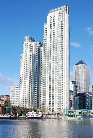
Pan Peninsula
Residential towers in London
Distance: Approx. 371 meters
Latitude and longitude: 51.5001,-0.0179
Pan Peninsula, also known as 1 Millharbour, is a residential development on the Isle of Dogs, London located near South Quay DLR station. Pan Peninsula is one of several high-rise residential developments that have been constructed on the Isle of Dogs. It was arguably the first “Ultra Luxury” development in Canary Wharf.

Massey Shaw
Former London Fire Brigade fireboat
Distance: Approx. 310 meters
Latitude and longitude: 51.501088,-0.011559
Massey Shaw is a former London Fire Brigade fireboat, named after the first Chief Officer of the Metropolitan Fire Brigade, Captain Sir Eyre Massey Shaw. Built in 1935 and decommissioned in 1971, the vessel was restored in the early 21st century and is moored in London's West India Docks.
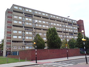
St John's Estate
Housing estate in Cubitt Town, London
Distance: Approx. 240 meters
Latitude and longitude: 51.49666667,-0.01138889
St John's Estate is a housing scheme in Cubitt Town, on the Isle of Dogs in London. Centred on the triangle formed by Manchester Road, East Ferry Road and Glengall Grove, it was developed by Poplar Borough Council after the Second World War. It is served by Crossharbour DLR station to which it is adjacent.

Baltimore Tower
High-rise residential skyscraper in Millwall on the Isle of Dogs, London
Distance: Approx. 176 meters
Latitude and longitude: 51.49744444,-0.01508333
Baltimore Tower, also known as Arena Tower and nicknamed The Slinky due to its resemblance to the popular toy, is a high-rise residential skyscraper in Millwall on the Isle of Dogs, London, England. The building is located on a site that was previously the location of the London Arena. The 45-storey building comprises 366 residential apartments and is 149 meters in height.

Glengall Bridge
Distance: Approx. 361 meters
Latitude and longitude: 51.49626,-0.01697
Glengall Bridge is a bridge in the Millwall Inner Dock, Isle of Dogs, London, England, near the Crossharbour DLR station. It is located in the London Borough of Tower Hamlets. The present Dutch-style double-leaf bascule bridge opened in 1990, resembling Langlois Bridge at Arles.The contract to manufacture the bridge across Millwall Dock was awarded to Butterley Engineering Company Ltd; of Ripley, Derbyshire.
Glengall Grove
Street on the Isle of Dogs, London
Distance: Approx. 278 meters
Latitude and longitude: 51.49603056,-0.01380833
Glengall Grove is a street on the Isle of Dogs, in London's East End. The street was once part of Glengall Road which stretched across most of the Isle of Dogs.

Isle of Dogs Pumping Station
Storm water pumping station in London
Distance: Approx. 378 meters
Latitude and longitude: 51.49933333,-0.00791667
The Isle of Dogs Pumping Station, nicknamed the Temple of Storms, is a pumping station located on the Isle of Dogs, London. It was designed by John Outram under commission from Edward Hollamby of the London Docklands Development Corporation and completed in 1988. It removes excess rainwater collected on the development's Enterprise Zone and overflow from the nearby Manchester Road sewers.
Weather in this IP's area
broken clouds
13 Celsius
13 Celsius
11 Celsius
14 Celsius
1012 hPa
85 %
1012 hPa
1010 hPa
10000 meters
2.24 m/s
4.02 m/s
125 degree
75 %
07:29:27
18:00:30