185.129.44.83 - IP Lookup: Free IP Address Lookup, Postal Code Lookup, IP Location Lookup, IP ASN, Public IP
Country:
Region:
City:
Location:
Time Zone:
Postal Code:
IP information under different IP Channel
ip-api
Country
Region
City
ASN
Time Zone
ISP
Blacklist
Proxy
Latitude
Longitude
Postal
Route
Luminati
Country
ASN
Time Zone
Europe/Paris
ISP
WEBEDIA SA
Latitude
Longitude
Postal
IPinfo
Country
Region
City
ASN
Time Zone
ISP
Blacklist
Proxy
Latitude
Longitude
Postal
Route
IP2Location
185.129.44.83Country
Region
ile-de-france
City
levallois-perret
Time Zone
Europe/Paris
ISP
Language
User-Agent
Latitude
Longitude
Postal
db-ip
Country
Region
City
ASN
Time Zone
ISP
Blacklist
Proxy
Latitude
Longitude
Postal
Route
ipdata
Country
Region
City
ASN
Time Zone
ISP
Blacklist
Proxy
Latitude
Longitude
Postal
Route
Popular places and events near this IP address

Pont de Levallois–Bécon station
Metro station in Paris, France
Distance: Approx. 687 meters
Latitude and longitude: 48.897313,2.280787
Pont de Levallois–Bécon (French pronunciation: [pɔ̃ d(ə) ləvalwa bekɔ̃]) is the northwestern terminus of Line 3 of the Paris Métro, located in the commune of Levallois-Perret.

Anatole France station
Metro station in Paris, France
Distance: Approx. 320 meters
Latitude and longitude: 48.892022,2.285536
Anatole France (French pronunciation: [anatɔl fʁɑ̃s]) is a station on Paris Métro Line 3. It is located in the commune of Levallois-Perret, northwest of the capital.

Louise Michel station
Metro station in Paris, France
Distance: Approx. 528 meters
Latitude and longitude: 48.889273,2.288073
Louise Michel (French pronunciation: [lwiz miʃɛl]) is a station on Paris Métro Line 3. It is located in the commune of Levallois-Perret, just outside Paris to the northwest.

Levallois-Perret
Commune in Île-de-France, France
Distance: Approx. 156 meters
Latitude and longitude: 48.895,2.2872
Levallois-Perret (French pronunciation: [ləvalwa pɛʁɛ] ) is a commune in the Hauts-de-Seine department and Île-de-France region of north-central France. It lies on the right bank of the Seine, some 6 km (3.7 mi) from the centre of Paris in the north-western suburbs of the French capital. It is the most densely populated town in Europe and, together with neighbouring Neuilly-sur-Seine, one of the most expensive suburbs of Paris.
Tours de Levallois
Office in Levallois-Perret
Distance: Approx. 805 meters
Latitude and longitude: 48.90111111,2.28666667
Tours de Levallois was a project to build two office skyscrapers in Levallois-Perret, in the inner suburbs of Paris, France. This project was canceled in 2011, following the reluctance of local residents.
Clichy–Levallois station
Railway station in Clichy, France
Distance: Approx. 765 meters
Latitude and longitude: 48.89666667,2.29833333
Clichy–Levallois station (French: Gare de Clichy–Levallois) is a railway station serving the towns of Clichy and Levallois-Perret, in the northwestern suburbs of Paris, France. It is on the Paris–Le Havre railway.
Levallois-Perret Cemetery
Cemetery in the commune of Levallois-Perret in Paris, France
Distance: Approx. 668 meters
Latitude and longitude: 48.9,2.289
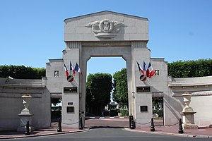
The Levallois-Perret Cemetery (French: Cimetière de Levallois-Perret, also known simply as Cimetière de Levallois) is a cemetery in the commune of Levallois-Perret in the northwestern suburbs of Paris, France. Strictly speaking it is just outside Paris in the arrondissement of Nanterre, in the Hauts-de-Seine department, in the Île-de-France region. The cemetery was subject of the Michèle Bernard song Au Cimetière de Levallois (which remembers Louise Michel, who is also buried here).
Canton of Levallois-Perret
Administrative division of Hauts-de-Seine, France
Distance: Approx. 455 meters
Latitude and longitude: 48.89,2.29
The canton of Levallois-Perret is an administrative division of the Hauts-de-Seine department, in northern France. It was created at the French canton reorganisation which came into effect in March 2015. Its seat is in Levallois-Perret.

Palais des sports Marcel-Cerdan
Distance: Approx. 825 meters
Latitude and longitude: 48.8959,2.2778
Palais des sports Marcel-Cerdan is a multi-purpose indoor sports arena that is located in Levallois, Paris, France. It is primarily used to host basketball games. The arena is named after the French boxer Marcel Cerdan.
2017 Levallois-Perret attack
Terrorist attack in Paris, France
Distance: Approx. 156 meters
Latitude and longitude: 48.895,2.2872
On the morning of 9 August 2017, a car rammed into a group of soldiers in the Levallois-Perret commune in the northwestern suburbs of Paris. Six soldiers patrolling the area as part of Opération Sentinelle were injured in the attack, three of them seriously. The driver fled the scene and, several hours later, was shot and arrested by an elite police unit on a highway near the town of Marquise, Pas-de-Calais after attempting to ram a roadblock.

Hertford British Hospital
Distance: Approx. 753 meters
Latitude and longitude: 48.89013,2.28027
The Hertford British Hospital was a hospital founded in Paris in 1871 for British and other English-speaking patients. In 2008, it merged with a nearby French hospital and was renamed to Hôpital franco-britannique. The Hertford British Hospital building was designed by Ernest-Paul Sanson and is a protected national monument.

European Jewish Center
Cultural center and synagogue in Paris, France
Distance: Approx. 809 meters
Latitude and longitude: 48.8879,2.2947
The European Jewish Center is a Jewish cultural center and synagogue located at place de Jérusalem, in the XVIIe arrondissement of Paris, France. The project was conceived by Joël Mergui, president of the Israelite Central Consistory of France. Construction began in 2015 and the building was inaugurated on 29 October 2019 in the presence of Emmanuel Macron, the President of France.
Weather in this IP's area
few clouds
9 Celsius
7 Celsius
8 Celsius
9 Celsius
1034 hPa
82 %
1034 hPa
1029 hPa
10000 meters
3.09 m/s
40 degree
20 %

