185.126.104.65 - IP Lookup: Free IP Address Lookup, Postal Code Lookup, IP Location Lookup, IP ASN, Public IP
Country:
Region:
City:
Location:
Time Zone:
Postal Code:
ISP:
ASN:
language:
User-Agent:
Proxy IP:
Blacklist:
IP information under different IP Channel
ip-api
Country
Region
City
ASN
Time Zone
ISP
Blacklist
Proxy
Latitude
Longitude
Postal
Route
db-ip
Country
Region
City
ASN
Time Zone
ISP
Blacklist
Proxy
Latitude
Longitude
Postal
Route
IPinfo
Country
Region
City
ASN
Time Zone
ISP
Blacklist
Proxy
Latitude
Longitude
Postal
Route
IP2Location
185.126.104.65Country
Region
catalunya
City
bas
Time Zone
ISP
Language
User-Agent
Latitude
Longitude
Postal
ipdata
Country
Region
City
ASN
Time Zone
ISP
Blacklist
Proxy
Latitude
Longitude
Postal
Route
Popular places and events near this IP address
Puigsacalm
Distance: Approx. 5740 meters
Latitude and longitude: 42.12511111,2.38793333
Puigsacalm is the highest mountain of the Catalan Transversal Range, Catalonia, Spain. It has an elevation of 1,512 metres above sea level.

Puigsacalm Xic
Distance: Approx. 5898 meters
Latitude and longitude: 42.12416667,2.38583333
Puigsacalm Xic is a mountain of Catalonia, Spain. It has an elevation of 1,490 metres above sea level.
Cabrera (Santa Maria de Corcó)
Mountain in Spain
Distance: Approx. 6214 meters
Latitude and longitude: 42.07611111,2.40722222
Cabrera is a mountain of Catalonia, Spain. It has an elevation of 1,307 metres above sea level.
Escola d'Art i Superior de Disseny d'Olot
Art school in Olot, Spain
Distance: Approx. 7847 meters
Latitude and longitude: 42.18353333,2.49216667
Escola d'Art i Superior de Disseny d'Olot is the main Design and Arts & Crafts school of the region of Girona (Catalonia, Spain). Since its foundation, it has maintained an active participation in the social, educational, economic and cultural life. The school is in Olot, a city with a population of over 34,000 inhabitants.

Les Preses
Municipality in Catalonia, Spain
Distance: Approx. 3006 meters
Latitude and longitude: 42.145,2.46
Les Preses (Catalan pronunciation: [ləs ˈpɾɛzəs]) is a village and municipality in the province of Girona and autonomous community of Catalonia, Spain. The municipality covers an area of 9.42 square kilometres (3.64 sq mi) and the population in 2014 was 1,772.

Sant Feliu de Pallerols
Municipality in Catalonia, Spain
Distance: Approx. 6261 meters
Latitude and longitude: 42.07666667,2.50805556
Sant Feliu de Pallerols (Catalan pronunciation: [ˈsaɱ fəˈliw ðə pəʎəˈɾɔls]) is a village in the province of Girona and autonomous community of Catalonia, Spain. The municipality covers an area of 34.8 square kilometres (13.4 sq mi) and the population in 2014 was 1,353. From 1902, Sant Feliu de Pallerols was linked to Girona by the narrow gauge Olot–Girona railway, which was extended to Olot in 1911.

La Vall d'en Bas
Municipality in Catalonia, Spain
Distance: Approx. 149 meters
Latitude and longitude: 42.11805556,2.455
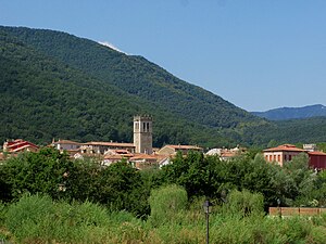
La Vall d'en Bas (Catalan pronunciation: [lə ˈβaʎ dəm ˈbas]) is a municipality in the province of Girona and autonomous community of Catalonia, Spain.

Croscat
Distance: Approx. 7661 meters
Latitude and longitude: 42.15416667,2.53583333
The Croscat (Catalan pronunciation: [kɾusˈkat]) is a volcano in the comarca of Garrotxa, Catalonia, Spain. It is both the youngest and highest volcano in the Iberian Peninsula, with the last eruption dated back to about 14,000 years Before Present. The volcanic cone has a horseshoe shape, and its northeastern flank was quarried for volcanic gravel until the early 1990s, exposing the internal structure of the cone from top to bottom.

Santa Margarida Volcano
Extinct volcano in Spain
Distance: Approx. 7471 meters
Latitude and longitude: 42.14138889,2.54166667
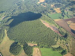
The Santa Margarida Volcano (Catalan: Volcà de Santa Margarida) is an extinct volcano in the comarca of Garrotxa, Catalonia, Spain. The volcano has a perimeter of 2 kilometers and a height of 682 meters and is part of the Zona Volcànica de la Garrotxa Natural Park. The hermitage of Santa Margarida, after which the volcano was named, is inside the crater of the volcano.
UE Olot
Spanish association football club
Distance: Approx. 8194 meters
Latitude and longitude: 42.190327,2.475919
Unió Esportiva Olot, S.A.D. is a Spanish football team based in Olot, in the autonomous community of Catalonia. Founded in 1921, it plays in Segunda Federación – Group 3, holding home games at Estadi Municipal d'Olot, with a capacity of 3,000 seats.

Volcà del Montsacopa
Distance: Approx. 8125 meters
Latitude and longitude: 42.187193,2.488525
Volcà del Montsacopa is an extinct volcano in the Zona Volcànica de la Garrotxa Natural Park, situated in Olot, Catalunya, Spain. The volcano has been extinct for about 100,000 years. On top of the crater is the hermitage of Sant Francesc, built in the 17th century.

Fageda d'en Jordà
Forest in Spain
Distance: Approx. 5864 meters
Latitude and longitude: 42.14944444,2.51388889
The fageda d'en Jordà – in English, the Jordan Beech Forest – is a natural reserve that includes a beech forest with unique characteristics in Spain, as it grows on relatively flat terrain, formed by a cooled lava flow from the volcano del Croscat, at an altitude that is not common in the Mediterranean area of the Iberian Peninsula for this type of forest, between 550 and 650 m. It has an area of about 4.8 km2 and its floor is made up of spatter cones (locally called tossols) that can reach more than 20 m in height. The beech forest is famous because the Catalan poet Joan Maragall wrote a well-known poem about it: La fageda d'en Jordà.
Weather in this IP's area
few clouds
9 Celsius
7 Celsius
9 Celsius
9 Celsius
1030 hPa
64 %
1030 hPa
948 hPa
10000 meters
3.11 m/s
5.15 m/s
72 degree
18 %

