Country:
Region:
City:
Latitude and Longitude:
Time Zone:
Postal Code:
IP information under different IP Channel
ip-api
Country
Region
City
ASN
Time Zone
ISP
Blacklist
Proxy
Latitude
Longitude
Postal
Route
Luminati
Country
Region
82
City
letojanni
ASN
Time Zone
Europe/Rome
ISP
Bbanda S.r.l.
Latitude
Longitude
Postal
IPinfo
Country
Region
City
ASN
Time Zone
ISP
Blacklist
Proxy
Latitude
Longitude
Postal
Route
db-ip
Country
Region
City
ASN
Time Zone
ISP
Blacklist
Proxy
Latitude
Longitude
Postal
Route
ipdata
Country
Region
City
ASN
Time Zone
ISP
Blacklist
Proxy
Latitude
Longitude
Postal
Route
Popular places and events near this IP address

Taormina
Comune in Sicily, Italy
Distance: Approx. 588 meters
Latitude and longitude: 37.85222222,15.29194444
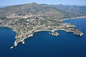
Taormina (UK: TAH-or-MEE-nə, US: -nah, also , Italian: [ta.orˈmiːna]; Sicilian: Taurmina) is a comune (municipality) in the Metropolitan City of Messina, on the east coast of the island of Sicily, Italy. Taormina has been a tourist destination since the 19th century. Its beaches on the Ionian Sea, including that of Isola Bella, are accessible via an aerial tramway built in 1992, and via highways from Messina in the north and Catania in the south.
Giardini Naxos
Administrative division in Sicily, Italy
Distance: Approx. 2041 meters
Latitude and longitude: 37.83333333,15.28333333
Giardini Naxos (Sicilian: Giaddini; English translation: Naxos Gardens) is a comune in the Metropolitan City of Messina on the island of Sicily in southern Italy. It is situated on the coast of the Ionian Sea on a bay which lies between Cape Taormina and Cape Schisò. Since the 1970s it has become a seaside-resort, a popular tourist destination and cruise ship stop.

Isola Bella (Sicily)
Island in Sicily, Italy
Distance: Approx. 1373 meters
Latitude and longitude: 37.85027778,15.30083333
Isola Bella (Sicilian: Ìsula Bedda) is a small island near Taormina, Sicily, southern Italy. Also known as The Pearl of the Ionian Sea, it is located within a small bay on the Ionian Sea; it was a private property, for a time owned by Florence Trevelyan, until 1990, when it was bought by the Region of Sicily, being turned into a nature reserve, administered by the Italian branch of the World Wide Fund for Nature. There is a narrow path that often connects the island to the mainland beach.

Naxos (Sicily)
Ancient Greek city state in Sicily
Distance: Approx. 3347 meters
Latitude and longitude: 37.82305556,15.27333333
Naxos or Naxus (‹See Tfd›Greek: Νάξος) was an ancient Greek city of Magna Graecia, presently situated in modern Giardini Naxos near Taormina on the east coast of Sicily. Much of the site has never been built on and parts have been excavated in recent years. Its remains are open to the public and an on-site museum contains many finds.

Alcantara (river)
River in Italy
Distance: Approx. 5474 meters
Latitude and longitude: 37.8076,15.2575
The Alcantara (Sicilian: Arcàntara or Càntara) is a river in Sicily, Southern Italy. It has its source on the south side of Monti Nebrodi and its mouth in the Ionian Sea at Capo Schiso in Giardini-Naxos. The river is 52 kilometres (32 mi) long.
Castelmola
Comune in Sicily, Italy
Distance: Approx. 1686 meters
Latitude and longitude: 37.86666667,15.28333333
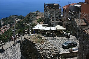
Castelmola (Sicilian: Castermula) is a comune (municipality) in the Province of Messina in the Italian region Sicily, located about 170 kilometres (110 mi) east of Palermo and about 40 kilometres (25 mi) southwest of Messina. As of 31 December 2004, it had a population of 1,107 and an area of 16.4 square kilometres (6.3 sq mi). It is one of I Borghi più belli d'Italia ("The most beautiful villages of Italy").

Gallodoro
Comune in Sicily, Italy
Distance: Approx. 5541 meters
Latitude and longitude: 37.9,15.3
Gallodoro (Sicilian: Jaddudoru) is a comune (municipality) in the Province of Messina in Sicily, Italy located about 170 kilometres (110 mi) east of Palermo and about 40 kilometres (25 mi) southwest of Messina. As of 31 December 2004, it had a population of 402 and an area of 6.9 square kilometres (2.7 sq mi). Gallodoro borders the following municipalities: Forza d'Agrò, Letojanni, Mongiuffi Melia.

Letojanni
Comune in Sicily, Italy
Distance: Approx. 3761 meters
Latitude and longitude: 37.88333333,15.3
Letojanni (Sicilian: Letujanni) is a comune (municipality), and coastal resort in the Province of Messina in the Italian region Sicily, located about 170 kilometres (110 mi) east of Palermo and about 40 kilometres (25 mi) southwest of Messina. Letojanni borders the following municipalities: Castelmola, Forza d'Agrò, Gallodoro, Mongiuffi Melia, Taormina.

Palazzo Corvaja
Medieval palace in Taormina, Sicily
Distance: Approx. 372 meters
Latitude and longitude: 37.85385556,15.28841667
Palazzo Corvaja (sometimes spelt Palazzo Corvaia) is a medieval palace in Taormina, Sicily, Italy. It was principally built at the end of the 14th century and is named after one of the oldest and most famous families of Taormina, which owned it from 1538 to 1945. On four main floors and constructed around a courtyard, the Catalan Gothic palazzo is crenellated.

Schisò Castle
Distance: Approx. 3337 meters
Latitude and longitude: 37.823574,15.271838
Schisò Castle (in Italian Castello di Schisò) is a 16th-century fortress on Cape Schisò in Giardini Naxos, Sicily, Italy.
Ancient theatre of Taormina
Ancient Greek theatre in Sicily, Italy
Distance: Approx. 612 meters
Latitude and longitude: 37.85222222,15.29222222
The ancient theatre of Taormina (Italian: Teatro antico di Taormina) is an ancient Greek theatre in Taormina, Sicily, built in the third century BC.
Siege of Taormina (1078)
Siege in Sicily
Distance: Approx. 1304 meters
Latitude and longitude: 37.85,15.3
The siege of Taormina in 1078 was one of the final acts in the Norman conquest of Sicily.
Weather in this IP's area
clear sky
15 Celsius
14 Celsius
12 Celsius
17 Celsius
1016 hPa
68 %
1016 hPa
995 hPa
10000 meters
2.06 m/s
2.04 m/s
311 degree
4 %
06:43:54
16:45:02


