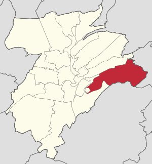
Country:
Region:
City:
Latitude and Longitude:
Time Zone:
Postal Code:
IP information under different IP Channel
ip-api
Country
Region
City
ASN
Time Zone
ISP
Blacklist
Proxy
Latitude
Longitude
Postal
Route
Luminati
Country
ASN
Time Zone
Europe/Luxembourg
ISP
Mixvoip S.A.
Latitude
Longitude
Postal
IPinfo
Country
Region
City
ASN
Time Zone
ISP
Blacklist
Proxy
Latitude
Longitude
Postal
Route
db-ip
Country
Region
City
ASN
Time Zone
ISP
Blacklist
Proxy
Latitude
Longitude
Postal
Route
ipdata
Country
Region
City
ASN
Time Zone
ISP
Blacklist
Proxy
Latitude
Longitude
Postal
Route
Popular places and events near this IP address

Luxembourg Airport
Main airport in Luxembourg
Distance: Approx. 2029 meters
Latitude and longitude: 49.62333333,6.20444444
Luxembourg Airport (IATA: LUX, ICAO: ELLX) is the main airport in Luxembourg. Previously called Luxembourg Findel Airport due to its location at Findel, it is Luxembourg's only international airport and is the only airport in the country with a paved runway. It is located 3.25 NM (6.02 km; 3.74 mi) east of Luxembourg City.

Hamm, Luxembourg
Quarter in Luxembourg City, Luxembourg
Distance: Approx. 2201 meters
Latitude and longitude: 49.607,6.169
Hamm (Luxembourgish pronunciation: [hɑm] ) is a quarter in eastern Luxembourg City, in southern Luxembourg. It is the home of the Luxembourg American Cemetery and Memorial, the final resting place of 5,076 American servicemen, including General Patton. As of 31 December 2023, the quarter has a population of 1,569 inhabitants.

Contern
Commune in Luxembourg, Luxembourg
Distance: Approx. 3013 meters
Latitude and longitude: 49.58444444,6.22583333
Contern (Luxembourgish: Conter [ˈkontɐ] ) is a commune and town in southern Luxembourg. It is located east of Luxembourg City. As of 2024 the commune has a population of 4,513 whereas the town itself, which lies in the south-west of the commune, has a population of 1,876.

Sandweiler
Commune in Luxembourg, Luxembourg
Distance: Approx. 1771 meters
Latitude and longitude: 49.6167,6.2167
Sandweiler (Luxembourgish pronunciation: [ˈzɑntvɑɪlɐ] ) is a commune and town in southern Luxembourg. It is located 5 kilometres (3.1 mi) east of Luxembourg City. As of 2024, the town of Sandweiler, which lies in the south-west of the commune, has a population of 3721.

Findel, Luxembourg
Village in Luxembourg
Distance: Approx. 2744 meters
Latitude and longitude: 49.62972222,6.20555556
Findel is a village in the commune of Sandweiler, in southern Luxembourg. As of 2024, the village had a population of 76. Findel is dominated by Luxembourg Findel Airport, the only international airport in Luxembourg.

Cents, Luxembourg
Quarter in Luxembourg City, Luxembourg
Distance: Approx. 3112 meters
Latitude and longitude: 49.61575,6.15933
Cents (Luxembourgish: Zens, pronounced [tsæns] ) is a quarter in eastern Luxembourg City, in southern Luxembourg. As of 31 December 2023, the quarter has a population of 6,416 inhabitants. It is the only quarter of Luxembourg City where a majority of residents are of Luxembourgish nationality.

Luxembourg American Cemetery and Memorial
ABMC World War II cemetery in Hamm, Luxembourg
Distance: Approx. 1219 meters
Latitude and longitude: 49.61166667,6.18555556
Luxembourg American Cemetery and Memorial is a Second World War American military war grave cemetery, located in Hamm, Luxembourg City, Luxembourg. The cemetery, containing 5,074 American war dead, covers 50.5 acres (20.4 ha) and was dedicated in 1960. It is administered by the American Battle Monuments Commission.

Cents-Hamm railway station
Railway station in Luxembourg
Distance: Approx. 2734 meters
Latitude and longitude: 49.61444444,6.16416667
Cents-Hamm railway station (Luxembourgish: Gare Zens-Hamm, French: Gare de Cents-Hamm, German: Bahnhof Cents-Hamm) is a railway station serving the quarters of Cents and Hamm in the east of Luxembourg City, in southern Luxembourg. It is operated by Chemins de Fer Luxembourgeois, the state-owned railway company. The station is situated on Line 30, which connects Luxembourg City to the east of the country and Trier.

Sandweiler German war cemetery
WWII Battle of the Bulge cemetery in Luxembourg
Distance: Approx. 632 meters
Latitude and longitude: 49.60944444,6.20555556
The Sandweiler German war cemetery is a World War II cemetery in Sandweiler, in southern Luxembourg. It contains the graves of 10,913 German servicemen from the Battle of the Bulge in winter 1944 and spring 1945. Of these, 5,599 were buried by the American war graves service during the war; American casualties were buried at the Luxembourg American Cemetery and Memorial about 1.5 kilometres (0.93 mi) away in Hamm.
Luxembourg-Cents
Football stadium in Luxembourg
Distance: Approx. 3396 meters
Latitude and longitude: 49.615,6.15472222
Luxembourg-Cents is a residential area in the east of Luxembourg city which is also famous for a football stadium. Cents is a quarter of Luxembourg City, in southern Luxembourg. It is currently the home stadium of FC RM Hamm Benfica which has a capacity of 2,800.

Aeroflot Flight 343
1982 aviation accident
Distance: Approx. 2029 meters
Latitude and longitude: 49.62333333,6.20444444
Aeroflot Flight 343 (Russian: Рейс 343 Аэрофлота Reys 343 Aeroflota) was a passenger flight from Moscow-Sheremetyevo Airport to Jorge Chávez International Airport, on a stopover at Luxembourg-Findel International Airport, that veered off the runway on 29 September 1982, fatally injuring seven occupants. The Ilyushin Il-62M operating the flight suffered a mechanical failure.

Kréintgeshaff
Hamlet in Luxembourg District, Luxembourg
Distance: Approx. 2295 meters
Latitude and longitude: 49.603,6.231
Kréintgeshaff (Luxembourgish: Kroentgeshof) is a small settlement near Sandweiler in the Commune of Contern in Luxembourg. It is located directly North-East of the Contern-Sandweiler Industrial zone and located adjacent to the E29 Main Road. The settlement is surrounded by small tracks and streams.
Weather in this IP's area
fog
5 Celsius
3 Celsius
4 Celsius
6 Celsius
1025 hPa
96 %
1025 hPa
986 hPa
100 meters
2.57 m/s
140 degree
100 %
07:30:52
17:06:43