185.123.56.71 - IP Lookup: Free IP Address Lookup, Postal Code Lookup, IP Location Lookup, IP ASN, Public IP
Country:
Region:
City:
Location:
Time Zone:
Postal Code:
ISP:
ASN:
language:
User-Agent:
Proxy IP:
Blacklist:
IP information under different IP Channel
ip-api
Country
Region
City
ASN
Time Zone
ISP
Blacklist
Proxy
Latitude
Longitude
Postal
Route
db-ip
Country
Region
City
ASN
Time Zone
ISP
Blacklist
Proxy
Latitude
Longitude
Postal
Route
IPinfo
Country
Region
City
ASN
Time Zone
ISP
Blacklist
Proxy
Latitude
Longitude
Postal
Route
IP2Location
185.123.56.71Country
Region
andalucia
City
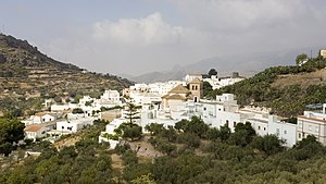
el campillo del moro
Time Zone
Europe/Madrid
ISP
Language
User-Agent
Latitude
Longitude
Postal
ipdata
Country
Region
City
ASN
Time Zone
ISP
Blacklist
Proxy
Latitude
Longitude
Postal
Route
Popular places and events near this IP address

Roquetas de Mar
Municipality in Andalusia, Spain
Distance: Approx. 5709 meters
Latitude and longitude: 36.76416667,-2.61472222
Roquetas de Mar (Spanish pronunciation: [roˈketas de maɾ]) is a municipality of Almería province, in the autonomous community of Andalucía, Spain. In 2016, the population was 91,965, the municipality with the second highest population in the province behind the capital, the 14th in Andalucía and the 69th in Spain. In 1981, in this town, three young men from Santander were murdered by various members of the Spanish Civil Guard, in what is known as Almería Case.
Enix, Spain
Municipality in Andalusia, Spain
Distance: Approx. 7481 meters
Latitude and longitude: 36.87694444,-2.60194444
Enix is a municipality of Almería province, in the autonomous community of Andalusia, Spain.

Felix, Spain
Place in Andalusia, Spain
Distance: Approx. 8968 meters
Latitude and longitude: 36.86861111,-2.65777778
Felix (Spanish: [feˈli(ɣ)s]) is a municipality of Almería province, in the autonomous community of Andalusia, Spain.

Vícar
Place in Andalusia, Spain
Distance: Approx. 5449 meters
Latitude and longitude: 36.83166667,-2.64305556
Vícar is a municipality of Almería province, in the autonomous community of Andalusia, Spain.

Castillo de Santa Ana
Fort in Andalusia, Spain
Distance: Approx. 6524 meters
Latitude and longitude: 36.75394,-2.60604
The Castillo de Santa Ana, also known as Castillo de Las Roquetas, is a fortification built between the 16th and 17th centuries, located in the town of Roquetas de Mar (Almería) which was used as a refuge for the inhabitants who lived near the port. It has an oblong shape. Near the castle there is a lighthouse.

Aguadulce (Almería)
Municipality in Andalusia, Spain
Distance: Approx. 5709 meters
Latitude and longitude: 36.76416667,-2.61472222
Aguadulce is a Spanish town in the municipality of Roquetas de Mar, province of Almería, in the autonomous community of Andalucía. It is located in the region of Poniente Almeriense, about 14 kilometres from the city of Almería, along the national road (N-340a) and 14 km along the dual carriageway (A-7) In 2018, it had a population of 16176 inhabitants (INE), although during summer the population triples due to tourism, the main economic engine of the town.
Weather in this IP's area
overcast clouds
12 Celsius
11 Celsius
12 Celsius
12 Celsius
1021 hPa
75 %
1021 hPa
990 hPa
10000 meters
3.08 m/s
3.38 m/s
254 degree
100 %