185.122.55.193 - IP Lookup: Free IP Address Lookup, Postal Code Lookup, IP Location Lookup, IP ASN, Public IP
Country:
 Slovakia
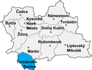
Region:
City:
Location:
Time Zone:
Postal Code:
ISP:
ASN:
language:
User-Agent:
Proxy IP:
Blacklist:
IP information under different IP Channel
ip-api
Country
Region
City
ASN
Time Zone
ISP
Blacklist
Proxy
Latitude
Longitude
Postal
Route
db-ip
Country
Region
City
ASN
Time Zone
ISP
Blacklist
Proxy
Latitude
Longitude
Postal
Route
IPinfo
Country
Region
City
ASN
Time Zone
ISP
Blacklist
Proxy
Latitude
Longitude
Postal
Route
IP2Location
185.122.55.193Country
skRegion
banskobystricky kraj
City
kremnica
Time Zone
Europe/Bratislava
ISP
Language
User-Agent
Latitude
Longitude
Postal
ipdata
Country
Region
City
ASN
Time Zone
ISP
Blacklist
Proxy
Latitude
Longitude
Postal
Route
Popular places and events near this IP address

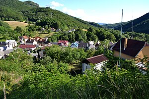
Kremnica
Town in Slovakia
Distance: Approx. 592 meters
Latitude and longitude: 48.7,18.92
Kremnica (; German: Kremnitz, Hungarian: Körmöcbánya) is a town in central Slovakia. It has around 5,300 inhabitants. The well-preserved medieval town built above important gold mines is the site of the oldest still-working mint in the world.

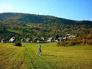
Dolná Ves
Municipality in Banská Bystrica Region, Slovakia
Distance: Approx. 3966 meters
Latitude and longitude: 48.67,18.91
Dolná Ves (before 1948(?): Šváb, older: Šváby; German: Schwabendorf; Hungarian: Sváb) is a village and municipality in Žiar nad Hronom District in the Banská Bystrica Region of central Slovakia. It is near the town of Kremnica. The first written record about the village is from the year 1427 (Schwabendorff), when the village became the property of Kremnica.
Bartošova Lehôtka
Village and municipality in Slovakia
Distance: Approx. 6175 meters
Latitude and longitude: 48.65,18.91
Bartošova Lehôtka (1920–1927: Bartošová Lehôtka, 1927–1946: Bartošova Lehotka; German: Lehotka; Hungarian: Bartos, until 1888: Bartoslehot(k)a) is a village and municipality in the Žiar nad Hronom District in the Banská Bystrica Region of central Slovakia.
Kopernica
Municipality in Banská Bystrica Region, Slovakia
Distance: Approx. 3932 meters
Latitude and longitude: 48.69,18.87
Kopernica (German: Deutschlitta; Hungarian: Barskapronca) is a village and municipality in Žiar nad Hronom District in the Banská Bystrica Region of central Slovakia.

Krahule
Municipality in Banská Bystrica Region, Slovakia
Distance: Approx. 2891 meters
Latitude and longitude: 48.73,18.93
Krahule (German: Blaufuss; Hungarian: Kékellő, until 1890: Blaufusz) is a village in Žiar nad Hronom District in the Banská Bystrica Region of central Slovakia. It is the only municipality in Slovakia that officially uses German along with Slovak.
Kremnické Bane
Municipality in Banská Bystrica Region, Slovakia
Distance: Approx. 2764 meters
Latitude and longitude: 48.73,18.92
Kremnické Bane (German: Johannesberg; Hungarian: Jánoshegy) is a village and municipality in Žiar nad Hronom District in the Banská Bystrica Region of central Slovakia.

Kunešov
Municipality in Banská Bystrica Region, Slovakia
Distance: Approx. 4495 meters
Latitude and longitude: 48.73,18.87
Kunešov (German: Kuneschhau; Hungarian: Kunosvágása) is a village and municipality in Žiar nad Hronom District in the Banská Bystrica Region of central Slovakia. The village once belonged to the German language island of Hauerland but the majority of the German population was expelled at the end of World War II. It still has a German minority (14% according to the 2011 census).

Nevoľné
Municipality in Slovakia
Distance: Approx. 4559 meters
Latitude and longitude: 48.67,18.95
Nevoľné (Hungarian: Tormáskert) is a village and municipality in Žiar nad Hronom District in the Banská Bystrica Region of central Slovakia, 6 kilometres from Kremnica town. The village is mentioned first in archive documents in 1487.

Horná Ves, Žiar nad Hronom District
Municipality in Banská Bystrica Region, Slovakia
Distance: Approx. 2871 meters
Latitude and longitude: 48.68,18.91
Horná Ves (Hungarian: Felsőtóti) is a village and municipality in Žiar nad Hronom District in the Banská Bystrica Region of central Slovakia.

Lúčky, Žiar nad Hronom District
Municipality in Banská Bystrica Region, Slovakia
Distance: Approx. 5299 meters
Latitude and longitude: 48.7,18.99
Lúčky (German: Honneshau; Hungarian: Jánosrét, until 1890: Lucska) is a village and municipality in the Žiar nad Hronom District of the Banská Bystrica Region of central Slovakia. The town belonged to a German language island. The German population was expelled in 1945.
Turček
Distance: Approx. 5938 meters
Latitude and longitude: 48.75833333,18.91111111
Turček (German: Turz; Hungarian: Turcsek) is a village and municipality in Turčianske Teplice District in the Žilina Region of northern central Slovakia.

Kremnica Mint
Distance: Approx. 171 meters
Latitude and longitude: 48.70541667,18.916
The Kremnica Mint (Slovak: Mincovňa Kremnica, Hungarian: Körmöcbányai pénzverde) is one of the oldest mints in the world established in 1328 by the King Charles Robert of Anjou, situated in Kremnica, Slovakia.
Weather in this IP's area
clear sky
3 Celsius
1 Celsius
3 Celsius
3 Celsius
1030 hPa
37 %
1030 hPa
952 hPa
10000 meters
1.9 m/s
2.58 m/s
151 degree