Country:
Region:
City:
Latitude and Longitude:
Time Zone:
Postal Code:
IP information under different IP Channel
ip-api
Country
Region
City
ASN
Time Zone
ISP
Blacklist
Proxy
Latitude
Longitude
Postal
Route
Luminati
Country
ASN
Time Zone
Europe/Oslo
ISP
Blix Solutions AS
Latitude
Longitude
Postal
IPinfo
Country
Region
City
ASN
Time Zone
ISP
Blacklist
Proxy
Latitude
Longitude
Postal
Route
db-ip
Country
Region
City
ASN
Time Zone
ISP
Blacklist
Proxy
Latitude
Longitude
Postal
Route
ipdata
Country
Region
City
ASN
Time Zone
ISP
Blacklist
Proxy
Latitude
Longitude
Postal
Route
Popular places and events near this IP address

Bekkelaget
Distance: Approx. 493 meters
Latitude and longitude: 59.88305556,10.77111111
Bekkelaget is a neighborhood in the borough Nordstrand in Oslo, Norway. Originally, Bekkelaget was the maritime area south of Oslo city, in Aker municipality adjacent to the Bunnefjorden. With the opening of the Østfold Line, Bekkelaget station was opened, and the elevated area between Ekeberg and Nordstrand was built up and more densely populated.
Holtet tram stop
Tram stop in Oslo, Norway
Distance: Approx. 572 meters
Latitude and longitude: 59.881514,10.784154
Holtet is a light rail/tram stop on the Ekeberg line of the Oslo Tramway. It is located at Holtet in Ekeberg, in the borough of Nordstrand, in Oslo, Norway. It was opened on 11 June 1917 by A/S Ekebergbanen and has a balloon loop.
Sportsplassen tram stop
Light rail/tram stop in Oslo, Norway
Distance: Approx. 259 meters
Latitude and longitude: 59.886,10.7736
Sportsplassen is a tram stop on the Ekeberg Line of the Oslo Tramway. It is located near Sportsplassen in Ekeberg, in the borough of Nordstrand, in Oslo, Norway. The station opened on 11 June 1917 as part of the Ekeberg Line to Sæter.
Jomfrubråten tram stop
Tram stop in Oslo, Norway
Distance: Approx. 514 meters
Latitude and longitude: 59.8883,10.7706
Jomfrubråten is a light rail tram stop on the Ekeberg Line of the Oslo Tramway. It is located near Jomfrubråten in Ekeberg, in the borough of Nordstrand, in Oslo, Norway. The station opened on 11 June 1917 as part of the Ekeberg Line to Sæter.

Ekebergparken tram stop (Simensbråten Line)
Tram stop in Oslo, Norway
Distance: Approx. 424 meters
Latitude and longitude: 59.8894,10.7764
The old Ekebergparken station was a tram stop on the Simensbråten Line of the Oslo Tramway. The station opened on 30 September 1931 when the Simensbråten Line was opened as a branch from the Ekeberg Line. The station was closed with the line on to 29 October 1967, following the political decision seven years earlier to gradually close the tramways.

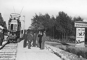
Smedstua tram stop
Tram stop in Oslo, Norway
Distance: Approx. 626 meters
Latitude and longitude: 59.8912,10.7805
Smedstua was a light rail tram stop on the Simensbråten Line of the Oslo Tramway. It was located at Smedstua in Ekeberg, in the borough of Nordstrand, in Oslo, Norway. The station opened on 30 September 1931 when the Simensbråten Line was opened as a branch from the Ekeberg Line.

Ekeberghallen
An indoor sports arena located at Ekebergsletta in Nordstrand, Oslo, Norw
Distance: Approx. 666 meters
Latitude and longitude: 59.89166667,10.77722222
Ekeberghallen, also known as Ekeberg idrettshall, is an indoor sports arena located at Ekebergsletta in the neighborhood of Ekeberg in the Nordstrand district of Oslo, Norway. Ekebergsletta is part of the Oslo park system and is used primarily for sporting events.
Sportsplassen
Sports stadium in Oslo, Norway
Distance: Approx. 150 meters
Latitude and longitude: 59.8864,10.7759
Sportsplassen ("The Sports Field") is a multi-use stadium in Nordstrand, Oslo, Norway. It is currently used mostly for track and field meets and football matches, both under the auspices of Bækkelagets SK. The 400-metre athletics track was inaugurated in 2012. It is served by the station Sportsplassen on the Oslo Tramway.

Bekkelaget Church
Church in Oslo, Norway
Distance: Approx. 568 meters
Latitude and longitude: 59.884894,10.78824194
Bekkelaget Church is a long church (Norwegian: langkirke) located in Bekkelaget in Nordstrand, a district of Oslo, Norway. The church is built of stone and can accommodate 370 or 420 people. The parish of Bekkelaget was split from the parish of Nordstrand in 1913, and plans for construction of a church began immediately.

Bekkelaget station
Former railway station in Nordstrand, Norway
Distance: Approx. 515 meters
Latitude and longitude: 59.88333333,10.77027778
Bekkelaget Station (Norwegian: Bekkelaget stasjon) was a railway station on the Østfold Line. It was located at Nedre Bekkelaget in the Nordstrand borough of Oslo, Norway. It was originally situated 3.34 kilometers (2.08 mi) from Oslo Central Station (Oslo S) and received a station building designed by Peter Andreas Blix.

Bekkelaget Tunnel
Railway tunnel in Oslo, Norway
Distance: Approx. 426 meters
Latitude and longitude: 59.885,10.7707
The Bekkelaget Tunnel (Norwegian: Bekkelagstunnelen) is a 578-meter (1,896 ft) long railway tunnel which carries two tracks of the Østfold Line past Bekkelaget in Oslo, Norway. Construction started 14 April 1955, after a landslide on 3 October 1953 had caused damage to the railway. The tunnel was built to allow for space for the road of Mosseveien.
KFUM Arena
Football stadium in Oslo, Norway
Distance: Approx. 510 meters
Latitude and longitude: 59.88955556,10.78313889
KFUM Arena is a football stadium located at Ekeberg in Oslo, Norway, and is the home of Norwegian Eliteserien club KFUM Oslo. The stadium is under reconstruction to temporarily get a capacity of 3,300 seats.
Weather in this IP's area
snow
0 Celsius
-2 Celsius
-1 Celsius
2 Celsius
997 hPa
62 %
997 hPa
981 hPa
10000 meters
1.52 m/s
2.35 m/s
329 degree
61 %
08:22:19
15:42:13


