185.12.50.88 - IP Lookup: Free IP Address Lookup, Postal Code Lookup, IP Location Lookup, IP ASN, Public IP
Country:
Region:
City:
Location:
Time Zone:
Postal Code:
IP information under different IP Channel
ip-api
Country
Region
City
ASN
Time Zone
ISP
Blacklist
Proxy
Latitude
Longitude
Postal
Route
Luminati
Country
Region
idf
City
paris
ASN
Time Zone
Europe/Paris
ISP
WEBEDIA SA
Latitude
Longitude
Postal
IPinfo
Country
Region
City
ASN
Time Zone
ISP
Blacklist
Proxy
Latitude
Longitude
Postal
Route
IP2Location
185.12.50.88Country
Region
auvergne-rhone-alpes
City
aurillac
Time Zone
Europe/Paris
ISP
Language
User-Agent
Latitude
Longitude
Postal
db-ip
Country
Region
City
ASN
Time Zone
ISP
Blacklist
Proxy
Latitude
Longitude
Postal
Route
ipdata
Country
Region
City
ASN
Time Zone
ISP
Blacklist
Proxy
Latitude
Longitude
Postal
Route
Popular places and events near this IP address

Aurillac
Prefecture and commune in Auvergne-Rhône-Alpes, France
Distance: Approx. 1282 meters
Latitude and longitude: 44.9261,2.4406
Aurillac (French pronunciation: [oʁijak] ; Occitan: Orlhac [uɾˈʎak]) is the prefecture of the Cantal department, in the Auvergne-Rhône-Alpes region of France.

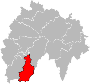
Arrondissement of Aurillac
Arrondissement in Auvergne-Rhône-Alpes, France
Distance: Approx. 1314 meters
Latitude and longitude: 44.91666667,2.43333333
The arrondissement of Aurillac is an arrondissement of France in the Cantal department in the Auvergne-Rhône-Alpes region. It has 93 communes. Its population is 82,237 (2021), and its area is 1,936.9 km2 (747.8 sq mi).
Aurillac–Tronquières Airport
Airport
Distance: Approx. 3387 meters
Latitude and longitude: 44.8975,2.41666667
Aurillac–Tronquières Airport (French: Aéroport d'Aurillac–Tronquières) (IATA: AUR, ICAO: LFLW) is an airport located 3 kilometres (1.9 mi) southwest of Aurillac, a commune of the Cantal département in the Auvergne région of France.

Stade Jean Alric
Rugby union stadium in Aurillac, France
Distance: Approx. 1835 meters
Latitude and longitude: 44.92444444,2.42944444
Stade Jean Alric is a rugby union stadium in Aurillac, France. It is the home stadium of Stade Aurillacois Cantal Auvergne. The stadium can hold 9,000 people (7,000 seated).

Arpajon-sur-Cère
Commune in Auvergne-Rhône-Alpes, France
Distance: Approx. 1461 meters
Latitude and longitude: 44.9047,2.4575
Arpajon-sur-Cère (French pronunciation: [aʁpaʒɔ̃ syʁ sɛʁ], literally Arpajon on Cère; Occitan: Arpajon de Cera or just Arpajon) is a commune in the Cantal department in the Auvergne region of south-central France.
Aurillac station
Railway station in Aurillac, France
Distance: Approx. 1222 meters
Latitude and longitude: 44.9211,2.4358
Aurillac station (French: Gare d'Aurillac) is a French railway station in Aurillac, Auvergne-Rhône-Alpes, France.

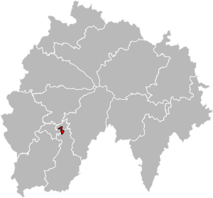
Canton of Aurillac-1
Canton in Auvergne-Rhône-Alpes, France
Distance: Approx. 1744 meters
Latitude and longitude: 44.91,2.43
The canton of Aurillac-1 is an administrative division of the Cantal department, southern France. Its borders were modified at the French canton reorganisation which came into effect in March 2015. Its seat is in Aurillac.

Canton of Aurillac-2
Canton in Auvergne-Rhône-Alpes, France
Distance: Approx. 1481 meters
Latitude and longitude: 44.93,2.45
The canton of Aurillac-2 is an administrative division of the Cantal department, southern France. Its borders were modified at the French canton reorganisation which came into effect in March 2015. Its seat is in Aurillac.

Canton of Aurillac-3
Canton in Auvergne-Rhône-Alpes, France
Distance: Approx. 1214 meters
Latitude and longitude: 44.925,2.44
The canton of Aurillac-3 is an administrative division of the Cantal department, southern France. Its borders were modified at the French canton reorganisation which came into effect in March 2015. Its seat is in Aurillac.

Canton of Arpajon-sur-Cère
Canton in Auvergne-Rhône-Alpes, France
Distance: Approx. 2019 meters
Latitude and longitude: 44.9,2.46
The canton of Arpajon-sur-Cère (Occitan: canton d'Arpajon de Cera) is an administrative division of the Cantal department, southern France. Its borders were modified at the French canton reorganisation which came into effect in March 2015. Its seat is in Arpajon-sur-Cère.

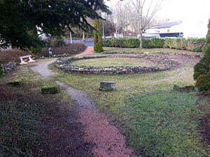
Fanum d'Aron
Distance: Approx. 1188 meters
Latitude and longitude: 44.91978,2.43557
Fanum d'Aron is a fanum, or Romano-Celtic temple, located in Aurillac, a French commune in the Auvergne region.
Aurillac Abbey
Abbey in Aurillac, France
Distance: Approx. 1640 meters
Latitude and longitude: 44.93138,2.448202
Aurillac Abbey, otherwise the Abbey of Saint Gerald, Aurillac (French: Abbaye Saint-Géraud d'Aurillac), founded around 895 in Auvergne (in the present department of Cantal) by Count Gerald of Aurillac, destroyed during the French Wars of Religion and suppressed with the Revolution, was one of the oldest Benedictine abbeys, and probably influenced, in its arrangements and organization, the foundation of Cluny itself. The abbey was also a leading intellectual center in the Middle Ages, the cradle of the French cultural and literary renewal of the 10th century: it formed among others Gerbert, later Pope Sylvester II, who maintained strong ties with his monastery of origin until his death.
Weather in this IP's area
clear sky
1 Celsius
-1 Celsius
1 Celsius
1 Celsius
1032 hPa
65 %
1032 hPa
944 hPa
10000 meters
1.75 m/s
7.32 m/s
23 degree
2 %

