Country:
 France
Region:
City:
Latitude and Longitude:
Time Zone:
Postal Code:
IP information under different IP Channel
ip-api
Country
Region
City
ASN
Time Zone
ISP
Blacklist
Proxy
Latitude
Longitude
Postal
Route
IPinfo
Country
Region
City
ASN
Time Zone
ISP
Blacklist
Proxy
Latitude
Longitude
Postal
Route
MaxMind
Country
Region
City
ASN
Time Zone
ISP
Blacklist
Proxy
Latitude
Longitude
Postal
Route
Luminati
Country
 LU
LUASN
Time Zone
Europe/Luxembourg
ISP
SkyLink Data Center BV
Latitude
Longitude
Postal
db-ip
Country
Region
City
ASN
Time Zone
ISP
Blacklist
Proxy
Latitude
Longitude
Postal
Route
ipdata
Country
Region
City
ASN
Time Zone
ISP
Blacklist
Proxy
Latitude
Longitude
Postal
Route
Popular places and events near this IP address

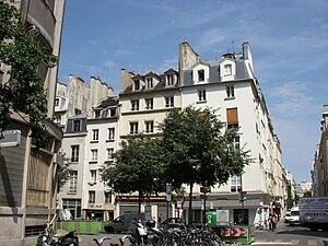
3rd arrondissement of Paris
Municipal arrondissement in Île-de-France, France
Distance: Approx. 190 meters
Latitude and longitude: 48.86381944,2.36165833
The 3rd arrondissement of Paris (IIIe arrondissement, French pronunciation: [tʁwɑzjɛm aʁɔ̃dismɑ̃]) is one of the 20 arrondissements (districts) of the capital city of France. In spoken French, this arrondissement is colloquially referred to as "le troisième" (French pronunciation: [lə tʁwɑzjɛm]) meaning "the third". Its postal code is 75003.

Square du Temple
Garden in Paris, France
Distance: Approx. 302 meters
Latitude and longitude: 48.86527778,2.36222222
The Square du Temple is a garden in Paris, France in the 3rd arrondissement, established in 1857. It is one of 24 city squares planned and created by Georges-Eugène Haussmann and Jean-Charles Adolphe Alphand. The Square occupies the site of a medieval fortress in Paris, built by the Knights Templar.

Rue de Montmorency
Street in Paris, France
Distance: Approx. 305 meters
Latitude and longitude: 48.86305556,2.355
The Rue de Montmorency is a street in the historic Le Marais quarter of Paris, part of the city's 3rd arrondissement. It runs from the Rue du Temple to the Rue Saint-Martin.

Carreau du Temple
Market in Paris
Distance: Approx. 259 meters
Latitude and longitude: 48.86416667,2.3625
The Carreau du Temple is a covered market in the 3rd arrondissement of Paris, built in 1863. As part of a public consultation exercise undertaken in 2004 the local population voted that the Carreau should be redeveloped as polyvalent public space. The Carreau is scheduled to reopen in 2013.

Musée de la Chasse et de la Nature
Hunting museum in Paris, France
Distance: Approx. 268 meters
Latitude and longitude: 48.86111111,2.35861111
The Musée de la Chasse et de la Nature (Museum of Hunting and Nature) is a private museum of hunting and nature located in the 3rd arrondissement of Paris, France. The museum is served by the Rambuteau Paris Métro station. Exhibits focus on the relationships between humans and the natural environment through the traditions and practices of hunting.
Rue Pastourelle
Street in Paris, France
Distance: Approx. 81 meters
Latitude and longitude: 48.86277778,2.35916667
The Rue Pastourelle is a street in the 3rd arrondissement of Paris. It starts at the Rue Charlot and ends at the Boulevard du Temple. Its nearest metro stations are Arts et Métiers and Saint-Sébastien - Froissart.

Inter-LGBT
Distance: Approx. 195 meters
Latitude and longitude: 48.8639,2.3617
Inter-LGBT (Interassociative Lesbienne, Gaie, Bi et Trans) is an umbrella group of 50 LGBT organisations in France.

Marché des Enfants Rouges
Oldest covered market in France
Distance: Approx. 226 meters
Latitude and longitude: 48.8628,2.362
The Marché des Enfants Rouges is the oldest covered market in Paris, France. It was established in 1628 as the "petit marché du Marais" and is located at 39 Rue de Bretagne in the Marais (3rd) arrondissement. The market has been listed as a historic monument since 1982.
École Duperré
Distance: Approx. 291 meters
Latitude and longitude: 48.86528056,2.36201944
The Duperré School of Applied Arts is a public college of art and design. The school is located in the Rue Dupetit-Thouars, in the 3rd arrondissement of Paris, near the Carreau du Temple, in the heart of Le Marais. Duperré School trains students for creative careers in fashion and textiles, as well as environmental and graphic design.

Lycée Turgot
School in France
Distance: Approx. 308 meters
Latitude and longitude: 48.866239,2.358477
The lycée polyvalent de Turgot is a lycée located in the 3rd arrondissement of Paris. Its entrance is located at 69 rue de Turbigo. It runs classe préparatoire aux grandes écoles in the D1, D2, PC and ECT streams.
Henri Cartier-Bresson Foundation
Art gallery in Paris
Distance: Approx. 98 meters
Latitude and longitude: 48.8629,2.36009
The Henri Cartier-Bresson Foundation (French: Fondation Henri Cartier-Bresson), also known as Fondation HCB, is an art gallery and non-profit organisation in Paris that was established to preserve and show the work of Henri Cartier-Bresson and Martine Franck, and show the work of others. It was set up in 2003 by the photographer and painter Cartier-Bresson, his wife, also a photographer, Franck, and their daughter, Mélanie Cartier-Bresson. The Foundation hosts four solo exhibitions per year by a variety of photographers, painters, sculptors, and illustrators.

Rue des Archives
Street in the Marais, Paris
Distance: Approx. 216 meters
Latitude and longitude: 48.86158,2.35867
The Rue des Archives is a street in Le Marais at the border of 3rd and 4th arrondissements of Paris, France.
Weather in this IP's area
light rain
13 Celsius
13 Celsius
12 Celsius
13 Celsius
990 hPa
98 %
990 hPa
984 hPa
10000 meters
6.69 m/s
290 degree
100 %
08:03:35
19:11:03