Country:
Region:
City:
Latitude and Longitude:
Time Zone:
Postal Code:
IP information under different IP Channel
ip-api
Country
Region
City
ASN
Time Zone
ISP
Blacklist
Proxy
Latitude
Longitude
Postal
Route
Luminati
Country
ASN
Time Zone
Asia/Tehran
ISP
Naji Research & Development Company Private Join-Stock
Latitude
Longitude
Postal
IPinfo
Country
Region
City
ASN
Time Zone
ISP
Blacklist
Proxy
Latitude
Longitude
Postal
Route
db-ip
Country
Region
City
ASN
Time Zone
ISP
Blacklist
Proxy
Latitude
Longitude
Postal
Route
ipdata
Country
Region
City
ASN
Time Zone
ISP
Blacklist
Proxy
Latitude
Longitude
Postal
Route
Popular places and events near this IP address

Razi High School
School in Tehran, Iran
Distance: Approx. 352 meters
Latitude and longitude: 35.76611111,51.40972222
Le Lycée Razi (Persian: دبیرستان رازی), translated in English as Razi High School, was a French-language co-ed school located on Pahlavi Street (now renamed Valiasr Street after the revolution of 79 ) in Tehran, Iran. The school is named after Razi a Persian physician, philosopher, and scholar. The first Razi school was built during the 1950s in a different area of the city of Teheran, and at the beginning of the 60s a new campus was built north of Vanak Square in Teheran.

K. N. Toosi University of Technology
Public research university in Tehran, Iran
Distance: Approx. 180 meters
Latitude and longitude: 35.7626,51.4128
The Khajeh Nasir Toosi University of Technology (KNTU; Persian: دانشگاه صنعتی خواجه نصيرالدين طوسی) is a public research university in Tehran, Iran. It is named after medieval Persian scholar Khajeh Nasir Toosi. The university is considered one of the most prestigious institutions of higher education in Iran.

Ararat Stadium
Distance: Approx. 1022 meters
Latitude and longitude: 35.767895,51.401253
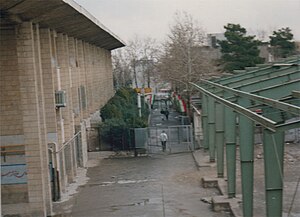
Ararat Stadium (Armenian: Արարատ մարզադաշտ; Persian: ورزشگاه آرارات) is a football stadium with 10,000 seats built in 1971 and located in the Ararat Sports Complex in the Vanak neighbourhood of Tehran, Iran. It is named after Mount Ararat, the highest mountain of the Armenian Highlands in what is now Turkey. The complex is owned by the Armenian Cultural Ararat Organization founded in 1944, one of the largest associations of Iranian Armenians.

Ministry of Energy (Iran)
Distance: Approx. 1194 meters
Latitude and longitude: 35.77336389,51.40706111
The Ministry of Energy (Persian: وزارت نیرو Vezârat-e Niru) regulates and manages the implementation of policies applicable to energy, electricity, water, and wastewater services in Iran.
Bank Pasargad
Distance: Approx. 454 meters
Latitude and longitude: 35.7622,51.4158
Bank Pasargad (Persian: بانک پاسارگاد, Bank Pasargad), also known as BPI, is a major Iranian bank offering retail, commercial and investment banking services. The company was established in 2005 as a part of the government's privatization of the banking system. While established in Tehran, the bank operates throughout the nation with 3685 employees and 327 branches.
Tehran Japanese School
School
Distance: Approx. 326 meters
Latitude and longitude: 35.7635177,51.4144756
The Tehran Japanese School (テヘラン日本人学校, Teheran Nihonjin Gakkō, Persian: مدرسه ژاپنیها در تهران) is a Japanese international school located in Tehran, Iran, attached to the Japanese Embassy. It used to be located in another area of Tehran. It serves primary school through junior high school.

Sheikh Bahaei Square
Distance: Approx. 1429 meters
Latitude and longitude: 35.76581389,51.39543333
Sheikh Bahaei Square is in the Vanak area of the Iranian capital, Tehran.

Tabiat Bridge
Bridge in Tehran, Iran
Distance: Approx. 1286 meters
Latitude and longitude: 35.7545,51.4204
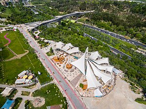
The Tabi'at Bridge (Persian: پل طبیعت, lit. 'The bridge of nature') is the largest pedestrian overpass in Tehran, Iran. The 270-metre (890 ft) bridge connects two public parks — Taleghani Park and Abo-Atash Park — by spanning Modarres Expressway, one of the main highways in northern Tehran. The word tabiat which was imported from Arabic to Persian, means "nature" in Persian, but it has several other meanings in Arabic.

Ab-o-Atash Park
Park in Tehran, Iran
Distance: Approx. 1201 meters
Latitude and longitude: 35.75413028,51.41828028
Ab-o-Atash Park (Persian: پارکِ آب و آتش, Pārk-e Āb-o-Ātaš), literally the "Water-and-Fire Park", also known as the Ebrahim Park (Persian: پارکِ ابراهیم, Pārk-e Ebrāhim), is a park in northern Tehran, Iran. With an area over 24,000 square meters (260,000 sq ft), the park was opened on June 27, 2009 by the 55th Mayor of Tehran, Mohammad Baqer Galibaf.
Velayat Stadium
Football stadium in Semnan, Iran
Distance: Approx. 1022 meters
Latitude and longitude: 35.767895,51.401253
Velayat Stadium (Persian: ورزشگاه ولایت), is a football stadium located in Semnan, Iran. It is owned by the Ministry of Sport and Youth.
Azadieh Stadium
Distance: Approx. 1022 meters
Latitude and longitude: 35.767895,51.401253
Azadieh Stadium (Persian: ورزشگاه آزادیه), is a football stadium located in the Tehran, Iran. It is the home stadium of Iran women's national football team.

Saint Minas Church of Tehran
Iranian national heritage site
Distance: Approx. 1231 meters
Latitude and longitude: 35.76809554,51.39873952
Saint Minas Church of Tehran, (Armenian: Սուրբ Մինաս եկեղեցի, Persian: کلیسای میناس مقدس), is an Armenian Apostolic church in Tehran, Iran.
Weather in this IP's area
few clouds
6 Celsius
5 Celsius
4 Celsius
6 Celsius
1021 hPa
75 %
1021 hPa
859 hPa
10000 meters
2.06 m/s
310 degree
20 %
06:40:37
16:57:35