185.119.47.41 - IP Lookup: Free IP Address Lookup, Postal Code Lookup, IP Location Lookup, IP ASN, Public IP
Country:
Region:
City:
Location:
Time Zone:
Postal Code:
ISP:
ASN:
language:
User-Agent:
Proxy IP:
Blacklist:
IP information under different IP Channel
ip-api
Country
Region
City
ASN
Time Zone
ISP
Blacklist
Proxy
Latitude
Longitude
Postal
Route
db-ip
Country
Region
City
ASN
Time Zone
ISP
Blacklist
Proxy
Latitude
Longitude
Postal
Route
IPinfo
Country
Region
City
ASN
Time Zone
ISP
Blacklist
Proxy
Latitude
Longitude
Postal
Route
IP2Location
185.119.47.41Country
Region
niederosterreich
City
amstetten
Time Zone
Europe/Vienna
ISP
Language
User-Agent
Latitude
Longitude
Postal
ipdata
Country
Region
City
ASN
Time Zone
ISP
Blacklist
Proxy
Latitude
Longitude
Postal
Route
Popular places and events near this IP address
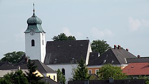
Amstetten, Lower Austria
City in Lower Austria, Austria
Distance: Approx. 803 meters
Latitude and longitude: 48.11666667,14.86666667
Amstetten (German pronunciation: [amˈʃtɛtn̩] ) is a city in Lower Austria. It is the capital of the Amstetten District and the centre of the historical region Mostviertel (“Most” – lightly fermented apple juice, “viertel” – a region of the province Lower Austria).
Amstetten District
District in Lower Austria, Austria
Distance: Approx. 798 meters
Latitude and longitude: 48.1167,14.8667
Bezirk Amstetten is a district of the state of Lower Austria in Austria.
Ardagger
Municipality in Lower Austria, Austria
Distance: Approx. 6379 meters
Latitude and longitude: 48.16666667,14.81666667
Ardagger is a town in the district of Amstetten in Lower Austria in Austria.

Euratsfeld
Municipality in Lower Austria, Austria
Distance: Approx. 6334 meters
Latitude and longitude: 48.08333333,14.93333333
Euratsfeld is a town in the district of Amstetten in Lower Austria in Austria.

Neustadtl an der Donau
Municipality in Lower Austria, Austria
Distance: Approx. 7039 meters
Latitude and longitude: 48.18333333,14.9
Neustadtl an der Donau is a town in the district of Amstetten in Lower Austria in Austria.
Oed-Öhling
Municipality in Lower Austria, Austria
Distance: Approx. 8241 meters
Latitude and longitude: 48.1,14.76666667
Oed-Öhling is a town in the district of Amstetten in Lower Austria in northern Austria. Oed has one primary school.

Sankt Georgen am Ybbsfelde
Municipality in Lower Austria, Austria
Distance: Approx. 4603 meters
Latitude and longitude: 48.11666667,14.93333333
Sankt Georgen am Ybbsfelde is a town in the district of Amstetten in Lower Austria in Austria.

Viehdorf
Municipality in Lower Austria, Austria
Distance: Approx. 3384 meters
Latitude and longitude: 48.11666667,14.91666667
Viehdorf is a town in the district of Amstetten in Lower Austria in Austria.

Winklarn, Austria
Municipality in Lower Austria, Austria
Distance: Approx. 4701 meters
Latitude and longitude: 48.08333333,14.85
Winklarn is a town in the district of Amstetten in Lower Austria in Austria.
Zeillern
Municipality in Lower Austria, Austria
Distance: Approx. 5403 meters
Latitude and longitude: 48.11666667,14.8
Zeillern is a town in the district of Amstetten in Lower Austria in Austria.

Fritzl case
Long-term captivity and abuse of Austrian Elisabeth Fritzl
Distance: Approx. 588 meters
Latitude and longitude: 48.11768611,14.87080556
The Fritzl case emerged in 2008, when a woman named Elisabeth Fritzl (born 6 April 1966) informed investigators in the city of Amstetten, Lower Austria, that she had been held captive for 24 years by her father, Josef Fritzl (born 9 April 1935). Fritzl had assaulted, sexually abused and raped his daughter countless times during her imprisonment inside a concealed area in the cellar of the family home. The incestuous rapes resulted in the birth of seven children.

Sankt Georgen Airport
Airport in Austria
Distance: Approx. 6257 meters
Latitude and longitude: 48.10313889,14.95091667
Sankt Georgen Airport (German: Flugplatz Sankt Georgen, ICAO: LOLG) is a private use airport located 3 kilometres (2 mi) south of Sankt Georgen am Ybbsfelde, Lower Austria, Austria.
Weather in this IP's area
overcast clouds
6 Celsius
6 Celsius
6 Celsius
6 Celsius
1014 hPa
90 %
1014 hPa
964 hPa
10000 meters
0.53 m/s
0.57 m/s
201 degree
100 %


