Country:
Region:
City:
Latitude and Longitude:
Time Zone:
Postal Code:
IP information under different IP Channel
ip-api
Country
Region
City
ASN
Time Zone
ISP
Blacklist
Proxy
Latitude
Longitude
Postal
Route
Luminati
Country
Region
rp
City
kaiserslautern
ASN
Time Zone
Europe/Berlin
ISP
VSE NET GmbH
Latitude
Longitude
Postal
IPinfo
Country
Region
City
ASN
Time Zone
ISP
Blacklist
Proxy
Latitude
Longitude
Postal
Route
db-ip
Country
Region
City
ASN
Time Zone
ISP
Blacklist
Proxy
Latitude
Longitude
Postal
Route
ipdata
Country
Region
City
ASN
Time Zone
ISP
Blacklist
Proxy
Latitude
Longitude
Postal
Route
Popular places and events near this IP address

Ramstein Air Base
US Air Force base in Rhineland-Palatinate, Germany
Distance: Approx. 3103 meters
Latitude and longitude: 49.43683333,7.60033333
Ramstein Air Base (IATA: RMS, ICAO: ETAR) is a United States Air Force installation located in Rhineland-Palatinate, southwestern Germany. It serves as the headquarters for the United States Air Forces in Europe – Air Forces Africa (USAFE-AFAFRICA) and NATO Allied Air Command (AIRCOM). The base plays a key role in supporting forward military operations, particularly those deploying to Eastern Europe and Africa.

Ramstein air show disaster
August 1988 air show mid-air collision in West Germany
Distance: Approx. 3274 meters
Latitude and longitude: 49.43833333,7.60361111
The Ramstein air show disaster occurred on Sunday, 28 August 1988 during the Flugtag '88 airshow at USAF Ramstein Air Base near Kaiserslautern, West Germany. Three aircraft of the Italian Air Force display team collided during their display, crashing to the ground in front of a crowd of about 300,000 people. There were 70 fatalities (67 spectators and 3 pilots), and 346 spectators sustained serious injuries in the resulting explosion and fire.

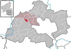
Ramstein-Miesenbach
Town in Rhineland-Palatinate, Germany
Distance: Approx. 411 meters
Latitude and longitude: 49.44611111,7.55472222
Ramstein-Miesenbach is a town in the district of Kaiserslautern in Rhineland-Palatinate in Germany, adjacent to the U.S. Ramstein Air Base.

Landstuhl
Town in Rhineland-Palatinate, Germany
Distance: Approx. 3945 meters
Latitude and longitude: 49.41222222,7.57222222
Landstuhl (German pronunciation: [ˈlantʃtuːl] ), officially the Sickingen Town of Landstuhl (German: Sickingenstadt Landstuhl), is a town in the district of Kaiserslautern, in Rhineland-Palatinate, Germany. It is the seat of the Municipal Association of Landstuhl. Situated on the north-west edge of the Palatinate Forest, 11 miles (18 km) west of the city of Kaiserslautern, the town is located near Ramstein Air Base.

Kottweiler-Schwanden
Municipality in Rhineland-Palatinate, Germany
Distance: Approx. 3528 meters
Latitude and longitude: 49.47472222,7.53722222
Kottweiler-Schwanden is a municipality in the district of Kaiserslautern, in Rhineland-Palatinate, western Germany.

Mackenbach
Municipality in Rhineland-Palatinate, Germany
Distance: Approx. 3317 meters
Latitude and longitude: 49.47166667,7.58555556
Mackenbach is a municipality in the district of Kaiserslautern, in Rhineland-Palatinate, western Germany.

Steinwenden
Municipality in Rhineland-Palatinate, Germany
Distance: Approx. 2634 meters
Latitude and longitude: 49.45583333,7.52666667
Steinwenden is a municipality in the district of Kaiserslautern, in Rhineland-Palatinate, western Germany.
Municipal Association of Landstuhl
Municipal association in Rhineland-Palatinate, Germany
Distance: Approx. 3947 meters
Latitude and longitude: 49.41219444,7.57219444
The Municipal Association of Landstuhl (German: Verbandsgemeinde Landstuhl) is a municipal association (German: verbandsgemeinde) in the district of Kaiserslautern, in Rhineland-Palatinate, Germany. The seat of the municipal association is the Sickingen Town of Landstuhl.
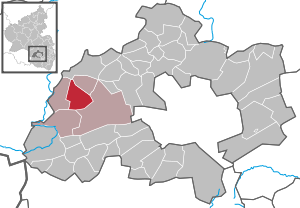
Ramstein-Miesenbach (Verbandsgemeinde)
Distance: Approx. 523 meters
Latitude and longitude: 49.45,7.555
Ramstein-Miesenbach is a Verbandsgemeinde ("collective municipality") in the district of Kaiserslautern, Rhineland-Palatinate, Germany. The seat of the Verbandsgemeinde is in Ramstein-Miesenbach.

Ramstein High School
Dodea secondary school in Germany
Distance: Approx. 1036 meters
Latitude and longitude: 49.446428,7.574607
Ramstein American High School (or RHS) is a Department of Defense Dependents Schools (DoDDS) high school in the Kaiserslautern district, Germany. RHS is a part of the Ramstein Community Schools in the Eastern Europe district that is run by the Department of Defense Education Activity (DoDEA). Their mascot is the Royal, a lion with a crown.

Landstuhl station
Railway station in Rhineland-Palatinate, Germany
Distance: Approx. 3417 meters
Latitude and longitude: 49.416334,7.566018
Landstuhl station is a station in the town of Landstuhl in the German state of Rhineland-Palatinate. Deutsche Bahn classifies it as belonging to station category 3 and has three platforms tracks. The station is located in the network of the Verkehrsverbund Rhein-Neckar (VRN) and belongs to fare zone 844.
West Palatine Musicians Museum
Distance: Approx. 3261 meters
Latitude and longitude: 49.4716,7.5843
The West Palatine Musicians Museum (German: Westpfälzer Musikantenmuseum) in Mackenbach, Germany, documents the history of the Westphalian Wandering Musicians, the heyday of which was between 1850 and the First World War. In addition to musical instruments of the travelling musicians, there is an extensive collection of African musical instruments, historical photos of the villages and houses of musicians and souvenirs of travellers are on display. The linkages between the Musikantenland ("Musicians' Land") and the culture of German emigrants, especially in the US, are also explained.
Weather in this IP's area
mist
6 Celsius
6 Celsius
5 Celsius
7 Celsius
1027 hPa
99 %
1027 hPa
997 hPa
2800 meters
100 %
07:33:11
16:54:21