Country:
 Luxembourg
Region:
City:
Latitude and Longitude:
Time Zone:
Postal Code:
IP information under different IP Channel
ip-api
Country
Region
City
ASN
Time Zone
ISP
Blacklist
Proxy
Latitude
Longitude
Postal
Route
IPinfo
Country
Region
City
ASN
Time Zone
ISP
Blacklist
Proxy
Latitude
Longitude
Postal
Route
MaxMind
Country
Region
City
ASN
Time Zone
ISP
Blacklist
Proxy
Latitude
Longitude
Postal
Route
Luminati
Country
LUASN
Time Zone
Europe/Luxembourg
ISP
NTT Luxembourg PSF S.A.
Latitude
Longitude
Postal
db-ip
Country
Region
City
ASN
Time Zone
ISP
Blacklist
Proxy
Latitude
Longitude
Postal
Route
ipdata
Country
Region
City
ASN
Time Zone
ISP
Blacklist
Proxy
Latitude
Longitude
Postal
Route
Popular places and events near this IP address

Canton of Capellen
Canton in Sud, Luxembourg
Distance: Approx. 927 meters
Latitude and longitude: 49.63333333,6
Capellen (Luxembourgish: Kapellen) is a canton in southwestern Luxembourg. It is named after Capellen, which is not a commune but rather a section of the commune of Mamer. It borders Belgium.

Mamer
Commune in Capellen, Luxembourg
Distance: Approx. 1875 meters
Latitude and longitude: 49.6283333,6.0261111
Mamer (Luxembourgish pronunciation: [ˈmaːmɐ] ) is a commune and town (strictly classified as a village) in south-western Luxembourg. It is located 7 km (4.3 mi) west of Luxembourg City. The commune includes both Mamer itself and the smaller communities of Capellen and Holzem.

Capellen
Town in Mamer, Luxembourg
Distance: Approx. 1370 meters
Latitude and longitude: 49.64444444,5.98972222
Capellen (Luxembourgish: Cap/Capellen [kɑpˈælən]) is a town in the commune of Mamer, in south-western Luxembourg, 12 km west of Luxembourg City. As of 2023, the town has a population of 2,371. Despite not having a commune named after it, Capellen lends its name to the canton of Capellen, and is the only town in Luxembourg to bear the latter distinction but not the former.

Stade François Trausch
Football stadium in Luxembourg
Distance: Approx. 2156 meters
Latitude and longitude: 49.6243,6.0248
Stade François Trausch is a football stadium in Mamer, in south-western Luxembourg. It is currently the home stadium of FC Mamer 32. The stadium has a capacity of 2,600.

Mamer Lycée railway station
Railway station in Luxembourg
Distance: Approx. 2642 meters
Latitude and longitude: 49.61861111,6.02305556
Mamer Lycée railway station (Luxembourgish: Gare Mamer Lycée, French: Gare de Mamer Lycée, ‹See Tfd›German: Bahnhof Mamer Lycée) is a railway station in Mamer, in south-western Luxembourg. It is named after the Lycée Technique Josy Barthel, which it was built to serve. It is operated by Chemins de Fer Luxembourgeois, the state-owned railway company.
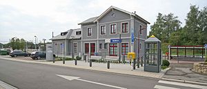
Mamer railway station
Railway station in Luxembourg
Distance: Approx. 1886 meters
Latitude and longitude: 49.62416667,6.01638889
Mamer railway station (Luxembourgish: Gare Mamer, French: Gare de Mamer, ‹See Tfd›German: Bahnhof Mamer) is a railway station serving Mamer, in south-western Luxembourg. It is operated by Chemins de Fer Luxembourgeois, the state-owned railway company. The station is situated on Line 50, which connects Luxembourg City to the west of the country and the Belgian town of Arlon.

Capellen railway station
Railway station in southwestern Luxembourg
Distance: Approx. 1850 meters
Latitude and longitude: 49.63861111,5.98194444
Capellen railway station (Luxembourgish: Gare Capellen, French: Gare de Capellen, ‹See Tfd›German: Bahnhof Capellen) is a railway station serving Capellen, in the commune of Mamer, in south-western Luxembourg. It is operated by Chemins de Fer Luxembourgeois, the state-owned railway company. The station is situated on Line 50, which connects Luxembourg City to the west of the country and the Belgian town of Arlon.

NATO Support and Procurement Agency
NATO's main logistics and procurement agency
Distance: Approx. 1504 meters
Latitude and longitude: 49.64083333,5.98666667
The NATO Support and Procurement Agency (French: Agence OTAN de soutien et d'acquisition), abbreviated to NSPA, is the main logistics and procurement agency of the North Atlantic Treaty Organization (NATO) and is the executive branch of the NATO Support and Procurement Organization (NSPO), formerly NATO Maintenance and Supply Organization (NAMSO). Until 2012, the tasks were organised with the NATO Supply Agency and other institutions. It has about 1200 employees in Luxembourg, France, Italy and Hungary.

Lycée Technique Josy Barthel
Distance: Approx. 2799 meters
Latitude and longitude: 49.62,6.03083333
Lycée Josy Barthel (English: Josy Barthel High School), abbreviated to LJBM, is a high school in Mamer, in south-western Luxembourg. It was opened in September 2003, and cost €67.4m to build. It comprises 60 classrooms and 16 workshops, and has a capacity of 1,300 students.

Olm, Luxembourg
Distance: Approx. 1228 meters
Latitude and longitude: 49.65,6
Olm (Luxembourgish: Ollem) is a village in the commune of Kehlen, in western Luxembourg. As of 2023, the village had a population of 1,763.
Mamer Castle
Distance: Approx. 1955 meters
Latitude and longitude: 49.62611111,6.02388889
Mamer Castle (Luxembourgish: Mamer Schlass, French: Château de Mamer, ‹See Tfd›German: Mamer Schloss) is the town hall for the commune of Mamer, in south-western Luxembourg. It is the home of the communal council, the site of local government offices, and the centre of administration for communal services. It is located on Place de l'Indépendance near the centre of the town.

Kinneksbond
Distance: Approx. 2136 meters
Latitude and longitude: 49.62805556,6.03055556
Kinneksbond is a cultural centre in Mamer in southern Luxembourg. Opened in October 2010, it houses a 480-seat auditorium with a stage and orchestra pit suitable for concerts, drama performances and shows. Designed by the architect Jim Clemes from Esch-sur-Alzette, the ultra-modern facility also contains dress rooms, a room for band rehearsals and a number of smaller rooms for music teaching.
Weather in this IP's area
light intensity drizzle
12 Celsius
11 Celsius
11 Celsius
12 Celsius
1011 hPa
93 %
1011 hPa
975 hPa
10000 meters
4.63 m/s
220 degree
75 %
07:36:05
19:14:49