185.117.78.66 - IP Lookup: Free IP Address Lookup, Postal Code Lookup, IP Location Lookup, IP ASN, Public IP
Country:
Region:
City:
Location:
Time Zone:
Postal Code:
IP information under different IP Channel
ip-api
Country
Region
City
ASN
Time Zone
ISP
Blacklist
Proxy
Latitude
Longitude
Postal
Route
Luminati
Country
ASN
Time Zone
Europe/Amsterdam
ISP
Gemeente Maastricht
Latitude
Longitude
Postal
IPinfo
Country
Region
City
ASN
Time Zone
ISP
Blacklist
Proxy
Latitude
Longitude
Postal
Route
IP2Location
185.117.78.66Country
Region
limburg
City
maastricht
Time Zone
Europe/Amsterdam
ISP
Language
User-Agent
Latitude
Longitude
Postal
db-ip
Country
Region
City
ASN
Time Zone
ISP
Blacklist
Proxy
Latitude
Longitude
Postal
Route
ipdata
Country
Region
City
ASN
Time Zone
ISP
Blacklist
Proxy
Latitude
Longitude
Postal
Route
Popular places and events near this IP address
Maastricht University
Public university in Maastricht, Netherlands
Distance: Approx. 309 meters
Latitude and longitude: 50.84583333,5.68722222
Maastricht University (abbreviated as UM; Dutch: Universiteit Maastricht) is a public research university in Maastricht, the Netherlands. Founded in 1976, it is the second youngest of the thirteen Dutch universities. In 2023, 22,976 students studied at Maastricht University, 59% of whom were students from outside of the Netherlands, with over 4,000 employees.

Maastricht Academy of Dramatic Arts
Dutch performing arts institute
Distance: Approx. 217 meters
Latitude and longitude: 50.84647,5.68842
The Toneelacademie Maastricht, or Maastricht Academy of Dramatic Arts, is a college of dramatic arts located in the city of Maastricht in the Netherlands. It is part of the Zuyd University of Applied Sciences.

Onze Lieve Vrouweplein
Square in Maastricht, the Netherlands
Distance: Approx. 305 meters
Latitude and longitude: 50.8475,5.693
The Onze Lieve Vrouweplein (Dutch: [ˌɔnzə ˌlivə ˈvrʌu.əˌplɛin]; Limburgish: Slevrouweplein [sləˈvʀɔwəˌplɛːn˦]; "Square of Our Lady") is a square in the historic center of Maastricht, the Netherlands. The square is situated south of Maastricht's pedestrianised shopping district. Well known for its many café terraces, it is a popular place with tourists and local people alike.
Basilica of Saint Servatius
Roman Catholic church in Maastricht, Netherlands
Distance: Approx. 120 meters
Latitude and longitude: 50.84861111,5.68722222
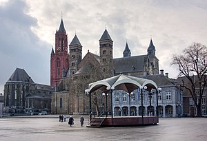
The Basilica of Saint Servatius (Dutch: Sint-Servaasbasiliek) is a Roman Catholic church dedicated to Saint Servatius, in the center of Maastricht, Netherlands. The architecturally hybrid but mainly Romanesque church is situated next to the Gothic Church of Saint John, backing onto the town's main square, Vrijthof.

Fotomuseum aan het Vrijthof
Distance: Approx. 7 meters
Latitude and longitude: 50.84833333,5.68888889
The Fotomuseum aan het Vrijthof (previously: Museum aan het Vrijthof and Museum Spaans Gouvernement) is a museum of photography in Maastricht, Netherlands.

Au Coin des Bons Enfants
Restaurant in Maastricht, Netherlands
Distance: Approx. 273 meters
Latitude and longitude: 50.84611111,5.6875
Au Coin des Bons Enfants is a restaurant in Maastricht, Netherlands. It is a fine dining restaurant that was awarded one Michelin star in the period 1958–1970 and 2006–2012. GaultMillau awarded the restaurant 15.0 out of 20 points.
Binnenstad, Maastricht
Neighborhood of Maastricht in Netherlands, Limburg
Distance: Approx. 156 meters
Latitude and longitude: 50.8498,5.689
Binnenstad (Dutch pronunciation: [ˈbɪnə(n)ˌstɑt]; Limburgish: Binnestad [ˈbɪnəˌstɑt]; English: Inner city) is a neighbourhood in Maastricht, Netherlands. Until 2007, it was officially named City. As its name suggests, it is the most centrally located area of Maastricht.
Chez Jacques
Restaurant in Maastricht, Netherlands
Distance: Approx. 295 meters
Latitude and longitude: 50.84956667,5.685125
Bistro Chez Jacques is a defunct restaurant in Maastricht, Netherlands. It was a fine dining restaurant that was awarded one Michelin star in 1976 and retained that rating until 1979. Its owner and head chef was Jacques Zeguers.

Vrijthof
Square in Maastricht, the Netherlands
Distance: Approx. 92 meters
Latitude and longitude: 50.849172,5.688419
Vrijthof is a large urban square in the centre of Maastricht, Netherlands. The square developed from an ancient Roman and Frankish cemetery into a semi-private space that belonged to the Collegiate Church of Saint Servatius. In the 19th century, it became the town's main square.

Dinghuis
Government building in Maastricht
Distance: Approx. 311 meters
Latitude and longitude: 50.84989,5.69264
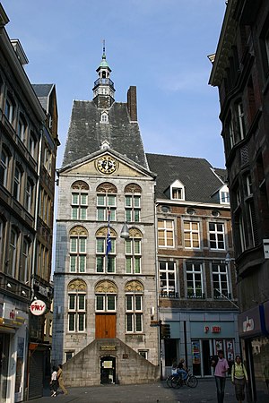
The Dinghuis (Ding House) is a building in downtown Maastricht, Netherlands, constructed at the end of the 15th century. (Ding is the Dutch name for the governing assembly known in most Germanic languages as a thing.) The building was constructed in the gothic style of architecture. The northern façade, built around 1470, is timber-framed, and the main façade, built of Namur stone, has a pediment containing a grand clock face.

Huis Soiron
Building in Maastricht-Statenkwartier, Grote Gracht
Distance: Approx. 285 meters
Latitude and longitude: 50.85022,5.68604
Huis Soiron is a former canon house in the center of the Dutch city of Maastricht. It is located at Grote Gracht 82 in the central neighborhood Statenkwartier and as of 2004 is owned by Maastricht University, which also occupies several nearby properties, including the Hof van Tilly. The building from the late 18th century possesses a number of rooms with lavish stucco work in Louis XVI style and has been a national monument since 1966.

Saint John Church (Maastricht)
Gothic church in the center of Maastricht, Netherlands
Distance: Approx. 120 meters
Latitude and longitude: 50.84861111,5.68722222
The Sint-Janskerk (Saint John Church) is a Gothic church in the center of Maastricht, Netherlands. The Protestant Sint-Jan is situated next to the Roman Catholic Basilica of Saint Servatius on the town's main square, Vrijthof.
Weather in this IP's area
snow
1 Celsius
-1 Celsius
0 Celsius
1 Celsius
1040 hPa
82 %
1040 hPa
1027 hPa
10000 meters
1.54 m/s
50 degree
3 %

