Country:
 Belgium
Region:
City:
Latitude and Longitude:
Time Zone:
Postal Code:
IP information under different IP Channel
ip-api
Country
Region
City
ASN
Time Zone
ISP
Blacklist
Proxy
Latitude
Longitude
Postal
Route
IPinfo
Country
Region
City
ASN
Time Zone
ISP
Blacklist
Proxy
Latitude
Longitude
Postal
Route
MaxMind
Country
Region
City
ASN
Time Zone
ISP
Blacklist
Proxy
Latitude
Longitude
Postal
Route
Luminati
Country
BEASN
Time Zone
Europe/Brussels
ISP
Accenture B. V.
Latitude
Longitude
Postal
db-ip
Country
Region
City
ASN
Time Zone
ISP
Blacklist
Proxy
Latitude
Longitude
Postal
Route
ipdata
Country
Region
City
ASN
Time Zone
ISP
Blacklist
Proxy
Latitude
Longitude
Postal
Route
Popular places and events near this IP address

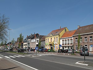
Destelbergen
Municipality in Flemish Community, Belgium
Distance: Approx. 7817 meters
Latitude and longitude: 51.05,3.8
Destelbergen (Dutch pronunciation: [ˌdɛstəlˈbɛrɣə(n)] ) is a municipality located in the Belgian province of East Flanders. The municipality comprises the towns of Destelbergen proper and Heusden and was created on 1 January 1977, by the fusion of these two municipalities. Its western border touches the municipality of Ghent and Melle and is formed by an ancient silted up branch of the river Scheldt.
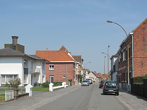
Lochristi
Municipality in Flemish Community, Belgium
Distance: Approx. 2509 meters
Latitude and longitude: 51.1,3.83333333
Lochristi (Dutch pronunciation: [loːˈkrɪsti]) is a municipality located in the Belgian province of East Flanders. The municipality is composed of the towns of Beervelde, Lochristi proper, Zaffelare and Zeveneken. As of 2021, Lochristi had a total population of 22,621.
Moerbeke
Municipality in Flemish Community, Belgium
Distance: Approx. 8176 meters
Latitude and longitude: 51.16666667,3.93333333
Moerbeke (Dutch pronunciation: [ˈmuːrbeːkə]) is a municipality in the Belgian province of East Flanders. It is sometimes unofficially called Moerbeke-Waas (Dutch pronunciation: [ˌmuːrbeːkə ˈʋaːs]) to distinguish between this place and Moerbeke in Geraardsbergen. The municipality comprises the town of Moerbeke proper, and part of the Dutch-Belgian village Koewacht.

Wachtebeke
Municipality in Flemish Community, Belgium
Distance: Approx. 6787 meters
Latitude and longitude: 51.16666667,3.86666667
Wachtebeke (Dutch pronunciation: [ˈʋɑxtəbeːkə]) is a municipality located in the Belgian province of East Flanders. The municipality comprises the town of Wachtebeke proper, and a smaller town: Overslag. In 2021, Wachtebeke had a total population of 7.769.

Lokeren
City and municipality in Flemish Community, Belgium
Distance: Approx. 8083 meters
Latitude and longitude: 51.1,3.98333333
Lokeren (Dutch pronunciation: [ˈloːkərə(n)] ) is a city and municipality located in the Belgian province of East Flanders, and belongs to the Waasland, also called Land van Waas, of which it is the second most important city after Sint-Niklaas. The city, located on the river Durme, the Lede, and the E17 motorway, has more than 42,100 inhabitants who are called Lokeraars or Rapenfretters. Because Lokeren is located on the Durme, Lokeren is often called "The Durme City".

Desteldonk
Sub-municipality of the city of Ghent, Belgium
Distance: Approx. 6340 meters
Latitude and longitude: 51.12194444,3.78111111
Desteldonk (French pronunciation: [ˈdɛstəldɔŋk]) is a sub-municipality of the city of Ghent located in the province of East Flanders, Flemish Region, Belgium. It was a separate municipality until 1965. In 1927, part of the original municipality was already annexed to Ghent.

Oostakker Basilica
Roman Catholic church at Oostakker near Ghent in Belgium
Distance: Approx. 7782 meters
Latitude and longitude: 51.0825,3.76305556
The Basilica of Our Lady of Lourdes is a Roman Catholic church at Oostakker, near Ghent in Belgium. Built in neogothic style at the end of the XIXe century it is the most important centre of Marian pilgrimage in Flanders. In 1873 the Marquise of Courtebourne-de Nédonchel had a Lourdes grotto built in the gardens of her château at Slotendries.

Mendonk
Sub-municipality of the city of Ghent, Belgium
Distance: Approx. 5606 meters
Latitude and longitude: 51.14666667,3.82138889
Mendonk (Dutch pronunciation: [ˈmɛndɔŋk]) is a sub-municipality of the city of Ghent located in the province of East Flanders, Flemish Region, Belgium. It was a separate municipality until 1965. In 1927, part of the original municipality was already annexed to Ghent.

Sint-Kruis-Winkel
Sub-municipality of the city of Ghent, Belgium
Distance: Approx. 6131 meters
Latitude and longitude: 51.15416667,3.82638889
Sint-Kruis-Winkel (Dutch: [ˌsɪnt krœys ˈʋɪŋkəl]; French: Winkel-Sainte-Croix) is a sub-municipality of the city of Ghent located in the province of East Flanders, Flemish Region, Belgium. It was a separate municipality until 1965. In 1927, part of the original municipality was already annexed to Ghent.
Zaffelare Heliport
Airport in Belgium
Distance: Approx. 2780 meters
Latitude and longitude: 51.13055556,3.86416667
Zaffelare Heliport (ICAO: EBLZ) is an airport located near Lochristi, East Flanders, Belgium. It has 1 grass helipad.

Lokeren railway station
Railway station in East Flanders, Belgium
Distance: Approx. 8233 meters
Latitude and longitude: 51.10722222,3.98583333
Lokeren railway station (Dutch: Station Lokeren; French: Gare de Lokeren) is a railway station in Lokeren, East Flanders, Belgium. The station opened on 9 August 1847 and is located on railway lines 57 and 59. The train services are operated by the National Railway Company of Belgium (NMBS/SNCB).

Heusden Castle (Belgium)
Distance: Approx. 7188 meters
Latitude and longitude: 51.05078194,3.81399167
Heusden Castle is a historical site and castle in Heusden, Destelbergen, Belgium. The present structure was built in 1899 on the grounds of a former castle built in the 11th century. The above-ground parts of the old castle were demolished in the 18th century.
Weather in this IP's area
overcast clouds
14 Celsius
14 Celsius
13 Celsius
15 Celsius
1017 hPa
90 %
1017 hPa
1016 hPa
10000 meters
4.22 m/s
8.76 m/s
199 degree
100 %
08:14:57
18:43:36