Country:
Region:
City:
Latitude and Longitude:
Time Zone:
Postal Code:
IP information under different IP Channel
ip-api
Country
Region
City
ASN
Time Zone
ISP
Blacklist
Proxy
Latitude
Longitude
Postal
Route
Luminati
Country
ASN
Time Zone
Europe/Vaduz
ISP
Telecom Liechtenstein AG
Latitude
Longitude
Postal
IPinfo
Country
Region
City
ASN
Time Zone
ISP
Blacklist
Proxy
Latitude
Longitude
Postal
Route
db-ip
Country
Region
City
ASN
Time Zone
ISP
Blacklist
Proxy
Latitude
Longitude
Postal
Route
ipdata
Country
Region
City
ASN
Time Zone
ISP
Blacklist
Proxy
Latitude
Longitude
Postal
Route
Popular places and events near this IP address
Zurich Altstetten railway station
Railway station in the Altstetten quarter of the Swiss city of Zürich
Distance: Approx. 2602 meters
Latitude and longitude: 47.3915,8.489
Zürich Altstetten railway station (German: Bahnhof Zürich Altstetten) is a railway station in the Altstetten quarter of the Swiss city of Zürich. The station is located on the Zürich to Olten main line and is the junction for the Zürich to Zug via Affoltern am Albis line. The station is served by lines S5, S11, S12, S14, S19, and S42 of the Zürich S-Bahn.

Gubrist Tunnel
Distance: Approx. 2176 meters
Latitude and longitude: 47.42388889,8.48277778
The Gubrist Tunnel is a motorway tunnel in Switzerland. The tunnel lies to the north-west of the city of Zürich, and forms part of the A1 motorway, on its northern ring section around Zürich. The tunnel was completed in 1985, and is 3,273 metres (10,738 ft) in length.

Swiss Life Arena
Ice hockey arena in Zürich, Switzerland
Distance: Approx. 1833 meters
Latitude and longitude: 47.39536944,8.48003056
The Swiss Life Arena is an ice hockey and entertainment arena the Altstetten quarter of Zürich, Switzerland. It is located approximately seven kilometers west of downtown Zürich. The arena officially opened in October 2022.
Schlieren, Switzerland
Municipality in Zurich, Switzerland
Distance: Approx. 1476 meters
Latitude and longitude: 47.4,8.45
Schlieren (Zürich German Schlierä) is a municipality in the district of Dietikon in the canton of Zürich in Switzerland.
Oberengstringen
Municipality in Zurich, Switzerland
Distance: Approx. 927 meters
Latitude and longitude: 47.41666667,8.46666667
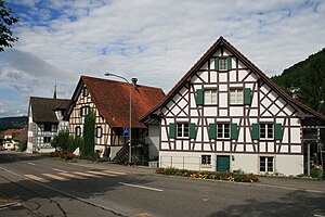
Oberengstringen is a municipality in the district of Dietikon in the canton of Zürich in Switzerland, located in the Limmat Valley (German: Limmattal).
Unterengstringen
Municipality in Zurich, Switzerland
Distance: Approx. 1466 meters
Latitude and longitude: 47.41666667,8.45
Unterengstringen is a municipality in the district of Dietikon in the canton of Zürich in Switzerland, located in the Limmat Valley (German: Limmattal).

Weiningen
Municipality in Zurich, Switzerland
Distance: Approx. 2567 meters
Latitude and longitude: 47.41666667,8.43333333
Weiningen is a municipality in the district of Dietikon in the canton of Zürich in Switzerland. It is located in the Limmat Valley (German: Limmattal). The municipality was first mentioned in 870 as Winingon.
Fahr Convent
Distance: Approx. 1947 meters
Latitude and longitude: 47.40845,8.4393
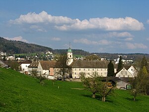
Fahr Convent (German: Kloster Fahr) is a Benedictine convent located in an exclave of the canton of Aargau, surrounded by the municipality of Unterengstringen (canton of Zürich). It is located 8 km to the north of Zürich's city centre. Located in different cantons, Einsiedeln Abbey and Fahr Convent form a double monastery, overseen by the male Abbot of Einsiedeln, no converse arrangement appears to be available for the Abbess of Fahr.

Schlieren railway station
Railway station in Switzerland
Distance: Approx. 1702 meters
Latitude and longitude: 47.39855278,8.44786389
Schlieren railway station (German: Bahnhof Schlieren) is a railway station in Switzerland, situated in the municipality of Schlieren. The station is located on the Zürich–Baden railway line and is a stop of the Zurich S-Bahn served by lines S11 and S12. The former Schlieren carriage works of the Schweizerische Wagons- und Aufzügefabrik AG Schlieren-Zürich were once situated adjacent to the station.

Alte Kirche Höngg
Evangelical church building in Zurich, Switzerland
Distance: Approx. 2513 meters
Latitude and longitude: 47.40153611,8.496925
The Alte Kirche Höngg (old church of Höngg) is a Reformed church in the district 10 of Zürich. Its congregation forms part of the Evangelical Reformed Church of the Canton of Zürich. Based on archeological research, the basement of the church relates to the 8/9th century.
Werdinsel
Distance: Approx. 1926 meters
Latitude and longitude: 47.4,8.4875
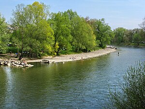
Werdinsel, also known as Limmatauen Werdhölzli, is an island and a protected area in the Limmat in Switzerland.
Liceo Vermigli
School in Zürich, Switzerland
Distance: Approx. 2379 meters
Latitude and longitude: 47.39388889,8.48833333
Liceo linguistico e scientifico "Pier Martire Vermigli" (Italian pronunciation: [liˈtʃɛːo liŋˈɡwistiko e ʃʃenˈtiːfiko ˌpjɛr ˈmartire verˈmiʎʎi]) is a private Italian international liceo (upper secondary school) in Zürich, Switzerland. It is on the second and third floors of the "Casa d'Italia" facility, which also houses the Scuola statale primaria e dell'infanzia/Scuola Italiana di Zurigo, a primary school operated by the Italian government; and the Scuola media paritaria "Enrico Fermi", which is a private Italian lower secondary school. It was founded in 1978.
Weather in this IP's area
overcast clouds
8 Celsius
7 Celsius
7 Celsius
9 Celsius
1026 hPa
91 %
1026 hPa
975 hPa
6000 meters
2.06 m/s
30 degree
100 %
07:14:35
17:04:48


