Country:
Region:
City:
Latitude and Longitude:
Time Zone:
Postal Code:
IP information under different IP Channel
ip-api
Country
Region
City
ASN
Time Zone
ISP
Blacklist
Proxy
Latitude
Longitude
Postal
Route
Luminati
Country
ASN
Time Zone
Europe/Zagreb
ISP
CRATIS d.o.o.
Latitude
Longitude
Postal
IPinfo
Country
Region
City
ASN
Time Zone
ISP
Blacklist
Proxy
Latitude
Longitude
Postal
Route
db-ip
Country
Region
City
ASN
Time Zone
ISP
Blacklist
Proxy
Latitude
Longitude
Postal
Route
ipdata
Country
Region
City
ASN
Time Zone
ISP
Blacklist
Proxy
Latitude
Longitude
Postal
Route
Popular places and events near this IP address

Čakovec
City in Međimurje, Croatia
Distance: Approx. 948 meters
Latitude and longitude: 46.38583333,16.43333333
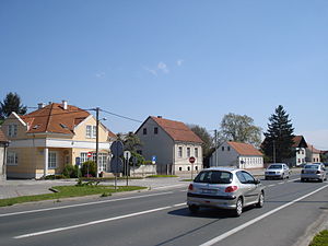
Čakovec (Croatian pronunciation: [tʃâkoʋets]; Hungarian: Csáktornya; Latin: Aquama; German: Tschakathurn) is a city in Northern Croatia, located around 90 kilometres (56 miles) north of Zagreb, the Croatian capital. Čakovec is both the county seat and the largest city of Međimurje County, the northernmost, smallest and most densely populated Croatian county.

Nedelišće
Municipality in Međimurje, Croatia
Distance: Approx. 3159 meters
Latitude and longitude: 46.38333333,16.38333333
Nedelišće (Hungarian: Drávavásárhely; Kajkavian: Nedelišče) is a village in Međimurje County, in northern Croatia, and the seat of the Municipality of Nedelišće, which also includes 10 other villages in the south-western part of Međimurje County. Nedelišće itself is a suburban village located just outside the county seat, Čakovec, around 3 kilometres from the city's centre. Despite not being designated as either a city or a town, Nedelišće was the third most populated settlement in Međimurje County, after Čakovec and Prelog, with 4,320 inhabitants according to the 2011 census.

Šenkovec
Municipality in Međimurje, Croatia
Distance: Approx. 4111 meters
Latitude and longitude: 46.41666667,16.41666667
Šenkovec (Hungarian: Szentilona) is a municipality in Međimurje County, Croatia, located just outside the county seat, Čakovec. The municipality includes two villages – Šenkovec and Knezovec. In the 2011 census, the two villages were populated by a total of 2,879 people, most of whom are Croats.

Stadion SRC Mladost, Čakovec
Stadium in Čakovec, Croatia
Distance: Approx. 1281 meters
Latitude and longitude: 46.391531,16.422307
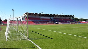
Stadion SRC Mladost is a multi-purpose stadium in Čakovec, Croatia. The approximate capacity of the stadium is 8,000 places, including around 5,000 seats. The stadium is owned by the city of Čakovec and primarily used for football matches and various athletics events.
Belica, Međimurje County
Municipality in Međimurje, Croatia
Distance: Approx. 7437 meters
Latitude and longitude: 46.4,16.51666667
Belica (Hungarian: Belica, earlier Belicza) is a village and municipality in Međimurje County, the northernmost county of Croatia. The municipality seat is in the village of Belica, located around 5 kilometres east of Čakovec, the largest city of Međimurje County. According to the 2011 census, the Belica municipality had a total population of 3,176 living in the two villages that the municipality consists of: Belica (population 2,278) Gardinovec (population 898) A total of 3,134 people living in the municipality (or 98.68 percent) identified themselves as Croats during the 2011 census.

Strahoninec
Municipality in Međimurje, Croatia
Distance: Approx. 1603 meters
Latitude and longitude: 46.36666667,16.41666667
Strahoninec (Hungarian: Drávanagyfalu) is a municipality in Međimurje County, Croatia. Strahoninec is the only village in the municipality. Also part of the municipality is the hamlet of Poleve, located just over a kilometre south of the village.

Sveti Juraj na Bregu
Municipality in Međimurje, Croatia
Distance: Approx. 6703 meters
Latitude and longitude: 46.4333,16.3833
Sveti Juraj na Bregu (Hungarian: Víziszentgyörgy, German: St. Georg im Gebirge) is a municipality in Međimurje County, Croatia. The municipality consists of 9 villages: Brezje, Dragoslavec, Frkanovec, Lopatinec, Mali Mihaljevec, Okrugli Vrh, Pleškovec, Vučetinec and Zasadbreg.

Zrinski Park
Park in Čakovec, Croatia
Distance: Approx. 1097 meters
Latitude and longitude: 46.38861111,16.43138889
Zrinski Park (Croatian: Perivoj Zrinskih) is situated in downtown Čakovec, northern Croatia, close to the central square. The area had been a part of the city fortification since the 13th century. The castle, located in the centre of the Park, was owned by the Zrinski family between the 16th and the 18th century.
Čakovec Castle
Historic site in Čakovec, Croatia
Distance: Approx. 1145 meters
Latitude and longitude: 46.38888889,16.43194444
Čakovec Castle or Zrinski Castle (Croatian: Čakovečka utvrda or Stari grad Zrinskih or Hungarian: Csáktornyai vár or Zrínyi-kastély) is a medieval fortification in the middle of the town of Čakovec, the administrative seat of Međimurje County, northern Croatia. The castle is located in the Zrinski Park, not far from the city's central square, and is the biggest fortification in Međimurje County. It was constructed of hewn stone and red brick, and, during its more than 7-century-long history, subjected to several reconstructions.
Feštetić Castle
Distance: Approx. 4471 meters
Latitude and longitude: 46.39583333,16.47777778
Feštetić Castle (Croatian: Dvorac Feštetić or Kaštel Feštetić) is a castle in Pribislavec, a village next to the town of Čakovec, northern Croatia. It was built most probably in the 16th century and owned by the members of the Zrinski family (count Adam Zrinski) almost till the end of the 17th century. The name of the castle comes from the Croatian-Hungarian Feštetić family, who possessed it from 1791 until 1923.

Lake Varaždin
Reservoir in Varaždin County, Croatia
Distance: Approx. 7302 meters
Latitude and longitude: 46.31666667,16.4
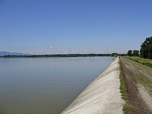
Lake Varaždin (Croatian: Varaždinsko jezero) is a reservoir on the Drava in northern Croatia. It is administratively divided between Međimurje County and Varaždin County, bordered by the municipalities of Varaždin, Trnovec Bartolovečki and Čakovec. The Drava flows into the reservoir near the city of Varaždin, while the dam is located near the village of Šemovec.

1918 occupation of Međimurje
Conflict between the Kingdom of Serbs, Croats and Slovenes and Hungary
Distance: Approx. 788 meters
Latitude and longitude: 46.38333333,16.43333333
In the immediate aftermath of World War I, the region of Međimurje was occupied by forces loyal to the National Council of the State of Slovenes, Croats and Serbs, one of the predecessor states to the Kingdom of Yugoslavia, in November and December 1918. Predominantly inhabited by Croats, this territory was a part of the Kingdom of Hungary until it was captured by Yugoslav forces. The region was annexed by Yugoslavia, which was awarded it at the Paris Peace Conference (1919–1920).
Weather in this IP's area
clear sky
7 Celsius
7 Celsius
6 Celsius
7 Celsius
1027 hPa
52 %
1027 hPa
1007 hPa
10000 meters
1.03 m/s
1.06 m/s
68 degree
6 %
06:49:03
16:27:34


