185.108.92.167 - IP Lookup: Free IP Address Lookup, Postal Code Lookup, IP Location Lookup, IP ASN, Public IP
Country:
 Great Britain
Region:
City:
Location:
Time Zone:
Postal Code:
ISP:
ASN:
language:
User-Agent:
Proxy IP:
Blacklist:
IP information under different IP Channel
ip-api
Country
Region
City
ASN
Time Zone
ISP
Blacklist
Proxy
Latitude
Longitude
Postal
Route
db-ip
Country
Region
City
ASN
Time Zone
ISP
Blacklist
Proxy
Latitude
Longitude
Postal
Route
IPinfo
Country
Region
City
ASN
Time Zone
ISP
Blacklist
Proxy
Latitude
Longitude
Postal
Route
IP2Location
185.108.92.167Country
gbRegion
england
City
holloway
Time Zone
Europe/London
ISP
Language
User-Agent
Latitude
Longitude
Postal
ipdata
Country
Region
City
ASN
Time Zone
ISP
Blacklist
Proxy
Latitude
Longitude
Postal
Route
Popular places and events near this IP address

HM Prison Holloway
1852–2016 prison in London, England
Distance: Approx. 197 meters
Latitude and longitude: 51.55416667,-0.125
HM Prison Holloway was a closed category prison for adult women and young offenders in Holloway, London, England, operated by His Majesty's Prison Service. It was the largest women's prison in western Europe, until its closure in 2016.

Caledonian Road tube station
London Underground station
Distance: Approx. 633 meters
Latitude and longitude: 51.54833333,-0.11861111
Caledonian Road is a station on the Piccadilly line of the London Underground, between King's Cross St. Pancras and Holloway Road, and in Travelcard Zone 2. It was opened on 15 December 1906 by the Great Northern, Piccadilly and Brompton Railway.
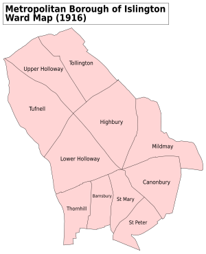
Lower Holloway
Human settlement in England
Distance: Approx. 543 meters
Latitude and longitude: 51.550151,-0.118039
Lower Holloway is a district in the London Borough of Islington, London. The name has fallen out of common use and the area is now generally regarded as being a part of Holloway. The area of Lower Holloway stretches from the South of Holloway Road to the Central side of Holloway, Nags Head.

Market Estate
Housing estate in London
Distance: Approx. 495 meters
Latitude and longitude: 51.548,-0.124
Market Estate is a public housing estate consisting of 271 flats and maisonettes situated to the north of Caledonian Park in the London Borough of Islington. It is named after the Metropolitan Cattle Market which operated on the site until the 1960s. After slaughter the carcasses of cattle and sheep were sent by underground trains to Smithfield Market to be traded.

Copenhagen House Grounds
Distance: Approx. 665 meters
Latitude and longitude: 51.5465,-0.1235
Copenhagen House Grounds in Islington, London also known as the 'Old Cope' was opened 24 September 1850 and was the leading venue for professional athletics until it closed in December 1853 after severe storm damage. Initially consisting of a 200-yard straight, an oval gravel track was added, opening on 17 March 1851, thought to be one third of a mile in length, enclosing a cricket pitch. One of the first world records for the mile was set there; Charles Westhall in 4:28 on 26 July 1852.

City and Islington College
Further education college in London, England
Distance: Approx. 668 meters
Latitude and longitude: 51.5572,-0.1192
City and Islington College (CANDI) is a further education college in the London Borough of Islington, England, established in 1993. The college has four major centres throughout the borough, including a dedicated sixth form centre. It is part of Capital City College Group, alongside Westminster Kingsway College and The College of Haringey, Enfield and North East London, which altogether have 25,000 students in 2020.

Pleasance Islington
Theatre in north London, England
Distance: Approx. 471 meters
Latitude and longitude: 51.5487,-0.1217
Pleasance Islington (also known as Pleasance London or the Pleasance Theatre) is a fringe theatre in Islington, London, opened in 1995. It is run by the Pleasance Theatre Trust and is the sister venue of the original Pleasance Edinburgh. It has hosted popular comedians including Michael McIntyre, Micky Flanagan, Mark Watson, Adam Hills and Mark Thomas.
Beacon High
Community school in Holloway, London, England
Distance: Approx. 301 meters
Latitude and longitude: 51.5531,-0.1292
Beacon High is a coeducational secondary school for 11-16-year-olds in the Tufnell Park area, located in the London Borough of Islington, England. Beacon High is a member of the Islington Futures Federation of Community Schools and the Islington Sixth Form Partnership.

Torriano Primary School
Community primary school in Kentish Town, London, England
Distance: Approx. 599 meters
Latitude and longitude: 51.549736,-0.132521
Torriano Primary School is a community primary school in Kentish Town, London. The school was founded in 2015 following the merger of the previous Torriano Junior School with Torriano Infants School. It is rated Outstanding by Ofsted.

Camden Town (ward)
Ward in the London Borough of Camden
Distance: Approx. 636 meters
Latitude and longitude: 51.55,-0.13333333
Camden Town is a ward in the London Borough of Camden, in the United Kingdom that represents the area of the same name. The ward was created before the 2022 Camden London Borough Council election, and elects two councillors to Camden London Borough Council. Most of its area was previously in the Camden Town with Primrose Hill ward, which was abolished at the same time.

Caledonian Park Clock Tower
Clock tower in Islington, London
Distance: Approx. 598 meters
Latitude and longitude: 51.5471,-0.1236
The Caledonian Park Clock Tower, Islington, London, is the major remaining element of the Metropolitan Cattle Market, opened in 1855 by the City of London Corporation as a replacement for the market at Smithfield. The complex was designed by the Corporation's Surveyor, James Bunstone Bunning, and was laid out on a site of 30 acres (0.12 km2) that originally formed the estate of a mansion, Copenhagen House. The market consisted of the central clock tower, enclosures for animals, slaughterhouses, sales arenas, administrative offices and four public houses, one standing at each corner of the complex.

Holloway car dock
Distance: Approx. 623 meters
Latitude and longitude: 51.54989,-0.11695
Holloway car dock was a railway station in London, England.
Weather in this IP's area
overcast clouds
2 Celsius
2 Celsius
1 Celsius
3 Celsius
1024 hPa
95 %
1024 hPa
1020 hPa
10000 meters
1.03 m/s
100 %