Country:
Region:
City:
Latitude and Longitude:
Time Zone:
Postal Code:
IP information under different IP Channel
ip-api
Country
Region
City
ASN
Time Zone
ISP
Blacklist
Proxy
Latitude
Longitude
Postal
Route
IPinfo
Country
Region
City
ASN
Time Zone
ISP
Blacklist
Proxy
Latitude
Longitude
Postal
Route
MaxMind
Country
Region
City
ASN
Time Zone
ISP
Blacklist
Proxy
Latitude
Longitude
Postal
Route
Luminati
Country
Region
gp
City
centurion
ASN
Time Zone
Africa/Johannesburg
ISP
Apptc.me s.r.o.
Latitude
Longitude
Postal
db-ip
Country
Region
City
ASN
Time Zone
ISP
Blacklist
Proxy
Latitude
Longitude
Postal
Route
ipdata
Country
Region
City
ASN
Time Zone
ISP
Blacklist
Proxy
Latitude
Longitude
Postal
Route
Popular places and events near this IP address

Wonderboom Nature Reserve
Nature Reserve in Pretoria, South Africa
Distance: Approx. 3505 meters
Latitude and longitude: -25.687,28.1918
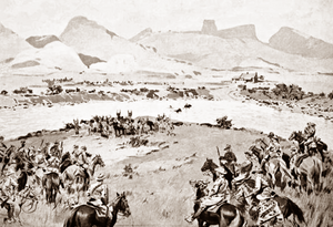
The Wonderboom Nature Reserve (Afrikaans: Wonderboom-natuurreservaat) is a 1 km², 200-hectare reserve that incorporates a section of the Magaliesberg range in the northern portion of the Pretoria metropole, South Africa. Its main attractions are the Wonderboom (Afrikaans for "Marvel tree") near the reserve entrance in Lavender street and the derelict Fort Wonderboompoort on the crest of the Magaliesberg, that was constructed towards the end of the nineteenth century, during the Second Boer War. The latter is reached by following the steep, paved walkway that leads from the picnic area to the summit.

Maritz rebellion
1914 pro-German insurrection in South Africa
Distance: Approx. 2025 meters
Latitude and longitude: -25.7167,28.2333
The Maritz rebellion, also known as the Boer revolt, Third Boer War, or the Five Shilling rebellion, was an armed pro-German insurrection in South Africa in 1914, at the start of World War I. It was led by Boers who supported the re-establishment of the South African Republic in the Transvaal. Many members of the South African government were themselves Boers who had fought with the Maritz rebels against the British in the Second Boer War, which had ended twelve years earlier. The rebellion failed, with 124 rebels killed and 229 wounded out of 12,000.
Hoërskool Staatspresident C R Swart
Public school in Pretoria, Gauteng, South Africa
Distance: Approx. 3512 meters
Latitude and longitude: -25.708743,28.257047
Hoërskool Staatspresident C R Swart is an English high school situated in Waverley, Pretoria, one of the Eastern suburbs of Pretoria, South Africa.
Hoërskool Wonderboom
Public school in Pretoria, Gauteng, South Africa
Distance: Approx. 2521 meters
Latitude and longitude: -25.69462,28.19899
Die Hoërskool Wonderboom is a public Afrikaans medium co-educational high school situated in the suburb of Wonderboom South in Pretoria in the Gauteng province of South Africa, on the southern slopes of the Magaliesberg, The learners are known as the Wonnies
Hoërskool Overkruin
Public school in Pretoria, Gauteng, South Africa
Distance: Approx. 2250 meters
Latitude and longitude: -25.684736,28.209777
Hoërskool Overkruin is a public Afrikaans and English language-medium high school in Wonderboom, Pretoria, Gauteng, South Africa.
Hoërskool Oos-Moot
Public school in Pretoria, Gauteng, South Africa
Distance: Approx. 1807 meters
Latitude and longitude: -25.7071,28.2398
Hoërskool Oos-Moot is a public Afrikaans medium co-educational high school situated in the northern suburbs of Pretoria in the Gauteng province of South Africa.

Wonderboom (tree)
Dense grove of parent and daughter trees of the species Ficus salicifolia
Distance: Approx. 3491 meters
Latitude and longitude: -25.68727778,28.19180556
The Wonderboom (Afrikaans: 'wonder tree') is a dense grove of parent and daughter trees of the species Ficus salicifolia, that descended from a central bole of about a thousand years old. It is situated in the Wonderboom Nature Reserve, Pretoria, and two circular walkways currently protect it from pedestrian traffic around its trunk and roots. As it has grown, its outlying branches have rooted themselves around the parent tree.
Mayville, Pretoria
Place in Gauteng, South Africa
Distance: Approx. 3401 meters
Latitude and longitude: -25.70472222,28.18944444
Mayville is a central-western suburb of Pretoria, South Africa (north of the CBD). It is also part of the so-called "Moot" community.

Wonderboom South, Pretoria
Place in Gauteng, South Africa
Distance: Approx. 2320 meters
Latitude and longitude: -25.7,28.2
Wonderboom South is a northern residential suburb of Pretoria, South Africa. It lies to the south of Wonderboom and the Wonderboom tree itself, on the southern slopes of the northern range of the Magaliesberg mountains.

Sinoville, Pretoria
Place in Gauteng, South Africa
Distance: Approx. 2469 meters
Latitude and longitude: -25.67888889,28.225
Sinoville is a northern suburb of Pretoria, South Africa. It lies to the east of the Wonderboom, on the northern slopes of the Magaliesberg mountains, and south of Wonderboom Airport.

Villieria
Place in Gauteng, South Africa
Distance: Approx. 2947 meters
Latitude and longitude: -25.718203,28.245436
Villieria is a suburb in the northern region of Pretoria. It is bordered by Rietfontein in the north-west and Queenswood in the south-east. The postal code is 0186.
Wonderboom, Pretoria
Place in Gauteng, South Africa
Distance: Approx. 3039 meters
Latitude and longitude: -25.68333333,28.2
Wonderboom is a northern residential suburb of Pretoria, South Africa. The suburb includes the Wonderboom Nature Reserve site of the famous Wonderboom (Afrikaans for "Marvel tree" or "Wonder tree"), on the northern slopes of the Magaliesberg mountains, just east of the Apies River. Neighbouring suburbs are Annlin to the west, Sinoville to the north and east and Wonderboom South to the south.
Weather in this IP's area
overcast clouds
21 Celsius
21 Celsius
20 Celsius
22 Celsius
1014 hPa
55 %
1014 hPa
875 hPa
10000 meters
3.6 m/s
100 degree
98 %
05:32:08
18:13:11