185.108.117.215 - IP Lookup: Free IP Address Lookup, Postal Code Lookup, IP Location Lookup, IP ASN, Public IP
Country:
Region:
City:
Location:
Time Zone:
Postal Code:
IP information under different IP Channel
ip-api
Country
Region
City
ASN
Time Zone
ISP
Blacklist
Proxy
Latitude
Longitude
Postal
Route
Luminati
Country
ASN
Time Zone
Europe/Amsterdam
ISP
Trans-iX B.V.
Latitude
Longitude
Postal
IPinfo
Country
Region
City
ASN
Time Zone
ISP
Blacklist
Proxy
Latitude
Longitude
Postal
Route
IP2Location
185.108.117.215Country
Region
noord-holland
City
purmerend
Time Zone
Europe/Amsterdam
ISP
Language
User-Agent
Latitude
Longitude
Postal
db-ip
Country
Region
City
ASN
Time Zone
ISP
Blacklist
Proxy
Latitude
Longitude
Postal
Route
ipdata
Country
Region
City
ASN
Time Zone
ISP
Blacklist
Proxy
Latitude
Longitude
Postal
Route
Popular places and events near this IP address
Purmerend
Municipality in North Holland, Netherlands
Distance: Approx. 861 meters
Latitude and longitude: 52.5,4.95
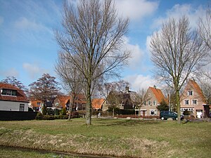
Purmerend (Dutch pronunciation: [ˌpʏrməˈrɛnt] ) is a city and municipality in the west of the Netherlands, in the province of North Holland. The city is surrounded by polders, such as the Purmer, Beemster and the Wormer. Purmerend's population grew relatively slowly until the 1960s, when it increased from around 10,000 to over 80,000 by 2020.

Ilpendam
Village in North Holland, Netherlands
Distance: Approx. 4318 meters
Latitude and longitude: 52.46666667,4.95
Ilpendam is a village in the province of North Holland, Netherlands. It is a part of the municipality of Waterland, and lies about 4 km south of Purmerend. It covers an area of 2.46 km2 (0.95 sq mi) and had 1,780 inhabitants in 2008.
Zuidoostbeemster
Place in North Holland, Netherlands
Distance: Approx. 1456 meters
Latitude and longitude: 52.51666667,4.95
Zuidoostbeemster is a town in the west of the Netherlands in the former municipality of Beemster, North Holland. It is located about 1 km northwest of Purmerend. Since 2022 it has been part of the municipality of Purmerend.

Kwadijk
Village in North Holland, Netherlands
Distance: Approx. 2894 meters
Latitude and longitude: 52.5275,4.98111111
Kwadijk is a village and former municipality in the northwest Netherlands. It is a part of the municipality of Edam-Volendam in the Dutch province of North Holland. Kwadijk is located about 20 kilometres (12 mi) north of Amsterdam and about 3 kilometres (1.9 mi) north of Purmerend.

Neck, Netherlands
Village in North Holland, Netherlands
Distance: Approx. 3220 meters
Latitude and longitude: 52.50833333,4.9125
Neck is a village in the northwest Netherlands. It is located in the municipality of Wormerland, North Holland, about 3 km west of Purmerend. The village was first mentioned in 1328 as "sic: van Hicke", and means "neck" which refers to the narrowest point of the waterway separating the Beemster from the Wormer.

Purmerland
Village in North Holland, Netherlands
Distance: Approx. 3002 meters
Latitude and longitude: 52.48333333,4.93333333
Purmerland () is a village of 395 (January 2007) in the municipality of Landsmeer, North Holland, the Netherlands. It is located just north of Den Ilp and just south of the housing estate of Weidevenne, part of the city of Purmerend. It is directly connected to both of these as Purmerland, like Den Ilp and Landsmeer is mainly characterised by ribbon building along the main road.
Weidevenne
Distance: Approx. 1661 meters
Latitude and longitude: 52.49716667,4.93883333
Weidevenne () is a district of Purmerend in the Netherlands, west of the Noordhollandsch Kanaal (North Holland Canal) across from the De Gors district. Its 14,451 inhabitants (as of 1-1-2007) mainly live in terraced houses. The population of Purmerend is expected to grow to 90,000, mainly due to the continuing expansion of Weidevenne.

Purmerbuurt
Place in North Holland, Netherlands
Distance: Approx. 1964 meters
Latitude and longitude: 52.49638889,4.985
Purmerbuurt is a village in the Dutch province of North Holland in the polder the Purmer. It is part of the municipality of Purmerend, and is directly connected to the city of Purmerend by an Intersection. The village has its own church, de Purmerkerk.
Purmerend Weidevenne railway station
Railway station in the Netherlands
Distance: Approx. 1816 meters
Latitude and longitude: 52.49666667,4.93666667
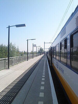
Purmerend Weidevenne is a suburban railway station, in the Weidevenne estate in Purmerend, Netherlands. The station opened on 9 December 2007 and is on the Zaandam–Enkhuizen railway. The official opening of the station was on 8 December 2007.

Purmerend railway station
Railway station in the Netherlands
Distance: Approx. 418 meters
Latitude and longitude: 52.50333333,4.95416667
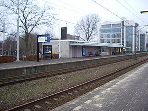
Purmerend is the railway station in the centre of Purmerend, Netherlands. The station opened on 20 May 1884 as part of the Zaandam–Hoorn railway, extended to Enkhuizen in 1885. The original station building was demolished in 1957.
Purmerend Overwhere railway station
Railway station in the Netherlands
Distance: Approx. 854 meters
Latitude and longitude: 52.51138889,4.96666667
Purmerend Overwhere is a suburb railway station in Purmerend, Netherlands. The station opened in 1971, and lies 2 km north of Purmerend. The station is on the Zaandam–Enkhuizen railway.

Purmer
Village in North Holland, Netherlands
Distance: Approx. 3777 meters
Latitude and longitude: 52.49111111,5.01055556
Purmer is a polder and reclaimed lake in the Netherlands province of North Holland, located between the towns of Purmerend and Edam-Volendam. It is also a village located in the municipalities of Waterland and Edam-Volendam.
Weather in this IP's area
overcast clouds
1 Celsius
-3 Celsius
-1 Celsius
2 Celsius
1037 hPa
68 %
1037 hPa
1037 hPa
10000 meters
3.58 m/s
4.47 m/s
194 degree
99 %


