Country:
Region:
City:
Latitude and Longitude:
Time Zone:
Postal Code:
IP information under different IP Channel
ip-api
Country
Region
City
ASN
Time Zone
ISP
Blacklist
Proxy
Latitude
Longitude
Postal
Route
Luminati
Country
ASN
Time Zone
Europe/Berlin
ISP
Hetzner Online GmbH
Latitude
Longitude
Postal
IPinfo
Country
Region
City
ASN
Time Zone
ISP
Blacklist
Proxy
Latitude
Longitude
Postal
Route
db-ip
Country
Region
City
ASN
Time Zone
ISP
Blacklist
Proxy
Latitude
Longitude
Postal
Route
ipdata
Country
Region
City
ASN
Time Zone
ISP
Blacklist
Proxy
Latitude
Longitude
Postal
Route
Popular places and events near this IP address
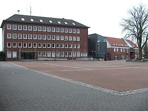
Oelde
Town in North Rhine-Westphalia, Germany
Distance: Approx. 529 meters
Latitude and longitude: 51.83333333,8.15
Oelde (German pronunciation: [ˈœldə]) is a town in the district of Warendorf, in North Rhine-Westphalia, Germany. It is located near Beckum.
Herzebrock-Clarholz
Municipality in North Rhine-Westphalia, Germany
Distance: Approx. 8471 meters
Latitude and longitude: 51.88333333,8.23333333
Herzebrock-Clarholz is a town in the district of Gütersloh in the state of North Rhine-Westphalia, Germany. It is located approximately 10 km west of Gütersloh.

Ennigerloh
Town in North Rhine-Westphalia, Germany
Distance: Approx. 8415 meters
Latitude and longitude: 51.83666667,8.02555556
Ennigerloh (German pronunciation: [ˈɛnɪɡɐˌloː] ) is a town in the district of Warendorf, in North Rhine-Westphalia, Germany. It is situated approximately 25 km northeast of Hamm and 30 km southeast of Münster. The town, located in an agricultural area and with a well-preserved medieval quarter, became more industrial in the 20th century as several cement factories were installed.
Stromberg, Oelde
Human settlement
Distance: Approx. 4600 meters
Latitude and longitude: 51.8042,8.20083
Stromberg is a quarter of Oelde with 4558 inhabitants. It lies to the southeast of Oelde on Bundesstraße 61, in the district of Warendorf and the region of Münster.

Beckum Hills
Hill range in Germany
Distance: Approx. 8416 meters
Latitude and longitude: 51.75333,8.15056
The Beckum Hills (German: Beckumer Berge), named after the town of Beckum, are a range of low hills, up to 174.4 m above sea level (NN), in the region of Münsterland in the German state of North Rhine-Westphalia (Germany). Along with the Baumberge and its foothills and the Haltern Hills they are among the few prominent elevations in the otherwise gently rolling Münsterland (which lies at 55 m above NN in the centre), the River Werse passes the ridge at 100 m to the east and the Lippe passing it at a height of 60 m near Hamm-Uentrop at some distance away from their highest point. In terms of natural regions the Beckum Hills belong to the Kernmünsterland, being located in the southeast of that region.
Oelde station
Railway station in Germany
Distance: Approx. 264 meters
Latitude and longitude: 51.828899,8.143398
Oelde station is a passenger station in the Westphalian town of Oelde in the German state of North Rhine-Westphalia. It lies on the Hamm–Minden railway, one of the most heavily trafficked lines in Germany. The station is served by an hourly Regional-Express service, the Rhein-Weser-Express (RE 6) on the Cologne–Düsseldorf–Dortmund–Bielefeld–Minden route and an hourly Regionalbahn service, the Ems-Börde-Bahn (RB 69) on the Münster–Hamm–Bielefeld route, meaning that trains run approximately every 30 minutes in both directions.

Neubeckum station
Railway station in Germany
Distance: Approx. 9132 meters
Latitude and longitude: 51.801663,8.022067
Neubeckum station is a passenger station in the district of Neubeckum, part the Westphalian town of Beckum in the German state of North Rhine-Westphalia. The station was established in 1847. The village of Neubeckum (literally "new Beckum") was established in 1847 at the railway station, six km from Beckum.
Maibach (Axtbach)
River in Germany
Distance: Approx. 7624 meters
Latitude and longitude: 51.89277778,8.18722222
Maibach is a river of North Rhine-Westphalia, Germany. It flows into the Axtbach near Clarholz.

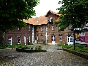
Alte Brennerei Schwake
Distance: Approx. 8567 meters
Latitude and longitude: 51.83666667,8.02333333
Alte Brennerei Schwake is a theatre in Ennigerloh, in the Münster region of North Rhine-Westphalia, Germany.

Craemer Group
Distance: Approx. 8493 meters
Latitude and longitude: 51.878276,8.241393
The Craemer Group is a company based in the German town of Herzebrock-Clarholz (district of Gütersloh, North Rhine-Westphalia). Today, the company, founded in 1912 by Paul Craemer as Press-, Stanz- und Hammerwerke GmbH, employs a staff of around 1100 in metal forming, tool making and plastics processing and achieved a total operating performance of around 355 million Euros in 2023. The group consists of the umbrella company Craemer Holding GmbH, its subsidiary Craemer GmbH and the subsidiaries thereof.
Weather in this IP's area
few clouds
8 Celsius
5 Celsius
6 Celsius
8 Celsius
1027 hPa
86 %
1027 hPa
1015 hPa
10000 meters
3.52 m/s
6.12 m/s
93 degree
18 %
07:27:38
16:54:17


