Country:
Region:
City:
Latitude and Longitude:
Time Zone:
Postal Code:
IP information under different IP Channel
ip-api
Country
Region
City
ASN
Time Zone
ISP
Blacklist
Proxy
Latitude
Longitude
Postal
Route
Luminati
Country
Region
es
City
roeser
ASN
Time Zone
Europe/Luxembourg
ISP
Mixvoip S.A.
Latitude
Longitude
Postal
IPinfo
Country
Region
City
ASN
Time Zone
ISP
Blacklist
Proxy
Latitude
Longitude
Postal
Route
db-ip
Country
Region
City
ASN
Time Zone
ISP
Blacklist
Proxy
Latitude
Longitude
Postal
Route
ipdata
Country
Region
City
ASN
Time Zone
ISP
Blacklist
Proxy
Latitude
Longitude
Postal
Route
Popular places and events near this IP address
Steinsel
Commune in Luxembourg, Luxembourg
Distance: Approx. 1993 meters
Latitude and longitude: 49.6764,6.1236
Steinsel (Luxembourgish: Steesel [ˈʃteːzəl] ) is a commune and town in central Luxembourg. It is located north of Luxembourg City. As of 2023, the town of Steinsel, which lies in the west of the commune, has a population of 2,549.
Walferdange
Commune in Luxembourg, Luxembourg
Distance: Approx. 1230 meters
Latitude and longitude: 49.6628,6.1333
Walferdange (Luxembourgish: Walfer [ˈvɑlfɐ] ; German: Walferdingen) is a commune and small town in central Luxembourg.

Heisdorf
Town in the commune of Steinsel, Luxembourg
Distance: Approx. 851 meters
Latitude and longitude: 49.673,6.139
Heisdorf (Luxembourgish: Heeschdrëf) is a town in the commune of Steinsel, in central Luxembourg. As of 2023, the town has a population of 1,889. It is noted for Heisdorf Castle and is served by a railway station.
Mullendorf
Town in Steinsel, Luxembourg
Distance: Approx. 1996 meters
Latitude and longitude: 49.68333333,6.13333333
Mullendorf (Luxembourgish: Mëllerëf, German: Müllendorf) is a town in the commune of Steinsel, in central Luxembourg. As of 2023, the town has a population of 1,239.

Bofferdange
Village
Distance: Approx. 1996 meters
Latitude and longitude: 49.68333333,6.13333333
Bofferdange (Luxembourgish: Boufer, German: Bofferdingen) is a small town in the commune of Lorentzweiler, in central Luxembourg. As of 2024, the town has a population of 1,152.

Helmdange
Town in Luxembourg
Distance: Approx. 1690 meters
Latitude and longitude: 49.68333333,6.15
Helmdange (Luxembourgish: Hielem, German: Helmdingen) is a small town in the commune of Lorentzweiler, in central Luxembourg. As of 2024, the town has a population of 770.

Pierre Werner Cricket Ground
Sports ground in central Luxembourg
Distance: Approx. 1543 meters
Latitude and longitude: 49.6644,6.1276
The Pierre Werner Cricket Ground, also known as the Walferdange Cricket Ground, is a cricket ground in Walferdange, in central Luxembourg. It is the premier cricket venue in Luxembourg, being the home ground of the country's top club, the Optimists Cricket Club, which plays in the Belgian Cricket League, and of the Luxembourg national team. The ground was opened in 1991.

Walferdange railway station
Railway station in Luxembourg
Distance: Approx. 1100 meters
Latitude and longitude: 49.66204,6.13626
Walferdange railway station (Luxembourgish: Gare Walfer, French: Gare de Walferdange, German: Bahnhof Walferdingen) is a railway station serving Walferdange, in central Luxembourg. It is operated by Chemins de Fer Luxembourgeois, the state-owned railway company. The station is situated on Line 10, which connects Luxembourg City to the centre and north of the country.

Heisdorf railway station
Railway station in Luxembourg
Distance: Approx. 1132 meters
Latitude and longitude: 49.67638889,6.13888889
Heisdorf railway station (Luxembourgish: Gare Heeschdref, French: Gare de Heisdorf, German: Bahnhof Heisdorf) is a railway station serving Heisdorf, in the commune of Steinsel, in central Luxembourg. It is operated by Chemins de Fer Luxembourgeois, the state-owned railway company. The station is situated on Line 10, which connects Luxembourg City to the centre and north of the country.
Raschpëtzer Qanat
Distance: Approx. 403 meters
Latitude and longitude: 49.66896111,6.14273056
The Raschpëtzer Qanat is located NE of Helmsange in the commune of Walferdange, 10 km north of the City of Luxembourg. A qanat is an underground water management system consisting of vertical shafts connecting to a sloping tunnel designed to provide a supply of fresh water. The Raschpëtzer is a particularly well preserved example of a qanat and is probably the most extensive system of its kind north of the Alps.
Walferdange Castle
Distance: Approx. 1349 meters
Latitude and longitude: 49.66043,6.13383
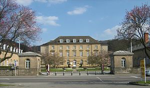
Walferdange Castle (Luxembourgish: Walfer Schlass; French: Château de Walferdange), located in the small town of Walferdange in central Luxembourg, dates from 1824, when William I of the Netherlands, who was also Grand Duke of Luxembourg, built it as a stud farm. It was a part of the University of Luxembourg and since 2015 has been used by the Ministry of National Education, Childhood and Youth (Luxembourg).

Heisdorf Castle
Distance: Approx. 798 meters
Latitude and longitude: 49.67527778,6.15
Heisdorf Castle (Luxembourgish: Schlass Heeschdref; French: Château de Heisdorf; German: Schloss Heisdorf) located in the village of Heisdorf in central Luxembourg was built by Baron Lippmann in the late 19th century. Surrounded by a large park, it was designed by the Belgian architect Charles Thirion. In 1916, the Sisters of the Christian Doctrine acquired the property as a convalescent home for their community.
Weather in this IP's area
fog
5 Celsius
3 Celsius
5 Celsius
7 Celsius
1025 hPa
100 %
1025 hPa
977 hPa
100 meters
2.57 m/s
160 degree
100 %
07:31:15
17:06:45


