185.103.210.231 - IP Lookup: Free IP Address Lookup, Postal Code Lookup, IP Location Lookup, IP ASN, Public IP
Country:
Region:
City:
Location:
Time Zone:
Postal Code:
IP information under different IP Channel
ip-api
Country
Region
City
ASN
Time Zone
ISP
Blacklist
Proxy
Latitude
Longitude
Postal
Route
Luminati
Country
ASN
Time Zone
Europe/Stockholm
ISP
Telia Company AB
Latitude
Longitude
Postal
IPinfo
Country
Region
City
ASN
Time Zone
ISP
Blacklist
Proxy
Latitude
Longitude
Postal
Route
IP2Location
185.103.210.231Country
Region
orebro lan
City
karlskoga
Time Zone
Europe/Stockholm
ISP
Language
User-Agent
Latitude
Longitude
Postal
db-ip
Country
Region
City
ASN
Time Zone
ISP
Blacklist
Proxy
Latitude
Longitude
Postal
Route
ipdata
Country
Region
City
ASN
Time Zone
ISP
Blacklist
Proxy
Latitude
Longitude
Postal
Route
Popular places and events near this IP address
Karlskoga Municipality
Municipality in Örebro County, Sweden
Distance: Approx. 806 meters
Latitude and longitude: 59.33333333,14.51666667
Karlskoga Municipality (Karlskoga kommun) is a municipality in Örebro County in central Sweden. Its seat is located in the city of Karlskoga. Other localities include Valåsen och Labbsand, Kortfors, Linnebäck and Villingsberg.

Karlskoga
Locality in Värmland, Sweden
Distance: Approx. 806 meters
Latitude and longitude: 59.33333333,14.51666667
Karlskoga (Swedish pronunciation: [kaɭˈskûːɡa] ) is a locality and the seat of Karlskoga Municipality, Sweden. Located within Örebro County, 45 km (28 mi) west of Örebro, and 10 km (6 mi) north of Degerfors. With a 2020 population of 27,386 distributed over 10.55 square miles (27.33 km2), Karlskoga is the second-largest city in both Örebro County and the historical province of Värmland.

Nobelhallen
Indoor ice hockey rink in Karlskoga, Sweden
Distance: Approx. 1085 meters
Latitude and longitude: 59.33666667,14.52027778
Nobelhallen is an indoor arena in Karlskoga, Sweden. Its current capacity is 5,600 and it was built in 1971. It is the home arena of the ice hockey team BIK Karlskoga.
Nobelstadion
Stadium in Karlskoga, Sweden
Distance: Approx. 3308 meters
Latitude and longitude: 59.3,14.5
Nobelstadion is a stadium in Karlskoga, Sweden and is the home ground of the football team KB Karlskoga FF. It has also been used for women's national team matches, including the UEFA Women's Euro 1997.

Björkborn Manor
Museum about Alfred Nobel in Karlskoga, Sweden
Distance: Approx. 1589 meters
Latitude and longitude: 59.34028,14.53464
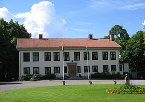
Björkborn Manor (Swedish: Björkborns herrgård, Swedish pronunciation: [bjœːrkboːɳ]) is a manor house and the very last residence of Alfred Nobel in Sweden. The manor is located in Karlskoga Municipality, Örebro County, Sweden. The current-standing white-colored manor house was built in the 1810s, but the history of the property is older.

Nobel Laboratory
Building in Karlskoga, Sweden
Distance: Approx. 1869 meters
Latitude and longitude: 59.343,14.5345
The Nobel Laboratory (Swedish: Nobellaboratoriet) is a laboratory museum in Karlskoga, Sweden, completed in 1895. The laboratory building sits near Björkborn Manor and the pedestrian Björkborn Bridge. Since the museum opened, the building has housed an exhibition on Alfred Nobel, his inventions, and businesses.

Bofors Hotel
Hotel in Karlskoga, Sweden
Distance: Approx. 1069 meters
Latitude and longitude: 59.328558,14.542508
The Bofors Hotel (Swedish: Bofors hotell) is a four-storey hotel located in Karlskoga, Karlskoga Municipality, Sweden.

Karlskoga Church
Church in Karlskoga, Sweden
Distance: Approx. 183 meters
Latitude and longitude: 59.32578,14.52197
The Karlskoga Church (Swedish: Karlskoga kyrka [kaɭˈskûːɡa ˈɕʏ̂rːka]) is a wooden church building in Karlskoga, Sweden. Belonging to the Church of Sweden, the church was inaugurated in the 1600s. It stands as both the oldest building and church in Karlskoga, predating Villa Ekeliden in age.
Bofors railway station
Railway station in Sweden
Distance: Approx. 1523 meters
Latitude and longitude: 59.3335,14.5476
Bofors railway station (Swedish: Bofors järnvägsstation, Swedish: [buːˈfɔʂː]) is a railway station in Karlskoga, Sweden, located on the Nora-Carlskoga Line. In 1966, the station stopped serving passenger traffic and began to serve freight transport full-on. The station opened on January 1, 1874.

Villa Ekeliden
Multi-purpose in Karlskoga, Sweden
Distance: Approx. 471 meters
Latitude and longitude: 59.3253,14.5164
Villa Ekeliden, located in Karlskoga Municipality, Sweden, holds historical significance as a prominent structure within the city center at Centralplan. Situated alongside an esker to the east, it stands as the second oldest building in Karlskoga, with only the Karlskoga Church predating it in age.

Karlskoga railway station
Railway station in Sweden
Distance: Approx. 666 meters
Latitude and longitude: 59.3257,14.5125
Karlskoga railway station (Swedish: Karlskoga järnvägsstation) was a railway station in Karlskoga, along the Nora–Karlskoga Line, in Karlskoga Municipality, Sweden. Originally named Bregårdstorp, the station changed its name on October 1, 1900, after the "Carlskoga station" in Strömtorp, Degerfors Municipality, changed its name to Strömtorp station. It was erected in 1900 to 1901, and demolished in 1974.
Karlskoga Hospital
Hospital in Örebro County, Sweden
Distance: Approx. 1644 meters
Latitude and longitude: 59.31571944,14.50546667
Karlskoga Hospital (Swedish: Karlskoga lasarett) is a rural general hospital in the Skranta area of Karlskoga, Sweden, serving a catchment area of 70,000 people.
Weather in this IP's area
overcast clouds
4 Celsius
1 Celsius
4 Celsius
4 Celsius
992 hPa
92 %
992 hPa
973 hPa
10000 meters
2.89 m/s
8.32 m/s
203 degree
100 %


