185.103.120.229 - IP Lookup: Free IP Address Lookup, Postal Code Lookup, IP Location Lookup, IP ASN, Public IP
Country:
Region:
City:
Location:
Time Zone:
Postal Code:
IP information under different IP Channel
ip-api
Country
Region
City
ASN
Time Zone
ISP
Blacklist
Proxy
Latitude
Longitude
Postal
Route
Luminati
Country
Region
84
City
hvidovre
ASN
Time Zone
Europe/Copenhagen
ISP
TD-K A/S
Latitude
Longitude
Postal
IPinfo
Country
Region
City
ASN
Time Zone
ISP
Blacklist
Proxy
Latitude
Longitude
Postal
Route
IP2Location
185.103.120.229Country
Region
sjaelland
City
greve
Time Zone
Europe/Copenhagen
ISP
Language
User-Agent
Latitude
Longitude
Postal
db-ip
Country
Region
City
ASN
Time Zone
ISP
Blacklist
Proxy
Latitude
Longitude
Postal
Route
ipdata
Country
Region
City
ASN
Time Zone
ISP
Blacklist
Proxy
Latitude
Longitude
Postal
Route
Popular places and events near this IP address

Ishøj Municipality
Municipality in Hovedstaden, Denmark
Distance: Approx. 3859 meters
Latitude and longitude: 55.61666667,12.31666667
Ishøj Municipality (Danish: Ishøj Kommune) is a municipality (Danish: kommune) in the Capital Region on the island of Zealand (Sjælland) in eastern Denmark. The municipality covers 26 km², with a total population of 23,663 (1. January 2024).
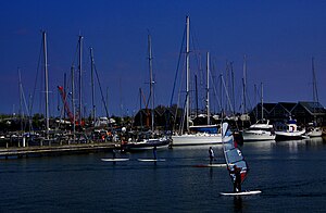
Greve Municipality
Municipality in Zealand, Denmark
Distance: Approx. 303 meters
Latitude and longitude: 55.5839,12.2953
Greve Municipality (Danish: Greve Kommune is a kommune about 21 km south-west of Copenhagen in Region Sjælland on the east coast of the island of Zealand (Sjælland) in eastern Denmark. The municipality covers an area of 60 km2, and has a total population of 52,157 (2024). The site of its municipal council is the town of Greve Strand.

Ishøj railway station
Commuter railway station in Greater Copenhagen, Denmark
Distance: Approx. 4938 meters
Latitude and longitude: 55.61333333,12.35777778
Ishøj station is a railway station on the Køge radial of the S-train network in Copenhagen, Denmark. It serves the urbanized coastal end of Ishøj municipality. The Greater Copenhagen Light Rail is expected to have its southern terminus at Ishøj station.
Greve railway station
Commuter railway station in Greater Copenhagen, Denmark
Distance: Approx. 278 meters
Latitude and longitude: 55.58166667,12.29666667
Greve station is a suburban rail railway station on the Køge radial of the S-train network in Copenhagen, Denmark. It is the middle of three stations in the urbanized coastal end of Greve municipality, and serves the mainly residential areas Greve and Mosede. In this area, the twin railroad sits on a ridge raised above the surrounding terrain.

Hundige railway station
Commuter railway station in Greater Copenhagen, Denmark
Distance: Approx. 2693 meters
Latitude and longitude: 55.598,12.334
Hundige station is a suburban rail railway station serving the suburb of Hundige southwest of Copenhagen, Denmark. The station is located on the Køge radial of the Copenhagen's S-train network. It is situated close to the WAVES shopping center.
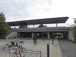
Karlslunde railway station
Commuter railway station in Greater Copenhagen, Denmark
Distance: Approx. 2738 meters
Latitude and longitude: 55.56611111,12.26888889
Karlslunde station is a suburban rail railway station serving the suburb of Karlslunde southwest of Copenhagen, Denmark. The station is located on the Køge radial of Copenhagen's S-train network.
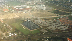
Greve Strand
Town in Zealand, Denmark
Distance: Approx. 709 meters
Latitude and longitude: 55.58222222,12.28888889
Greve Strand (commonly also known simply as Greve) is a Danish town, seat of the Greve Municipality, in the Region Sjælland. Its population is 44,682 (1. January 2024).

Hundige
Suburb in Denmark
Distance: Approx. 2802 meters
Latitude and longitude: 55.6,12.33333333
Hundige is a suburb 18 kilometres (11 mi) southwest of Copenhagen in Greve Municipality. The suburb was originally a small town, but redeveloped into a suburb in the 1960s. The suburb was connected to Copenhagen's S-train network in 1976 and is served by Hundige railway station.
Karlslunde
Distance: Approx. 4586 meters
Latitude and longitude: 55.56666667,12.23333333
Karlslunde is a suburb 25 km (16 mi) south-west of central Copenhagen, Denmark. The suburb is a part of Greve municipality. Karlslunde is generally divided into Karlslunde Landsby and Karlslunde Strand split by Karlslunde Landevej (Taastrupvejen).
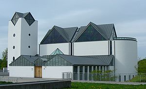
Ishøj
Town in Denmark near Copenhagen
Distance: Approx. 4854 meters
Latitude and longitude: 55.61583333,12.35138889
Ishøj is a Danish town with a population of 21,465 (1. January 2024). It is situated in the Region Hovedstaden, and is the seat of the Ishøj Municipality.

Mosede Fort
Distance: Approx. 2683 meters
Latitude and longitude: 55.56388889,12.27472222
Mosede Fort, located in Mosede, Denmark is a coastal fort, part of Tunestillingen (the Tune Line), built in the years before and during the First World War, to protect the Bay of Køge from possible German naval invasions. It is now a protected area with a museum, grassy fields for recreation and a restaurant.
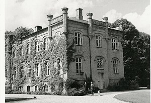
Benzonsdal
Danish historic manor house
Distance: Approx. 5225 meters
Latitude and longitude: 55.62293611,12.25550556
Benzonsdal is a manor house located at Torslunde, south of Taastrup, in the northern part of Ishøj Municipality, some 20 kilometres west of central Copenhagen, Denmark. It has been owned by members of the noble Lerche family since 1853. The main building is from 1856.
Weather in this IP's area
broken clouds
2 Celsius
2 Celsius
1 Celsius
3 Celsius
999 hPa
87 %
999 hPa
997 hPa
10000 meters
0.51 m/s
20 degree
75 %
