Country:
Region:
City:
Latitude and Longitude:
Time Zone:
Postal Code:
IP information under different IP Channel
ip-api
Country
Region
City
ASN
Time Zone
ISP
Blacklist
Proxy
Latitude
Longitude
Postal
Route
Luminati
Country
Region
mv
City
greifswald
ASN
Time Zone
Europe/Berlin
ISP
e.discom Telekommunikation GmbH
Latitude
Longitude
Postal
IPinfo
Country
Region
City
ASN
Time Zone
ISP
Blacklist
Proxy
Latitude
Longitude
Postal
Route
db-ip
Country
Region
City
ASN
Time Zone
ISP
Blacklist
Proxy
Latitude
Longitude
Postal
Route
ipdata
Country
Region
City
ASN
Time Zone
ISP
Blacklist
Proxy
Latitude
Longitude
Postal
Route
Popular places and events near this IP address

Wolgast
Town in Mecklenburg-Vorpommern, Germany
Distance: Approx. 1099 meters
Latitude and longitude: 54.05,13.76666667
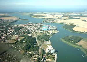
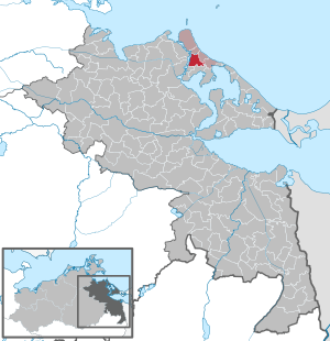
Wolgast (German pronunciation: [ˈvɔlˌɡast] ) is a town in the district of Vorpommern-Greifswald, in Mecklenburg-Vorpommern, Germany. It is situated on the bank of the river (or strait) Peenestrom, vis-a-vis the island of Usedom on the Baltic coast that can be accessed by road and railway via a movable bascule bridge (Blaues Wunder). In December 2004, the town had a population of 12,725.

Peenestrom
River in Germany
Distance: Approx. 1718 meters
Latitude and longitude: 54.06972222,13.79361111
The Peenestrom is a strait in Mecklenburg-Vorpommern, Germany. It is 20 kilometres long and is the westernmost connection of the Szczecin Lagoon (together with the Świna and the Dziwna) with the Baltic Sea. The Peenestrom is therefore also one of the three distributaries of the Oder.
Battle of Wolgast
1628 battle of Thirty Years' War
Distance: Approx. 1099 meters
Latitude and longitude: 54.05,13.76666667
The Battle of Wolgast was an engagement in the Thirty Years' War, fought on 22 August (O.S.) or 2 September (N.S.) 1628 near Wolgast, Duchy of Pomerania, Germany. Danish forces of Christian IV of Denmark-Norway had made landfall on Usedom and the adjacent mainland, and expelled the imperial occupation forces. An Imperial army commanded by Albrecht von Wallenstein left besieged Stralsund to confront Christian IV. Ultimately, the Danish forces were defeated.

Sauzin
Municipality in Mecklenburg-Vorpommern, Germany
Distance: Approx. 2691 meters
Latitude and longitude: 54.03333333,13.78333333
Sauzin is a municipality in the Vorpommern-Greifswald district, in Mecklenburg-Vorpommern, Germany. It consists of Sauzin and Ziemitz.

Rubenow
Municipality in Mecklenburg-Vorpommern, Germany
Distance: Approx. 6216 meters
Latitude and longitude: 54.1,13.71666667
Rubenow is a municipality in the Vorpommern-Greifswald district, in Mecklenburg-Vorpommern, Germany.

Mölschow
Municipality in Mecklenburg-Vorpommern, Germany
Distance: Approx. 4633 meters
Latitude and longitude: 54.08333333,13.83333333
Mölschow is a municipality in the Vorpommern-Greifswald district, in Mecklenburg-Vorpommern, Germany.
Kröslin
Municipality in Mecklenburg-Vorpommern, Germany
Distance: Approx. 6650 meters
Latitude and longitude: 54.11666667,13.76666667
Kröslin is a municipality in the Vorpommern-Greifswald district, in Mecklenburg-Vorpommern, Germany. It consists of the villages Freest Hollendorf Karrin Kröslin Spandowerhagen and the islands Greifswalder Oie Ruden Dänholm Großer Wotig Kleiner Wotig Großer Rohrplan.
Krummin
Municipality in Mecklenburg-Vorpommern, Germany
Distance: Approx. 3706 meters
Latitude and longitude: 54.05,13.83333333
Krummin is a municipality in the Vorpommern-Greifswald district, in Mecklenburg-Vorpommern, Germany.

Katzow
Municipality in Mecklenburg-Vorpommern, Germany
Distance: Approx. 6239 meters
Latitude and longitude: 54.05,13.68333333
Katzow is a municipality in the Vorpommern-Greifswald district, in Mecklenburg-Vorpommern, Germany.
Hohendorf
Ortsteil of Wolgast in Mecklenburg-Vorpommern, Germany
Distance: Approx. 3955 meters
Latitude and longitude: 54.03333333,13.73333333
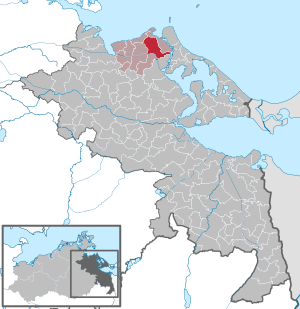
Hohendorf is a village and a former municipality in the Vorpommern-Greifswald district, in Mecklenburg-Vorpommern, Germany. It consists of the villages Schalense, Pritzier, Hohendorf and Zarnitz. Since 1 January 2012, it is part of the town Wolgast.
Peene-Werft
German company
Distance: Approx. 924 meters
Latitude and longitude: 54.0491667,13.7808333
Peene-Werft is a German shipyard with headquarter and shipbuilding facilities in Wolgast. It has been part of the Bremen Lürssen Group since May 2013.

Siege of Wolgast
1675 siege in Germany
Distance: Approx. 1099 meters
Latitude and longitude: 54.05,13.76666667
The Siege of Wolgast (German: Belagerung von Wolgast, Swedish: Belägringen av Wolgast) was a siege on the Swedish city of Wolgast from 1–10 November 1675 initiated by Frederick William of Brandenburg during the Swedish invasion of Brandenburg. The siege was successful for the German army and the Swedish garrison marched off Wolgast after a ten-day siege.
Weather in this IP's area
broken clouds
9 Celsius
5 Celsius
9 Celsius
9 Celsius
1026 hPa
100 %
1026 hPa
1026 hPa
10000 meters
7.69 m/s
13.2 m/s
267 degree
83 %
07:10:02
16:26:47


