Country:
 Qatar
QatarRegion:
City:
Latitude and Longitude:
Time Zone:
Postal Code:
IP information under different IP Channel
ip-api
Country
Region
City
ASN
Time Zone
ISP
Blacklist
Proxy
Latitude
Longitude
Postal
Route
IPinfo
Country
Region
City
ASN
Time Zone
ISP
Blacklist
Proxy
Latitude
Longitude
Postal
Route
MaxMind
Country
Region
City
ASN
Time Zone
ISP
Blacklist
Proxy
Latitude
Longitude
Postal
Route
Luminati
Country
QARegion
da
City
doha
ASN
Time Zone
Asia/Qatar
ISP
Gulf Bridge International Inc.
Latitude
Longitude
Postal
db-ip
Country
Region
City
ASN
Time Zone
ISP
Blacklist
Proxy
Latitude
Longitude
Postal
Route
ipdata
Country
Region
City
ASN
Time Zone
ISP
Blacklist
Proxy
Latitude
Longitude
Postal
Route
Popular places and events near this IP address
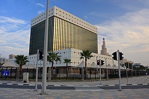
Qatar Central Bank
Central Bank of Qatar
Distance: Approx. 381 meters
Latitude and longitude: 25.2902,51.5349
The Qatar Central Bank (Arabic: مصرف قطر المركزي) is the central bank of Qatar. Originally known as the Qatar Monetary Agency it was founded in 1973. Over its history the Qatar Central Bank has increasingly worked in association with other, larger central banks to achieve a stable currency for the country, most recently and notably with the Monetary Authority of Singapore.

Museum of Islamic Art, Doha
Museum in Doha, Ad-Dawhah, Qatar
Distance: Approx. 774 meters
Latitude and longitude: 25.2950187,51.53926545
The Museum of Islamic Art (MIA) is a museum on one end of the seven-kilometer-long (4.3 mi) Corniche in Doha, Qatar. As per the architect I. M. Pei's specifications, the museum is built on an island off an artificial projecting peninsula near the traditional dhow harbor. A purpose-built park surrounds the edifice on the eastern and southern facades while two bridges connect the southern front facade of the property with the main peninsula that holds the park.
Al-Bidaʽ ash-Sharqiyah
Place in Ad Dawhah, Qatar
Distance: Approx. 422 meters
Latitude and longitude: 25.29083333,51.52833333
Al-Bidaʽ ash-Sharqiyah (البیدع الشرقیه) is a settlement in Qatar, located in the municipality of Ad Dawhah.

Al Jasrah
District in Ad-Dawhah, Qatar
Distance: Approx. 741 meters
Latitude and longitude: 25.28611111,51.53416667
Al Jasrah (Arabic: الجسرة) is a district in Qatar, located in the municipality of Ad Dawhah. It hosts Souq Waqif, one of the largest souqs in Qatar. Other points of interest in the district include Souq Jaidah, the Souq Waqif Falcon Hospital, the Souq Waqif Horse Stables, Abdul Aziz Nasser Theatre, Waqif Art Centre, Al Koot Fort (also known as Doha Fort) and Doha Fort Museum.

Doha Corniche
Waterfront promenade in Doha, Qatar
Distance: Approx. 530 meters
Latitude and longitude: 25.29138889,51.53722222
The Doha Corniche (Arabic: كورنيش الدوحة) is a waterfront promenade and dual carriageway extending for seven kilometres (4.3 mi) along the crescent-shaped Doha Bay in Qatar's capital city, Doha. A lush, semi-circular linear public space, the Corniche serves as the central location for national celebrations, including Qatar National Day Parade and National Sports Day, as well as various religious, civic, and sporting events, making it one of the most popular tourist and recreational destinations in Qatar. The Corniche links the modern central business district of Al Dafna in the north to the historic sections of old Doha in the south.

Doha
Capital and largest city of Qatar
Distance: Approx. 661 meters
Latitude and longitude: 25.28666667,51.53333333
Doha (Arabic: الدوحة, romanized: ad-Dawḥa [adˈduħa] or ad-Dūḥa) is the capital city and main financial hub of Qatar. Located on the Persian Gulf coast in the east of the country, north of Al Wakrah and south of Al Khor, it is home to most of the country's population. It is also Qatar's fastest growing city, with over 80% of the nation's population living in Doha or its surrounding suburbs, known collectively as the Doha Metropolitan Area.

Al Koot Fort
Fortress in Doha, Qatar
Distance: Approx. 668 meters
Latitude and longitude: 25.2866,51.5309
Al Koot Fort most commonly known as the Doha Fort, is a historical military fortress located in the heart of Doha, Qatar's capital city. It was built in 1927 by Sheikh Abdulla bin Qassim Al Thani, better known as Sheikh Abdullah bin Jassim Al Thani, who ruled Qatar from 1913 until 1949, after Sheikh Mohammed bin Jassim Al Thani, Sheikh Abdullah's brother, abdicated in favor of him. The fort was later converted into a museum.

Al Hilal (district)
District in Ad Dawhah, Qatar
Distance: Approx. 661 meters
Latitude and longitude: 25.28666667,51.53333333
Al Hilal (Arabic: الهلال) a is multipurpose district in central Doha. It is home to the Doha Mall, the city's first shopping centre. Prior to the 2010 census, Zone 41 comprised Al Hilal West, but the zone was later transferred to Nuaija.

Al Souq (Doha)
District in Ad-Dawhah, Qatar
Distance: Approx. 632 meters
Latitude and longitude: 25.28888889,51.53694444
Al Souq (Arabic: السوق, romanized: As Sūq; also spelled As Sawq) is a Qatari commercial district in the municipality of Doha. It was named for its high density of souqs (markets) in the southern section of the district. Abdullah bin Jassim Street services numerous government buildings and banks in the northern end of the district, including Abdulla Bin Zaid Al Mahmoud Islamic Cultural Center, Qatar Central Bank, the Ministry of Economy and Finance, and the Supreme Council for Economic Affairs and Investment.

Ad-Dawhah (municipality)
Municipality in Qatar
Distance: Approx. 661 meters
Latitude and longitude: 25.28666667,51.53333333
Ad-Dawhah (Arabic: الدوحة, ad-Dawḥa or ad-Dōḥa, [addawħa]) is one of the eight municipalities of Qatar. It is the most populous municipality with a population of 1,186,023 in 2020, and is the municipality of Qatar's capital city, Doha.

Amiri Diwan of the State of Qatar
Building in Doha, Qatar
Distance: Approx. 533 meters
Latitude and longitude: 25.2912,51.527
The Amiri Diwan of the State of Qatar is the sovereign body and the administrative office of the Amir. It is the official workplace and office of the Amir of the State of Qatar. The Amiri Diwan represents the figurative and bureaucratic center of Qatar.
Fereej Mohammed Bin Jasim
District in Ad Dawhah, Qatar
Distance: Approx. 947 meters
Latitude and longitude: 25.28555556,51.52666667
Fereej Mohammed Bin Jasim (Arabic: فريج محمد بن جاسم, romanized: Farīj Moḥammed Bin Jāsim) is a district in Qatar, located in the municipality of Ad Dawhah. It is bordered by Mushayrib, which it shares Zone 3 with. The district was first mentioned in the 1940s.
Weather in this IP's area
clear sky
39 Celsius
44 Celsius
38 Celsius
42 Celsius
1003 hPa
36 %
1003 hPa
1003 hPa
6000 meters
3.6 m/s
120 degree
05:17:24
17:45:58