Country:
 Hungary
Region:
City:
Latitude and Longitude:
Time Zone:
Postal Code:
IP information under different IP Channel
ip-api
Country
Region
City
ASN
Time Zone
ISP
Blacklist
Proxy
Latitude
Longitude
Postal
Route
IPinfo
Country
Region
City
ASN
Time Zone
ISP
Blacklist
Proxy
Latitude
Longitude
Postal
Route
MaxMind
Country
Region
City
ASN
Time Zone
ISP
Blacklist
Proxy
Latitude
Longitude
Postal
Route
Luminati
Country
HURegion
ve
City
pusztamiske
ASN
Time Zone
Europe/Budapest
ISP
Vodafone Hungary Ltd.
Latitude
Longitude
Postal
db-ip
Country
Region
City
ASN
Time Zone
ISP
Blacklist
Proxy
Latitude
Longitude
Postal
Route
ipdata
Country
Region
City
ASN
Time Zone
ISP
Blacklist
Proxy
Latitude
Longitude
Postal
Route
Popular places and events near this IP address

Devecser
Town in Central Transdanubia, Hungary
Distance: Approx. 5010 meters
Latitude and longitude: 47.1061,17.4372
Devecser (Hungarian pronunciation: [ˈdɛvɛt͡ʃɛr]) is a town in Veszprém County, Hungary. In the Middle Ages there were five villages in the area of today's Devecser: Devecser, Kisdevecser, Szék, Meggyes, and Patony. These villages expanded in the 12th and 13th century.
Bodorfa
Place in Central Transdanubia, Hungary
Distance: Approx. 8628 meters
Latitude and longitude: 47.0764,17.3427
Bodorfa is a village in Veszprém county, Hungary.

Borszörcsök
Place in Veszprém, Hungary
Distance: Approx. 8686 meters
Latitude and longitude: 47.13305,17.40512
Borszörcsök is a village in Veszprém county, Hungary.
Halimba
Place in Veszprém, Hungary
Distance: Approx. 6977 meters
Latitude and longitude: 47.03312,17.53579
Halimba (Hungarian pronunciation: [ˈhɒlimbɒ]) is a village in Veszprém county, Hungary.
Káptalanfa
Place in Veszprém, Hungary
Distance: Approx. 8345 meters
Latitude and longitude: 47.0641,17.34467
Káptalanfa is a village in Veszprém county, Hungary. Like all the surrounding villages, Káptalanfa also hold their own 'Village Day'. It contains horse riding, food cooking- and football competitions between local teams.
Kolontár
Place in Veszprém, Hungary
Distance: Approx. 2868 meters
Latitude and longitude: 47.084435,17.475021
Kolontár (Hungarian: [ˈkolontaːr]) is a village in Veszprém county, Hungary.
Nemeshany
Place in Veszprém, Hungary
Distance: Approx. 6831 meters
Latitude and longitude: 47.07032,17.36531
Nemeshany is a village in Veszprém county, Hungary.
Nyirád
Place in Hungary
Distance: Approx. 6612 meters
Latitude and longitude: 47.00337,17.45055
Nyirád is a village in Veszprém county, Hungary.
Pusztamiske
Place in Veszprém, Hungary
Distance: Approx. 565 meters
Latitude and longitude: 47.05995,17.44843
Pusztamiske is a village in Veszprém county, Hungary.
Szőc
Place in Veszprém, Hungary
Distance: Approx. 6459 meters
Latitude and longitude: 47.02069,17.51342
Szőc is a village in Veszprém county, Hungary.

Ajka alumina plant accident
2010 industrial accident in Hungary
Distance: Approx. 4248 meters
Latitude and longitude: 47.08861111,17.49583333
The Ajka alumina plant accident in October 2010 was a caustic waste reservoir chain collapse at the Ajkai Timföldgyár alumina plant in Ajka, Veszprém County, in western Hungary. On 4 October 2010, at 12:25 CEST (10:25 UTC), the northwestern corner of the dam of reservoir number 10 collapsed, releasing approximately one million cubic metres (35 million cubic feet) of liquid waste from red mud lakes. The mud was released as a 1–2 m (3–7 ft) wave, flooding several nearby localities, including the village of Kolontár and the town of Devecser.
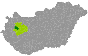
Devecser District
Districts of Hungary in Veszprém
Distance: Approx. 4299 meters
Latitude and longitude: 47.1,17.44
Devecser District (Hungarian: Devecseri járás) is a district in the western part of Veszprém County. 'Devecser is also the name of the town where the district seat is found. The district is located in the Central Transdanubia Statistical Region.
Weather in this IP's area
clear sky
29 Celsius
28 Celsius
26 Celsius
29 Celsius
1013 hPa
38 %
1013 hPa
991 hPa
10000 meters
5.35 m/s
7.16 m/s
164 degree
4 %
06:19:04
19:16:52