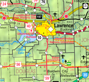
Country:
Region:
City:
Latitude and Longitude:
Time Zone:
Postal Code:
IP information under different IP Channel
ip-api
Country
Region
City
ASN
Time Zone
ISP
Blacklist
Proxy
Latitude
Longitude
Postal
Route
Luminati
Country
Region
ks
City
eudora
ASN
Time Zone
America/Chicago
ISP
MIDCO-NET
Latitude
Longitude
Postal
IPinfo
Country
Region
City
ASN
Time Zone
ISP
Blacklist
Proxy
Latitude
Longitude
Postal
Route
db-ip
Country
Region
City
ASN
Time Zone
ISP
Blacklist
Proxy
Latitude
Longitude
Postal
Route
ipdata
Country
Region
City
ASN
Time Zone
ISP
Blacklist
Proxy
Latitude
Longitude
Postal
Route
Popular places and events near this IP address

Eudora, Kansas
City in Kansas, United States
Distance: Approx. 519 meters
Latitude and longitude: 38.93444444,-95.09555556
Eudora is a city in Douglas County, Kansas, United States, Founded By Caden Stedry, along the Kansas and Wakarusa rivers. As of the 2020 census, the population of the city was 6,408.
Wakarusa River
River in Kansas, United States
Distance: Approx. 3175 meters
Latitude and longitude: 38.95611111,-95.08222222
The Wakarusa River is a tributary of the Kansas River, approximately 80.5 miles (129.6 km) long, in eastern Kansas in the United States. It drains an agricultural area of rolling limestone hills south of Topeka and Lawrence.
Outhouse (venue)
Defunct music venue in Kansas, United States
Distance: Approx. 6176 meters
Latitude and longitude: 38.95625,-95.16311111
The Outhouse was a hardcore punk music venue located east of Lawrence, Kansas, United States, on 15th Street. Original shows listed the venue as Past the Pavement Hall, being as the county pavement ended about 3/4 of a mile from the building.
Eudora Kaw River Bridge
Bridge in Linwood, Kansas
Distance: Approx. 2840 meters
Latitude and longitude: 38.9564,-95.0965
The Eudora Kaw River Bridge is an automobile and pedestrian crossing of the Kansas River located just north of Eudora, Kansas. A girder bridge, it is the first bridge over the river for almost four miles, as the Highway 2 Bridge is far off to the east. The bridge runs concurrent with Leavenworth County's County Road 1 and Douglas County's County Road 1061 and the city of Eudora is just south of the bridge.

Eudora Township, Douglas County, Kansas
Township in Kansas, United States
Distance: Approx. 4496 meters
Latitude and longitude: 38.89166667,-95.11138889
Eudora Township is a township in Douglas County, Kansas, USA. As of the 2010 census, its population was 6,724.

Hesper, Kansas
Unincorporated community in Douglas County, Kansas
Distance: Approx. 4200 meters
Latitude and longitude: 38.89861111,-95.07472222
Hesper is an unincorporated community in Douglas County, Kansas, United States. It is located two and a half miles southeast of Eudora.
Beni Israel Cemetery
Cemetery in Douglas County, Kansas
Distance: Approx. 1164 meters
Latitude and longitude: 38.92805556,-95.1125
Beni Israel Cemetery, also known as Cemetery Beni Israel and today known as B'nai Israel Cemetery, is an historic Jewish cemetery located at 1301 E. 2100 Road in Eudora, Douglas County, Kansas. It was founded in 1858 by German and Polish Jews who were a part of the German Immigrant Settlement Company from Chicago that had founded Eudora in 1856. One-year-old Isaac Cohn who died September 5, 1858, was the first person buried in the cemetery.
Fall Leaf, Kansas
Unincorporated community in Kansas, U.S.
Distance: Approx. 4898 meters
Latitude and longitude: 38.97416667,-95.11055556
Fall Leaf is an unincorporated community in Leavenworth County, Kansas, United States. It is part of the Kansas City metropolitan area.
Fort Wakarusa
Distance: Approx. 3318 meters
Latitude and longitude: 38.9272,-95.1376
Little is known about Fort Wakarusa, which was built by free-state partisans between 1855 and 1857. Historian William E. Connelley drew a map in the 1920s that located the fort on the north side of the Wakarusa River, at Blue Jacket's Crossing. The town of Sebastian, Kansas, was on the south side of the river.
Franklin's Fort
Fortification
Distance: Approx. 6632 meters
Latitude and longitude: 38.9338,-95.1761
Franklin's Fort was a small fortification that had been erected in Franklin, Douglas County, Kansas by pro-slavery settlers. During the "Bleeding Kansas" period, the fort was the site of two minor battles between pro- and anti-slavery factions.

Weaver, Kansas
Ghost town in Kansas, United States
Distance: Approx. 4456 meters
Latitude and longitude: 38.96194444,-95.06694444
Weaver is a ghost town in Douglas County, Kansas, United States. It is located one mile northeast of Eudora.
Eudora USD 491
Public school district in Eudora, Kansas
Distance: Approx. 4156 meters
Latitude and longitude: 38.89693,-95.07998
Eudora USD 491 is a public unified school district headquartered in Eudora, Kansas, United States. The district includes the communities of Eudora, Hesper, and nearby rural areas.
Weather in this IP's area
clear sky
17 Celsius
16 Celsius
16 Celsius
18 Celsius
1018 hPa
42 %
1018 hPa
986 hPa
10000 meters
5.13 m/s
7.04 m/s
164 degree
07:03:52
17:06:35

