Country:
 USA
USARegion:
City:
Latitude and Longitude:
Time Zone:
Postal Code:
IP information under different IP Channel
ip-api
Country
Region
City
ASN
Time Zone
ISP
Blacklist
Proxy
Latitude
Longitude
Postal
Route
IPinfo
Country
Region
City
ASN
Time Zone
ISP
Blacklist
Proxy
Latitude
Longitude
Postal
Route
MaxMind
Country
Region
City
ASN
Time Zone
ISP
Blacklist
Proxy
Latitude
Longitude
Postal
Route
Luminati
Country
USRegion
ca
City
stinsonbeach
ASN
Time Zone
America/Los_Angeles
ISP
AS-SONICTELECOM
Latitude
Longitude
Postal
db-ip
Country
Region
City
ASN
Time Zone
ISP
Blacklist
Proxy
Latitude
Longitude
Postal
Route
ipdata
Country
Region
City
ASN
Time Zone
ISP
Blacklist
Proxy
Latitude
Longitude
Postal
Route
Popular places and events near this IP address

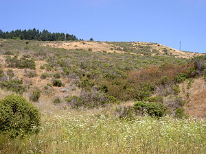
Stinson Beach, California
Census-designated place in California, United States
Distance: Approx. 912 meters
Latitude and longitude: 37.90055556,-122.64444444
Stinson Beach is an unincorporated community and census-designated place (CDP) in Marin County, California, on the west coast of the United States. Stinson Beach is located east-southeast of Bolinas, right across the channel that terminates the bay mouth bar of the Bolinas Lagoon. at an elevation of 26 feet (8 m).

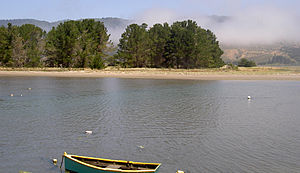
Bolinas Bay
Distance: Approx. 2978 meters
Latitude and longitude: 37.89333333,-122.66611111
Bolinas Bay is a small bay, approximately 5 miles (8 km) long, on the Pacific coast of California in the United States. It is in Marin County, north of the Golden Gate, approximately 15 miles (25 km) northwest of San Francisco. The town of Bolinas is at its shore.
Fantasy Fair and Magic Mountain Music Festival
An event held in California
Distance: Approx. 2522 meters
Latitude and longitude: 37.91258,-122.60844
The KFRC Fantasy Fair and Magic Mountain Music Festival was an event held June 10 and 11, 1967, at the 4,000-seat Sidney B. Cushing Memorial Amphitheatre high on the south face of Mount Tamalpais in Marin County, California. Although 20,000 tickets were reported to have been sold for the event, as many as 40,000 people may have actually attended the two-day concert, which was the first of a series of San Francisco–area cultural events known as the Summer of Love. The Fantasy Fair was influenced by the popular Renaissance Pleasure Faire and became a prototype for large scale multi-act outdoor rock music events now known as rock festivals.
Morses Gulch
Distance: Approx. 3610 meters
Latitude and longitude: 37.918814,-122.671095
Morses Gulch is a coastal valley in Marin County, California, United States. It descends the western slope of Bolinas Ridge and drains into Bolinas Lagoon.
McKinnan Gulch
Valley in Marin County, California
Distance: Approx. 2725 meters
Latitude and longitude: 37.912704,-122.663594
McKinnan Gulch is a valley in Marin County, California, United States. It contains a small stream which descends the western slope of the Bolinas Ridge and drains into Bolinas Lagoon. Near the head of the gulch is an ore vein (reported in 1955) containing chalcopyrite, galena, pyrite, and calcite.

Stinson Gulch
Distance: Approx. 1528 meters
Latitude and longitude: 37.90694444,-122.65166667
Stinson Gulch is a valley in Marin County, California, United States which is associated with a small stream. The stream descends the western slope of the Bolinas Ridge, crosses State Route 1 just north of Stinson Beach, California, and drains into the southern tip of Bolinas Lagoon. Most of Stinson Gulch is included in Mount Tamalpais State Park.
Kent Island (California)
Distance: Approx. 3966 meters
Latitude and longitude: 37.91222222,-122.67861111
Kent Island is a small island in Marin County, California. In 1964, it was proposed for large-scale development including a hotel and marina, but the plan was defeated in 1967. The island is now included in the Greater Farallones National Marine Sanctuary.

Bolinas Ridge
Mountain ridge in California, United States
Distance: Approx. 1338 meters
Latitude and longitude: 37.90722222,-122.62027778
Bolinas Ridge is a north-south ridge in southwestern Marin County, California. Much of the western side of the ridge is protected parkland in the Golden Gate National Recreation Area, and the eastern side is watershed lands of the Marin Municipal Water District.
Gull Rock
Distance: Approx. 3469 meters
Latitude and longitude: 37.876038,-122.616369
Gull Rock is a rock formation and a small rocky island in Marin County, in the U.S. state of California. It lies in the Pacific Ocean just offshore of the Golden Gate National Recreation Area.
Newport Pop Festival
Southern California music festivals in 1968 and 1969
Distance: Approx. 2522 meters
Latitude and longitude: 37.91258,-122.60844
The Newport Pop Festival, held in Costa Mesa, California, on August 3–4, 1968, was the first music concert ever to have more than 100,000 paid attendees. Its sequel, billed as Newport 69, was held in Northridge, California, on June 20–22, 1969, and had a total attendance estimated at 200,000.

Mountain Play Association
United States historic place
Distance: Approx. 2522 meters
Latitude and longitude: 37.91258,-122.60844
The Mountain Play Association (MPA, or Mountain Play) is a 501(c)3 organization responsible for the production of theatrical events at the Sidney B. Cushing Amphitheater (formerly the Mount Tamalpais Mountain Theater) within Mount Tamalpais State Park on Mount Tamalpais in Marin County, California, United States. The stone amphitheater, named for the owner of the railroad company which constructed the Mount Tamalpais Scenic Railway, is at an elevation of 2,000 feet and has 4,000 seats. The organization was founded in 1913, and is a member of Theatre Bay Area and the North Bay Theatre Group.

Cushing Memorial Amphitheatre
Open-air theater in California
Distance: Approx. 2495 meters
Latitude and longitude: 37.91277778,-122.60888889
The Sidney B. Cushing Memorial Amphitheatre, also known as the Cushing Memorial Amphitheatre or simply the Mountain Theatre, is a 4,000-seat open-air venue in Mount Tamalpais State Park, in Marin County, California, United States.
Weather in this IP's area
scattered clouds
17 Celsius
17 Celsius
14 Celsius
22 Celsius
1011 hPa
78 %
1011 hPa
988 hPa
10000 meters
0.89 m/s
3.13 m/s
160 degree
44 %
06:56:16
19:12:03