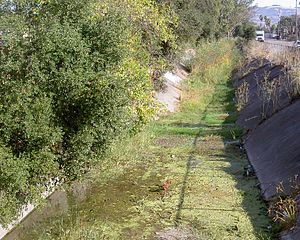
Country:
Region:
City:
Latitude and Longitude:
Time Zone:
Postal Code:
IP information under different IP Channel
ip-api
Country
Region
City
ASN
Time Zone
ISP
Blacklist
Proxy
Latitude
Longitude
Postal
Route
Luminati
Country
Region
ca
City
pointreyesstation
ASN
Time Zone
America/Los_Angeles
ISP
AS-SONICTELECOM
Latitude
Longitude
Postal
IPinfo
Country
Region
City
ASN
Time Zone
ISP
Blacklist
Proxy
Latitude
Longitude
Postal
Route
db-ip
Country
Region
City
ASN
Time Zone
ISP
Blacklist
Proxy
Latitude
Longitude
Postal
Route
ipdata
Country
Region
City
ASN
Time Zone
ISP
Blacklist
Proxy
Latitude
Longitude
Postal
Route
Popular places and events near this IP address

Petaluma, California
City in Northern California, United States
Distance: Approx. 1088 meters
Latitude and longitude: 38.24583333,-122.63138889
Petaluma is a city in Sonoma County, California, located in the North Bay region of the San Francisco Bay Area. Its population is, according to World Population Review, 58,489 people. It was 59,776 according to the 2020 census.
Sonoma Mountain High School
Alternative high school in California, USA
Distance: Approx. 1950 meters
Latitude and longitude: 38.24222222,-122.59805556
Sonoma Mountain High School is one of three alternative schools in Petaluma, California. It is located on the Casa Grande High School campus. There are, on average, 32 pupils enrolled at Sonoma Mountain High School at any given time.
Telecom Valley
Distance: Approx. 1078 meters
Latitude and longitude: 38.245849,-122.631276
Telecom Valley was an area located in Sonoma County, California specifically the Redwood Business Park of Petaluma, California.

Petaluma Municipal Airport
Airport in Petaluma
Distance: Approx. 1630 meters
Latitude and longitude: 38.25777778,-122.60555556
Petaluma Municipal Airport (FAA LID: O69) is a public airport one mile (1.6 km) northeast of Petaluma, in Sonoma County, California, United States. It covers 220 acres (89 ha) and has one runway measuring 3601 x 75 feet. It is used for general aviation.
Casa Grande High School
Public school in Petaluma, California, United States
Distance: Approx. 1862 meters
Latitude and longitude: 38.24277778,-122.59888889
Casa Grande High School is a public high school in Petaluma, California. Casa Grande is one of two high schools in the Petaluma City Schools District.

Lynch Creek
River in California, United States
Distance: Approx. 1603 meters
Latitude and longitude: 38.24694444,-122.6375
Lynch Creek is a 7.1-mile-long (11.4 km) stream in Sonoma County, California, United States which discharges into the Petaluma River.

Washington Creek
River in California, United States
Distance: Approx. 1720 meters
Latitude and longitude: 38.24527778,-122.63861111
Washington Creek is a southward-flowing stream in Sonoma County, California, United States which enters the city of Petaluma and discharges to the Petaluma River.
United States Post Office (Petaluma, California)
United States historic post office
Distance: Approx. 2405 meters
Latitude and longitude: 38.23166667,-122.6375
The United States Post Office in Petaluma, California, is located at 120 West Fourth Street. The building, completed in 1933, has been listed on the National Register of Historic Places since 1985. The building is in the Spanish Colonial Revival style with some Gothic touches.
Petaluma Downtown station
Railway station in California
Distance: Approx. 1809 meters
Latitude and longitude: 38.2374,-122.6351
Petaluma Downtown station is a Sonoma–Marin Area Rail Transit station in Petaluma. It opened to preview service on June 29, 2017; full commuter service commenced on August 25, 2017. A new platform and facilities were constructed adjacent to the historic Northwestern Pacific Railroad station building, which opened in 1914.
Ellis-Martin House
United States historic place
Distance: Approx. 985 meters
Latitude and longitude: 38.24527778,-122.63
The Ellis--Martin House, at 1197 E. Washington St. in Petaluma, California, is a Craftsman style house which was built in 1908. It was listed on the National Register of Historic Places in 2006.

Haystack Landing Bridge
Bridge
Distance: Approx. 2213 meters
Latitude and longitude: 38.22835,-122.61397
The Haystack Landing Bridge is a railroad bridge owned by Sonoma-Marin Area Rail Transit (SMART) at Haystack Landing in Petaluma, California. The original Haystack Landing bridge, which was built in 1903 and installed in 1904, was a Warren truss swing bridge built by the Pennsylvania Steel Company. It was operated by buttons on the approach trestles, and had a 5-horsepower (3.7 kW) electric motor, as well as fabric belts and bevel gears.

Mystic Theatre (Petaluma, California)
Music venue in Petaluma, California
Distance: Approx. 2381 meters
Latitude and longitude: 38.234104,-122.64012
Mystic Theatre, also known as McNear's Mystic Theatre, is a historic building and music venue built in 1911, and located in Petaluma, California. The McNear's Saloon and Dining House is housed next door in an adjoined building. The building is part of the Petaluma Historic Commercial District, which has been listed on the National Register of Historic Places since March 31, 1995.
Weather in this IP's area
clear sky
19 Celsius
18 Celsius
17 Celsius
20 Celsius
1015 hPa
38 %
1015 hPa
1014 hPa
10000 meters
2.06 m/s
170 degree
06:45:55
17:02:54


